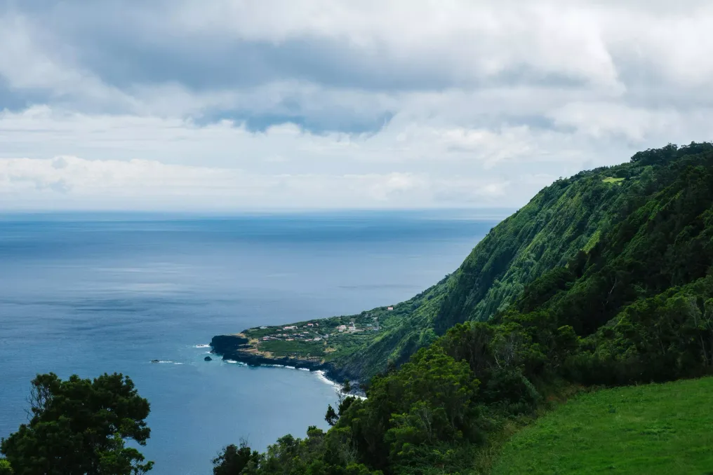
Descending from Serra do Topo, you can first see Fajã da Caldeira de Santa Cristo, even if there is still a long descent ahead. Below, a narrow strip of land separates the lagoon from the Atlantic Ocean. The village is located on a small ledge at the foot of the cliffs. From here, it is easy to understand why the residents of this coastal area used every available patch of flat ground.
These coastal plains are called fajãs. There are more than 70 of them on São Jorge. Some formed as a result of rock and earth landslides from the cliffs, which accumulated at their base. Others were formed when lava flowed into the sea. In 2016, UNESCO included the island and its waters in its network of biosphere reserves. A walk along the north coast allows for a more detailed view of the landscape under this status—from the plants growing in the highlands to the villages situated beneath them.
The walk starts near the wind farm on Serra do Topo, approximately 700 meters above sea level. You should look for Azorean heather, juniper, and scrub along the dirt road before the trail begins to descend towards Caldeira de Sima. After the Tia Júlia bridge, a short detour leads to Cascata Pequena. The ground here can be slippery, so move slowly if you decide to go down to see the waterfall. Further on, the Santa Cristo lagoon is visible.
In the Santa Cristo area, the lagoon demonstrates how people interacted with the land. An open channel to the ocean is maintained to support the oysters, for which the village is known. The lagoon is also used by local and migratory birds. If the interpretation center is open during your visit, it is worth stopping. It occupies a former house, preserving its traditional facade, and features a reconstructed oven and exhibits on the geology and daily life of the fajã.
From Santa Cristo, the trail follows the coast past Fajã do Belo, where people lived before the 1980 earthquake. Pay attention to the wires along this section. They were used to lower firewood into the settlements—a small detail that helps visualize how homes under these cliffs were previously supplied. The trail ends near the Church of Nossa Senhora de Lourdes in Fajã dos Cubres, where another lagoon and a village with its own history of recovery from earthquakes are located.
If you have an extra day and good visibility, you can start near Pico do Pedro and follow the central ridge to Fajã do Ouvidor. A marked branch leads to Pico da Esperança, the highest point on the island at 1053 meters, where you can circle the crater and view the lake. Returning to the main route, the descent passes through wooded areas and farm roads before reaching the north coast.
In Ouvidor, the land beneath the village has a different history. Here, lava formed a wider protrusion, sufficient for the settlement to develop around a small fishing harbor. If you have already passed through Santa Cristo and Cubres, you will feel how the shape of each fajã influenced people's ability to use the land.
If you only have time for one walk, dedicate the entire morning to the route from Serra do Topo to Cubres. Take a detour to the waterfall if the ground allows, spend time by the lagoon in Santa Cristo, and allow yourself a few minutes at the church before transport arrives. Then, look at the cliffs from above. From below, you can see how little space there is between the hillside and the sea, and how much people have achieved in these conditions.