Cham-Jangal Village in Iran: A Hidden Natural Corner Along the Seymareh River
Read more
Tehran Times
www.tehrantimes.com

Cham-Jangal Village in Iran: A Hidden Natural Corner Along the Seymareh River

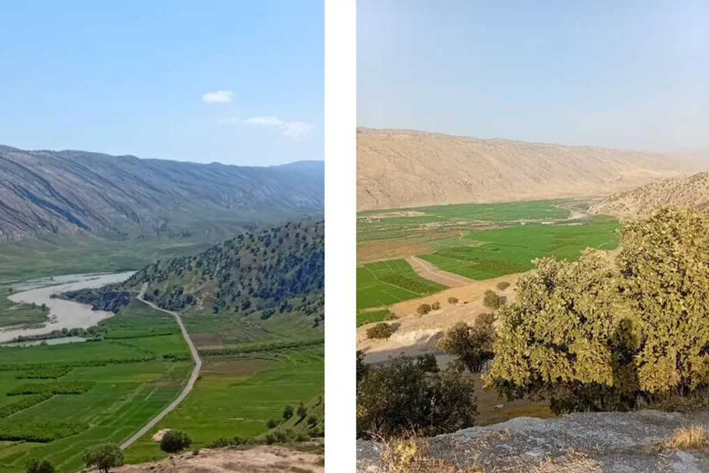
Located between oak-covered mountains and the picturesque Seymareh River in western Iran, Cham-Jangal village is a place where rugged mountains, lush forests, and traditional rural life converge.

Thanks to panoramic views of the river, agricultural heritage, and a remarkable natural attraction that cools the air even in the hottest months, the village has significant potential to become a destination for nature lovers. However, the agricultural landscape is marred by the loss of some historical pomegranate orchards due to rising water levels in the Seymareh dam reservoir.

Cham-Jangal is situated in Rudbar Rural District, Central Sirvan County, Ilam Province, approximately 11 kilometers from the county's main town of Lumar. The village lies near the Seymareh River, surrounded by the Zoreh, Tagtukh, and Lavala mountains, whose slopes are covered with local oak forests.

Its elevated position offers extensive views of the river and the surrounding area, making the village particularly attractive in spring when the mountains turn green and the oak forests create an impressive natural backdrop.

According to Lidy Mirzaei, the village head, the combination of mountainous terrain, forests, and proximity to the river gives Cham-Jangal unique potential for ecotourism.

A Natural Refuge from Summer Heat

One of the most distinctive features of the village is a natural formation located in the mountains. Resembling a small cave, this spot provides surprisingly cool air in the summer, serving as a natural refuge from the surrounding heat.

This unusual phenomenon has made the formation a popular gathering place for locals and an attraction for visitors seeking a cooler environment during the warmer months. Together with the nearby oak forests and mountain landscapes, this location could form the basis for developing small-scale eco-tourism, especially activities related to hiking, sightseeing, and visiting rural communities.

The surrounding Zoreh, Tagtukh, and Lavala mountains also offer opportunities to study the region's natural environment. Their forest cover and elevated viewpoints provide diverse landscapes in a relatively compact rural area.

Nevertheless, transforming these natural resources into a sustainable tourist destination will require improvements in basic infrastructure and careful environmental management.

Despite its tourism potential, Cham-Jangal remains predominantly an agricultural community.

According to the 2016 national census, the village had 203 inhabitants in 120 households. Of these, 71 households were permanent, while the rest were seasonal residents. The main agricultural products are wheat, barley, and rice, and animal husbandry has long played an important role in the local economy.

Agricultural lands and access to water traditionally supported farming and livestock, shaping the livelihoods and daily lives of the residents. Pomegranate orchards once also constituted an important part of the local agricultural landscape, contributing to household income and the rural character of the village. However, this agricultural heritage has suffered due to the Seymareh dam project.

The Cost of Rising Reservoirs

One of the most serious challenges facing Cham-Jangal is the impact of rising water levels in the Seymareh dam reservoir, which has affected parts of the village's agricultural land. Farzad Sharifi, Director General of the Department of Cultural Heritage, Tourism, and Handicrafts of Ilam, reported that some of the village's pomegranate orchards were damaged after being flooded due to the rise in reservoir levels.

These losses have affected not only farmers' incomes but also part of the village's agricultural potential and natural landscape. This situation highlights the problem faced by communities around large water infrastructure projects: the need to balance the benefits of development with the economic and ecological interests of people whose well-being depends on the land.

For Cham-Jangal, protecting remaining agricultural resources and addressing the consequences of rising reservoir levels are crucial aspects of any long-term development strategy.

Infrastructure Still Needs Attention

Basic infrastructure is another issue that needs to be addressed if the village wants to attract more visitors. Mirzaei noted that some streets in the village have been paved, while others still require preparation and paving. Some roads also need curb installation and drainage systems.

She also pointed to the need for environmental improvements, including better organized streets, green spaces, tree planting, and the installation of appropriate urban and recreational furniture. According to her, such improvements could enhance the village's appearance, improve the quality of life for residents, and make it more appealing to guests.

For a place whose appeal largely lies in its natural setting and rural atmosphere, maintaining cleanliness and ensuring that development is compatible with the village's character will be particularly important.

A Broader Landscape of History and Nature

The wider Seymareh region also holds significant historical importance, offering an additional dimension for travel in western Ilam. The ancient city of Seymareh, located in the Seymareh Valley in present-day Darre Shahr, is one of the region's most important archaeological sites. It covers an area of about 120 hectares and is considered one of the largest historical sites in western Iran.

It is believed that the settlement was the ancient Elamite city of Madakht, later known by other names, including Mehregan Kadak and Seymareh. Historical records describe it as a prosperous settlement with two fortresses, which was abandoned, possibly after a major earthquake about a thousand years ago.

British explorer and archaeologist Henry Robinson visited the site in 1836, followed by French archaeologist Jacques de Morgan in 1891. Hungarian-British archaeologist Aurel Stein also explored the area in 1936.
Similar stories

Semnan Province in Iran: Natural Wealth with High Biodiversity Level
Read more
www.tehrantimes.com

Semnan Province in Iran: Natural Wealth with High Biodiversity Level

Semnan Province, located in the central-northern part of Iran, possesses an outstanding diversity of plant and animal species. This is due to a wide range of natural habitats, which extend from forests and mountains to wetlands and vast desert landscapes.

Although the province is often associated with the desert and wildlife, its climatic and natural diversity makes it a valuable reservoir of botanical and faunistic biodiversity. Semnan is home to 254 bird species, 69 reptile species, 67 mammal species, 10 fish species, and four amphibian species.

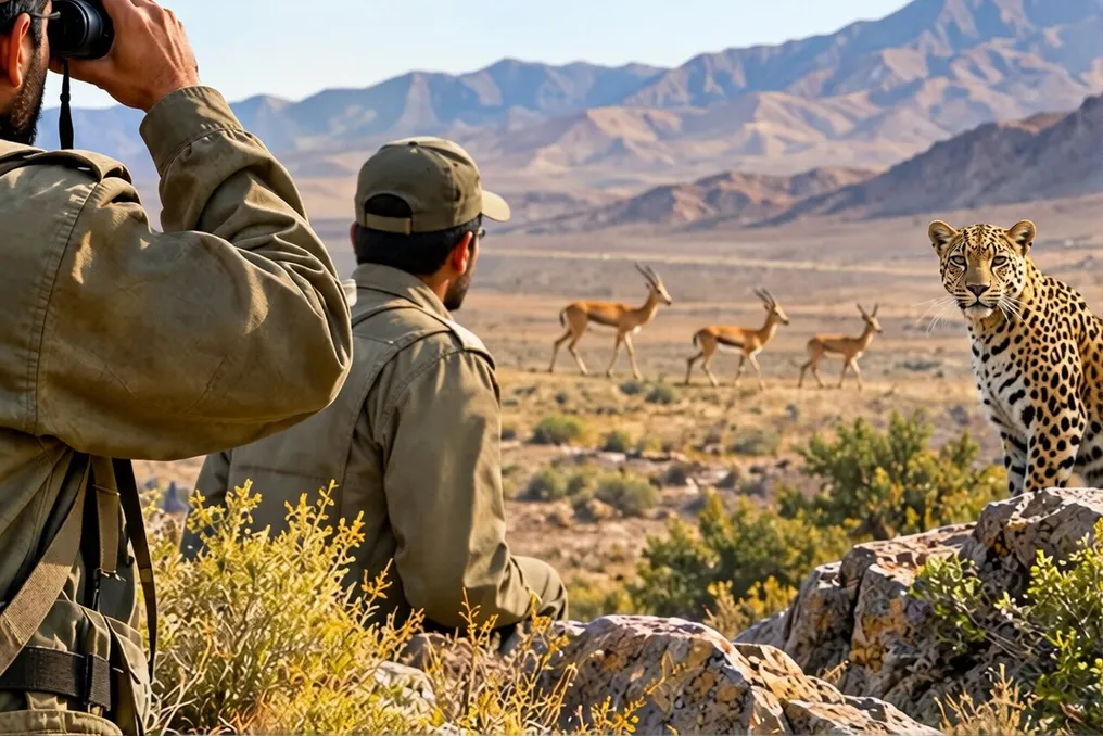
One of the most notable ecological features of Semnan is the presence of all eight species of cats found in Iran: the Asiatic cheetah, Persian leopard, Eurasian lynx, caracal, jungle cat, Pallass's cat, sand cat, and wild cat. Furthermore, the province is home to many other wild animals, including maral (Persian red deer), spotted deer, gazelles, Persian gazelle, wild sheep, wild goats, and the Persian ground jay, as well as drofa.

The preservation of this rich natural heritage depends on protecting wildlife habitats, conserving ecosystems, and ensuring the survival of species in their natural environment. To protect this natural asset, a large area of the province spanning 2.8 million hectares is managed by the Provincial Department of Environment (DOE). The protection network also includes national parks, wildlife reserves, protected areas, no-hunting zones, as well as private or joint protected areas.

Iran is among the 20 countries in the world with the highest level of biodiversity and is home to numerous plant and animal species. Nevertheless, certain actions in recent years have led to habitat destruction and placed many species on the brink of extinction.

To date, over two million plant and animal species have been identified globally, of which 43,000 are found in Iran. There are 11 types of ecosystems worldwide, including aquatic, terrestrial, natural, and artificial, and Iran hosts nine of them. Moreover, out of 42 types of wetlands globally, 41 types have been identified in Iran.

According to the DOE, approximately 2000 animal species have been identified in the country's ecosystems, including mammals, birds, reptiles, amphibians, and freshwater fish, as well as about 1200 fish species. Among these species are 210 mammal species, 640 bird species, 300 reptile species, 23 amphibian species, and 350 freshwater fish species. However, Iran's biodiversity, like that of the entire world, faces several challenges such as habitat destruction, overhunting, drought, and climate change.

To strengthen the protection of wildlife species and their habitats across the country based on a targeted and strategic approach, the DOE implements a comprehensive set of initiatives in conservation, science, law, and operational activities, whose priorities are determined by data and scientific research. According to Peyman Valizadeh, an official of the DOE, the department focuses on a more scientific approach to developing and implementing conservation measures adapted to the specific needs of each species and habitat.

Currently, plans for the conservation of 25 endangered species have been prepared, and another thirteen plans are under development. These plans create a clear framework for species conservation by defining the species status, main threats, conservation priorities, necessary actions, and evaluation indicators, he noted.

Nevertheless, the DOE faces some difficulties in implementing these measures at the national and provincial levels. One of the most serious problems is securing funding to execute the plans. Another problem is the development of specialized capacity for species conservation. A lack of trained, specialized personnel hinders the effective implementation of conservation plans. Therefore, training specialized personnel, developing expert potential in provinces, and strengthening the headquarters' scientific and technical capabilities are on the agenda, emphasized the official.

Regarding measures taken to combat illegal wildlife trade, Valizadeh stated that to promote greater coordination between responsible DOE agencies, he established a National Committee for Combating Illegal Wildlife Trade; the committee has already held three expert meetings. Additionally, the development of a comprehensive plan to combat illegal wildlife trade is nearing completion, and a comprehensive program to prevent this trade is being prepared.

Efforts are being made to manage human-wildlife conflicts by shifting from a reactive stance to identifying critical hotspots, understanding the causes of conflicts, and implementing preventive measures. The DOE has identified certain conflict hotspots for species such as leopards, black bears, and herbivores; data collection on black bears is underway in the Hormozgan and Kermanshah provinces.

Furthermore, Valizadeh added that the DOE has signed an agreement with the National Environmental Fund and the Agricultural Insurance Fund to support local communities and compensate for their losses. He also noted that precise information on species distribution, habitats, migration routes, and ecological corridors makes conservation efforts more effective.

In this regard, the DOE, in collaboration with Shiraz University, conducted research to prepare comprehensive distribution maps to determine migratory and dispersal corridors for herbivores and predators. These maps will serve as a management tool for habitat conservation, preventing and managing human-wildlife conflicts, determining conservation priorities, and properly utilizing intelligent monitoring systems and conservation programs, thereby providing a more accurate basis for conservation decision-making, concluded Valizadeh.

The official continued that the DOE will provide funding, train qualified personnel, and promote intersectoral cooperation to create an integrated system that utilizes scientific information, field data, local community capacities, and executive body potential to develop and implement conservation plans for each species and habitat.

Area along the Chirchik River in Tashkent's Sergeli district is planned for improvement
Read more
podrobno.uz

Area along the Chirchik River in Tashkent's Sergeli district is planned for improvement

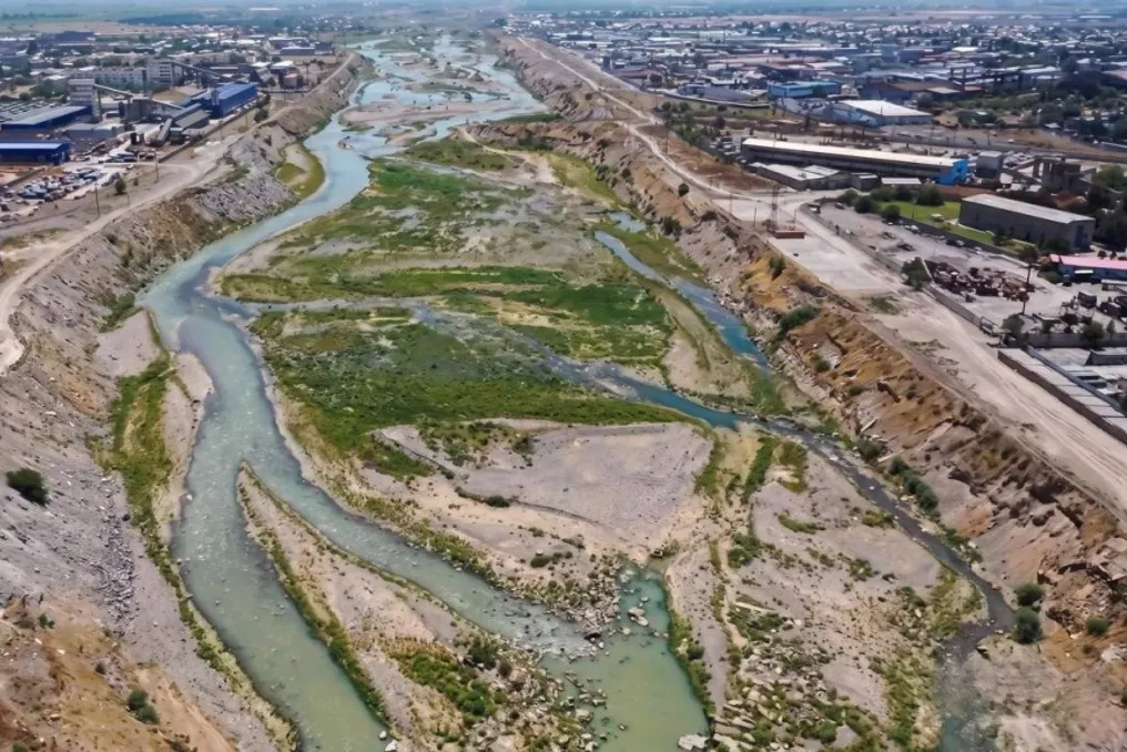
A proposal has been put forward in Tashkent's Sergeli district to implement a large investment project covering an area of 100 hectares located along the Chirchik River. This project aims for the comprehensive development of the territory, including supporting production, trade, services, and tourism, as well as creating public recreation areas for city residents.

Public Discussion of the Project

The proposed project resolution from the capital's hokimiyat has been submitted for public discussion. The initiative affects the lands of the mahallas 'Farogatl' and 'Kuruvchilar'. According to the information provided, pedestrian zones, fountains, and equipped children's and sports playgrounds are planned for the coastal sections. Additionally, the placement of mobile trade points is being considered.

In addition to improving the condition of the riverbank, the project also aims to stimulate entrepreneurial activity. Objects related to production, trade, and services are planned for placement in this area, which should contribute to the economic growth of the district and attract capital investments.

The period for public discussion of this project has been extended until November 20. Currently, final deadlines for work execution, the total funding volume, or a list of potential investors have not been established; the document may be adjusted after analyzing the received proposals.

It is worth noting that previously, Tashkent also presented the 'Daryo Boyi Business City' project, which covers a 24-kilometer stretch of the Chirchik River. This previous plan envisioned the formation of residential and business quarters, the development of public spaces, improvement of the transport system, and landscaping of territories adjacent to the river.

Muling in Himachal Pradesh: A picturesque remote village in the Lahaul Valley offering solitude
Read more
www.aajtak.in

Muling in Himachal Pradesh: A picturesque remote village in the Lahaul Valley offering solitude

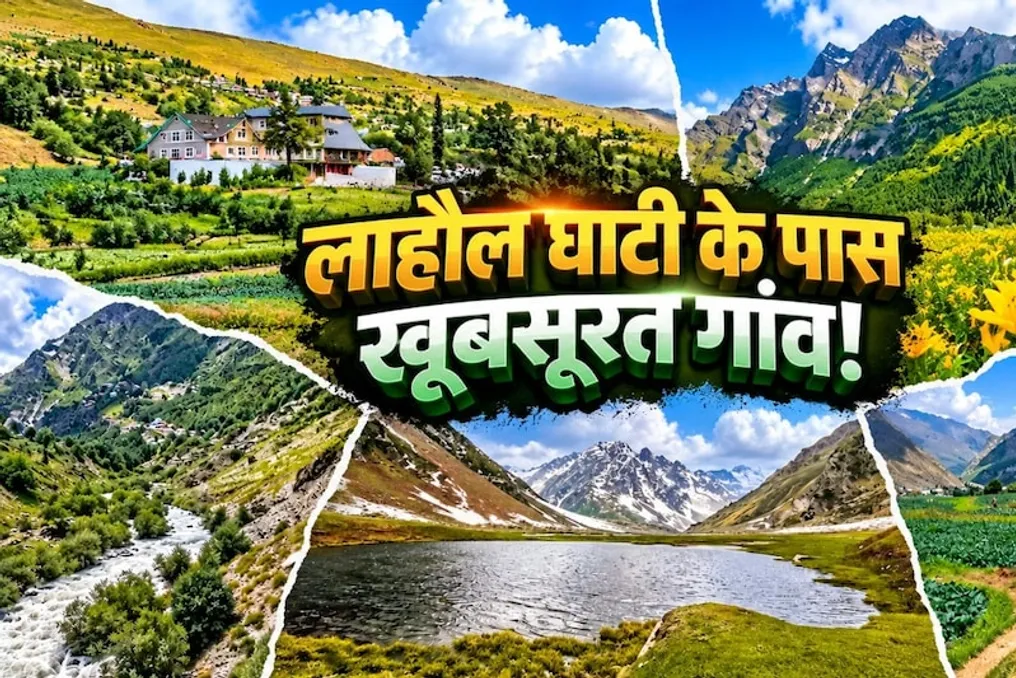
If you wish to spend time in the quiet amidst the beautiful landscapes of Himachal Pradesh but want to avoid the hustle and bustle of Manali, you can visit this remote village in the Lahaul Valley. This village, situated among the mountains, is known for its tranquil atmosphere, traditional dwellings, and natural beauty. Here, you can enjoy time away from the city rush and also have the opportunity to get acquainted with the local culture.

Muling might appeal to travelers who value not only visiting famous photo spots but also deep immersion in the local culture. In the village, you can walk through the streets, admire the surrounding natural scenery, and spend time outdoors. It is an ideal place to relax from office routine and create unforgettable memories.

Muling is a small village located in the Lahaul Valley, Himachal Pradesh. To reach it, you need to drive through the Atal Tunnel from Manali towards Sissu. The road passes through high mountains, picturesque valleys, and changing nature, making the journey itself special. If you are planning a trip to a quiet place in Himachal, it is worth including Muling in your list of places to visit.

Muling can be reached via the road from Manali. The route includes passing through the Atal Tunnel to Sissu. According to available information, the distance from Manali to Muling is about 45 kilometers, and the journey takes approximately one and a half hours. Sissu is near Muling, and from there, you can take a local taxi to the village. However, it should be noted that the actual distance and travel time depend on your starting point, road conditions, and weather conditions. Therefore, before traveling, be sure to check information about local road conditions, weather, and available means of transport.

Firstly, you can enjoy walks through the village streets. The best way to explore Muling is by walking through its streets. Here, you can see traditional Himachali houses built from clay and wood. The architecture of these houses and the surrounding nature allow one to understand the local lifestyle of Lahaul. However, permission must be obtained before photographing anyone's house or private property.

Secondly, you should visit the apple and apricot orchards, which can be seen in the Lahaul Valley depending on the season. The view around these orchards will be especially picturesque in spring and summer. It is also a great place for photography enthusiasts.

Thirdly, you can get to know the culture of Lahaul by visiting local monasteries. The culture of the Lahaul Valley is heavily influenced by Buddhist traditions. Visiting small monasteries allows one to experience local religious customs and the peaceful atmosphere. When entering a monastery, established rules must be observed, and silence should be maintained during prayers or religious events.

Fourthly, you can go for a nature walk. If you enjoy trekking and mountain hiking, you can explore the trails and views around Muling. To enjoy the natural beauty, long hikes are not necessary; even short walks can make your trip memorable. It is important to avoid solitary walks on unfamiliar routes and always check the weather forecast.

Fifthly, you can observe the starry sky at night. Since the village is far from city lights, stars can be seen in some areas of the Lahaul Valley if the sky is clear. Under favorable weather conditions, you can also spend time outdoors in Muling. For this, choose a safe spot away from light sources and try not to stray too far from the village at night.

Sixthly, be sure to try the local cuisine of Himachal. Any trip seems incomplete without getting to know the local food. In Muling or nearby local guesthouses, you can try dishes such as thukpa, momos, and siddu, depending on availability. If you have the chance to stay with locals, you can learn more about traditional diet and lifestyle.

Before traveling to a small mountain village like Muling, it is necessary to book accommodation and transportation in advance. One cannot assume that public transport or grocery stores will be constantly available. It is also recommended to bring warm clothing to protect against the cold and plan the trip taking into account the characteristics of the mountain climate.

Popular