IMD data suggests western disturbance will improve air quality in Delhi-NCR due to rain and strong winds
Read more
Aaj Tak
www.aajtak.in

IMD data suggests western disturbance will improve air quality in Delhi-NCR due to rain and strong winds

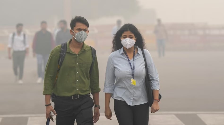
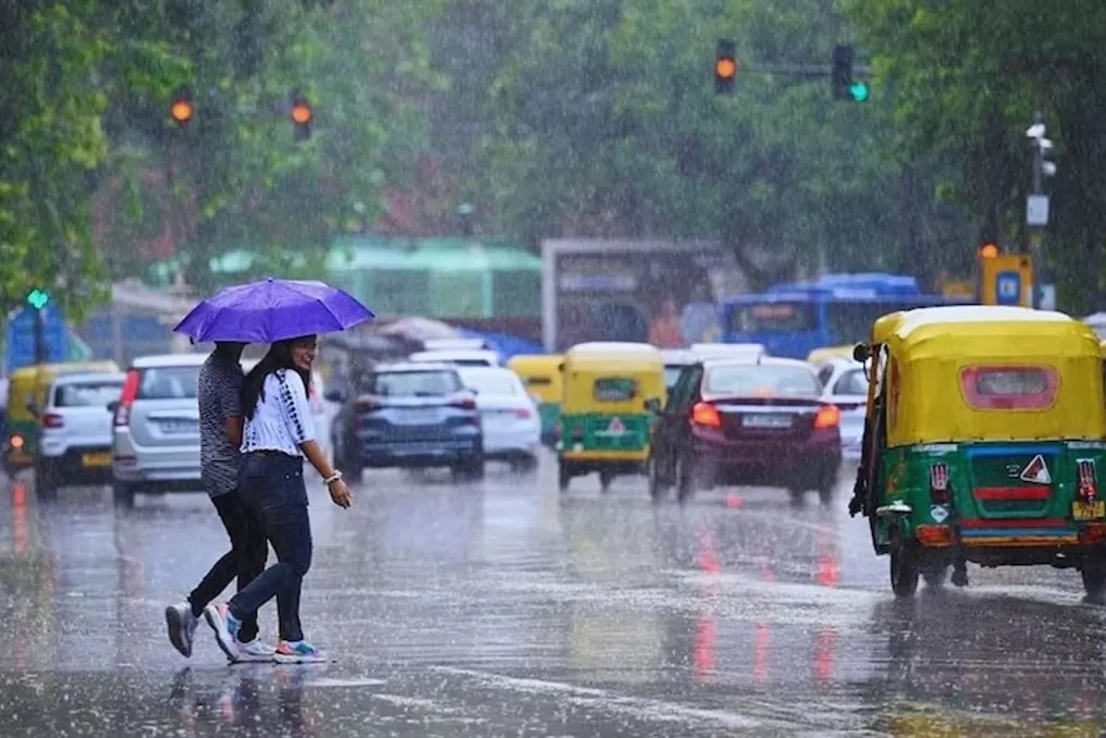
Residents of Delhi-NCR suffering from pollution may expect relief over the next week. According to the India Meteorological Department (IMD) bulletin, a new Western Disturbance may affect northwestern India starting November 10th. This is expected to bring rain to the hilly states, as well as brief showers in some areas of Delhi-NCR, Punjab, Haryana, and Chandigarh on November 11-12. Consequently, some improvement in air quality in Delhi is anticipated.

Causes of rising pollution in Delhi-NCR include vehicle exhaust fumes, dust from construction work, industrial emissions, and stable weather conditions that promote the accumulation of pollutants in the air. When it rains, some dust particles and pollutants settle to the ground along with the water. Furthermore, strong winds prevent the concentration of pollution in one place by dispersing it into other areas, which can bring some relief from pollution.

According to the meteorological department's forecasts, the initial impact of the new Western Disturbance may appear in Jammu and Kashmir and Ladakh from November 10th, where light rains are expected in some places. Then, on November 11th and 12th, the precipitation zone may expand. In Himachal Pradesh, rain is possible in several locations from November 10th to 12th, and there is a chance of thunderstorms and lightning on November 12th. In Uttarakhand, sporadic rains are expected in some areas on November 8th and 9th.

In Jammu and Kashmir and Ladakh, strong winds with thunderstorms are forecast from November 10th to 12th, with speeds potentially reaching 40-50 kilometers per hour, and gusts up to 60 kilometers per hour. Heavy rain is possible in Jammu and Kashmir on November 12th. The influence of the Western Disturbance will lead to light or sporadic rains in Delhi, Haryana, Punjab, and Chandigarh on November 11th and 12th.

Meanwhile, the monsoon season continues in several South Indian states. Heavy rains are possible in Tamil Nadu, Puducherry, and Karaikal from November 7th to 10th. Strong rains are expected in Kerala and Mahicutty from November 7th to 8th. Heavy rains are possible in coastal Andhra Pradesh and Yanam on November 7th. In coastal Karnataka from November 7th to 8th, and in southern interior Karnataka from November 7th to 10th, some areas are expected to receive precipitation. Rains are also possible in some places in Telangana on November 7th.

In several South Indian states, rains may be accompanied by thunderstorms and strong gusty winds. In Tamil Nadu, Puducherry, and Karaikal from November 7th to 10th, wind speeds may reach 30-40 kilometers per hour, with gusts up to 50 kilometers per hour. Thunderstorms and strong winds are expected in Kerala, Mahicutty, and Lakshadweep from November 6th to 8th. Similar weather conditions are likely in coastal Andhra Pradesh and Yanam from November 7th to 9th.

Weather in North Eastern Indian states may also change in the coming days. Heavy rains are possible in some places in Arunachal Pradesh, Assam, and Meghalaya on November 10th and 11th. Strong rains are expected in some places in Nagaland, Manipur, Mizoram, and Tripura from November 9th to 11th. Light or sporadic rains are also possible in these states on different days from November 7th to 12th, so residents of North Eastern India should prepare for weather changes next week.

Rains are also expected in some Eastern Indian states next week. Rain is forecasted in some places in Bihar on November 10th. Rains may fall in Jharkhand, sub-Himalayan West Bengal, and Sikkim from November 9th to 11th. Sporadic rains are expected in plains West Bengal from November 9th to 12th. In Odisha, rains are also possible in some places after November 7th on November 10th and 11th. An increase in the precipitation zone is expected in the Andaman and Nicobar Islands from November 8th to 12th, with heavy rains possible in some places from November 9th to 11th.

According to IMD, there is currently a trough of easterly winds in South India, extending from the southeast Arabian Sea through Kerala to southern interior Karnataka. Additionally, cyclonic circulation has formed around eastern Bangladesh and northeastern Assam in the upper layers of the atmosphere. These atmospheric systems may sustain rainfall activity in South and North Eastern India. Meanwhile, the new Western Disturbance affecting northwestern India from November 10th will alter the weather in Jammu and Kashmir, Ladakh, Himachal Pradesh, and surrounding areas, which may subsequently affect Delhi, Punjab, and Haryana.

The meteorological department forecasts no significant atmospheric activity in Western and Central India during this week, meaning no heavy rains or major weather changes are currently predicted for these regions.

Similar stories

Cyclonic effect caused weather cooling; heavy rain in Delhi-NCR since night
Read more
www.aajtak.in

Cyclonic effect caused weather cooling; heavy rain in Delhi-NCR since night

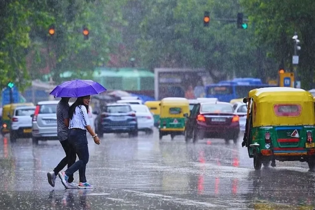
Due to the influence of a western disturbance and the cyclonic storm 'Arnab', the weather in Delhi-NCR has drastically changed. Rain has been falling in several areas of the capital since Thursday. The rain started early on Thursday morning. In Delhi-NCR, there was drizzle on Thursday morning, the weather was clear for several hours during the day, after which rain began in many areas after five in the evening. This rain continues into Friday morning, occasionally stopping.

The strongest impact of the rain is felt in West and Central Delhi. Forecasts suggest that the total amount of precipitation in some areas could exceed 50 millimeters by Friday. Due to the incessant rain and strong winds, the temperature has significantly dropped.

The series of rains, which began in Delhi-NCR on Thursday morning, continued until late at night. Both drizzle and heavy rain were observed in the national capital and surrounding areas. During this period, cold winds blew at speeds of 30 to 50 kilometers per hour, leading to a sudden drop in temperature.

Due to the constant precipitation, the maximum temperature in Delhi dropped by 5.6 degrees below normal, reaching 25.4 degrees Celsius. This is 6.4 degrees lower than the previous 24 hours. The minimum temperature was 19.1 degrees Celsius. In connection with the weather changes, the meteorological department issued a yellow warning for Delhi.

The cyclonic storm 'Arnab' and bad weather led to cloudiness and rain in Delhi-NCR, Haryana, Faridabad, and Madhya Pradesh. This also affected the celebration of Karva Chauth. On Thursday evening, due to dense clouds, women observing the fast had to wait a long time for the moon to appear. After the scheduled time for the moonrise in Delhi passed, the moon was not visible in many areas. In such cases, women continued their fasts using technology and watched the moon via video calls with relatives living in other cities to break their fast.

However, later, when the weather improved, the moon became visible through the clouds in many other parts of the country, including Guwahati and Mumbai. Meanwhile, in Alwar, Rajasthan, a long queue of cars formed on an overpass to see the moon.

Although the period of rain in Delhi lasted about 12 hours, precipitation continues in some places. West and Central Delhi are particularly affected by the rain. It is forecasted that the total amount of precipitation in several places may exceed 50 millimeters by Friday.

Weather in Delhi-NCR has changed: light drizzle and heavy downpours are observed
Read more
www.aajtak.in

Weather in Delhi-NCR has changed: light drizzle and heavy downpours are observed

The weather in the Delhi-NCR region has suddenly changed. Both light precipitation and heavy rains are being observed in the capital region and surrounding areas. Due to these changes, the meteorological department has issued a yellow warning for Delhi.

According to the meteorological department's data, the weather in Delhi will change throughout the day. Because of the rains, the weather pattern in different parts of the capital and NCR appears variable. The Delhi-NCR region is experiencing an alternation of light and heavy rain, and the weather is expected to be unstable throughout the day against the backdrop of the yellow warning.

Meanwhile, the influence of Cyclone Arnab continues in Odisha. Rains are occurring in the Rayagada area under the influence of the cyclone, although the intensity of precipitation has decreased compared to the previous period. The district administration has taken precautionary measures and placed all departments on high alert.

Ashutosh Kulkarni, the collector of Rayagada district, reported that the amount of rainfall in the district was lower than expected. He specified that 40 millimeters of rain were recorded in the last 24 hours, which ended at 8:30 AM. Subsequently, another approximately 26 millimeters fell from 8:30 AM until the evening.

Kulkarni emphasized that the total amount of rainfall in the district is significantly less than forecasted, and there is currently no threat of large-scale danger. Nevertheless, the collector stated that despite the decrease in rain intensity, they remain on high alert because the probability of further rainfall in Rayagada persists.

The administration has instructed all departments to remain vigilant due to the influence of Cyclone Arnab. Despite the reduction in precipitation, authorities continue to monitor the situation.

Delhi air becomes toxic before Diwali: Air Quality Index worsens for the fourth day
Read more
www.aajtak.in

Delhi air becomes toxic before Diwali: Air Quality Index worsens for the fourth day

The air in Delhi has once again become toxic shortly before the celebration of Diwali. In the capital, the Air Quality Index (AQI) has been in the poor to very poor range for the fourth consecutive day. In the morning, dense smog and haze were observed in many areas. The deterioration of the situation is linked to weather changes, low wind speed, emissions from transport, and instances of stubble burning in Punjab.

The level of pollution in Delhi began to rise before winter; in areas such as Akshardham, a thick veil of smog was visible in the morning. The AQI in Delhi reached about 230–250, and at some monitoring stations, the air quality reached the 'very poor' category. According to the Central Pollution Control Board (CPCB) standards, an AQI from 201 to 300 is classified as 'poor,' and from 301 to 400 as 'very poor.' This means that even in the 'poor' category, the air can be harmful to health, especially for children, the elderly, and individuals with heart or respiratory diseases.

According to meteorological department forecasts, current weather conditions and wind speed may hinder the dispersion of pollutants, so the possibility of a quick improvement depends on the weather conditions.

A significant factor contributing to the rise in pollution in Delhi is vehicle exhaust fumes. A large number of private cars, diesel buses, and other commercial vehicles operate in the capital. Furthermore, the air quality is worsened by dust from construction work, road dust, and the practice of burning waste.

To control pollution, it is necessary not only to reduce the number of vehicles but also to effectively implement measures such as checking Pollution Under Control Certificates (PUCC), preventing dust on construction sites, and banning open waste burning.

Winds blowing from the northwest also affect the air quality in Delhi. The increase in stubble burning after rice harvesting in Punjab and Haryana can aggravate the pollution problem. To stop stubble burning, state governments must provide farmers with access to machinery and alternative methods to eliminate the need to burn crop residues in the fields.

However, the entire responsibility for Delhi's pollution cannot be placed solely on stubble; numerous factors influence the air quality, including transport, construction activities, road dust, and weather conditions.

To combat pollution in Delhi-NCR, the Commission for Air Quality Management (CAQM) has established phased measures under the Graded Response Action Plan (GRAP). On October 21, 2026, an order was issued to implement the first phase of GRAP measures due to the worsening air quality in Delhi-NCR. The first phase of GRAP is activated when the AQI reaches the 'poor' level (from 201 to 300). Measures taken under this phase include mechanical cleaning of roads, water sprinkling, dust control at construction sites, and a ban on open waste burning. Municipal bodies and relevant agencies are obligated to monitor the implementation of these measures to curb dust and local pollution sources.

In September 2026, CAQM approved a revised GRAP program that includes certain measures related to controlling polluting vehicles in the first phase. These include entry restrictions into NCR and neighboring states for buses meeting BS-IV standards and older.

Particles generated from road dust and construction work play an important role in increasing pollution. According to GRAP, mechanical road cleaning, water sprinkling, and dust prevention measures at construction sites must be carried out. Part of these measures also includes a ban on open waste burning and regular waste collection.

The effect of these rules will only be noticeable with regular inspection of construction sites and action against violators. Coordination between Delhi, Punjab, Haryana, and other NCR states is required to reduce transport emissions, control construction dust, regularly clean streets, and decrease stubble burning incidents.

If wind speed remains low and effective control over pollution sources is not implemented, the situation may worsen in the coming days. Therefore, it is crucial to monitor how strictly governments enforce the directives issued under GRAP and how long the residents of Delhi can breathe clean air.

Popular