Ancient fossils discovered along the KwaZulu-Natal coast at Trafalgar Beach
Read more
Getaway
getaway.co.za

Ancient fossils discovered along the KwaZulu-Natal coast at Trafalgar Beach

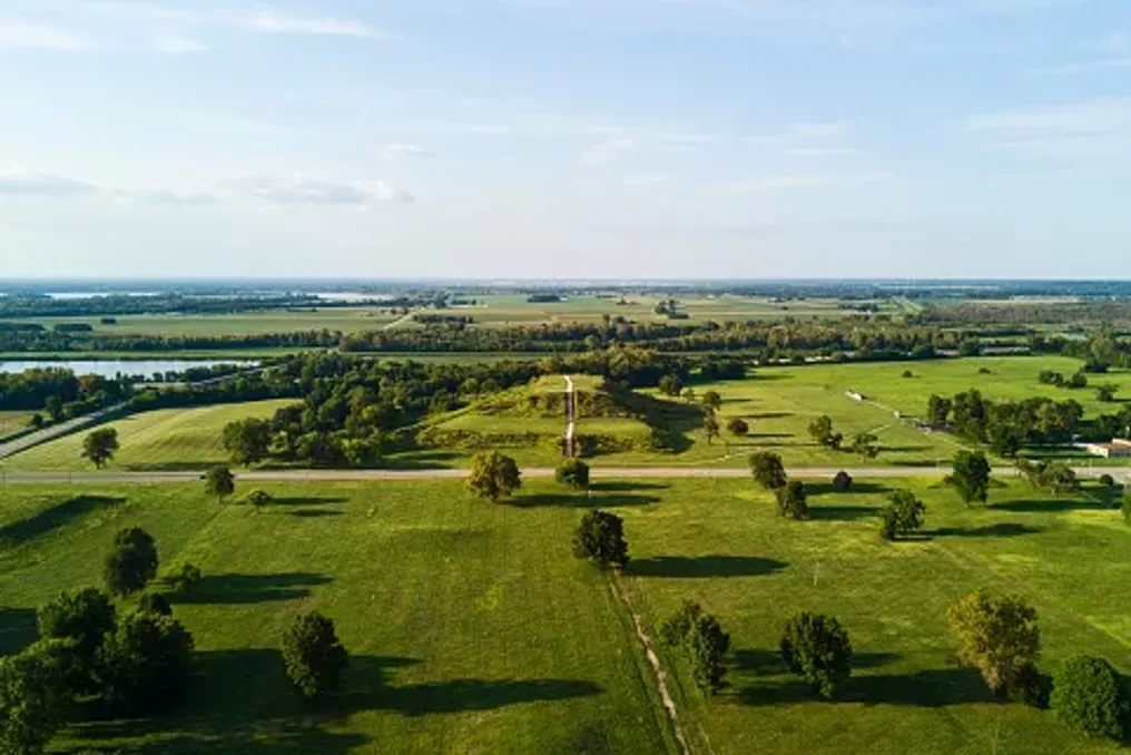
Trafalgar Beach is known for its sandy shoals, warm waters of the Indian Ocean, and rocky coastline. However, closer examination of this section of the South Coast of KwaZulu-Natal reveals evidence of a world that is millions of years old.

Fossilized trees, ancient seashells, and shark teeth are embedded in the sandstone, providing insight into the prehistoric past of the area. These findings remind us that the history of this coast is much deeper than what we see today.

The fossils found along the Trafalgar coast date back to the Cretaceous period, which lasted approximately from 145 to 66 million years ago. At that time, the landscape and coastline looked completely different.

The sandstone containing the fossils preserves traces of ancient vegetation and marine life, including woody remains that were transported by water, buried, and eventually fossilized.

A larger geological zone around the Mzimba River, near Port Edward, is also famous for rich fossil deposits. Research has allowed for the identification of ancient marine species such as ammonites, bivalves, and gastropods, as well as siliceous forests.

These discoveries help scientists understand the environmental conditions that existed on this part of the coast millions of years ago. The rocky shore within the Trafalgar Marine Reserve is the best place to begin research; the fossils are preserved in the sandstone and are easier to find during low tide.

When planning a visit, one should aim for low tide, when most of the rocky shore becomes accessible. It is necessary to carefully examine the surfaces of the rocks for fossilized remains and impressions. Some of them may be inconspicuous, especially if you expect to find complete specimens.

The coast is also inhabited by living marine organisms. Areas in the rocks support small creatures such as sea snails, while algae occupy various sections of the rocks depending on tidal action. Caution is important during exploration, as the rocks can be slippery, especially when wet.

Trafalgar is part of the Trafalgar Marine Reserve, established in 1979. This protected area covers about 8.3 square kilometers and includes sandy beaches, rocky shores, reefs, wetlands, and the Mpemba River estuary.

The importance of this area extends beyond its geological history, as it protects diverse marine habitats and the wildlife that depends on them. The fossils are part of this natural heritage and must remain in place. Removing or collecting paleontological material without proper authorization is prohibited by the South African National Natural Resources Act. Visitors should also avoid disturbing areas where water accumulates or removing marine life.

Trafalgar is located on the Lower South Coast of KwaZulu-Natal, between Marina Beach and Palm Beach. Before visiting, it is recommended to check tide tables, as low tide provides the best opportunity to study exposed rock formations. Sturdy footwear should be worn, and caution should be exercised near approaching waves, as the rocks can be uneven and slippery, so avoid exploring in unfavorable conditions. The trip can also be combined with a visit to the nearby Mpemba Reserve, known for its wetlands, dune forest, and hiking trails.

Trafalgar is worth visiting not only for its coast. Its fossiliferous rocks offer a rare opportunity to connect with a part of South Africa's history dating back millions of years. A casual walk on the beach turns into something entirely different when you realize what is under your feet, and perhaps that is the best thing about visiting Trafalgar: discovering that even a familiar stretch of coast can hold stories far older than we could imagine.

Similar stories

Dinosaur Traces Discovered in Remote Ntumbwe Reserve, Zimbabwe
Read more
getaway.co.za

Dinosaur Traces Discovered in Remote Ntumbwe Reserve, Zimbabwe

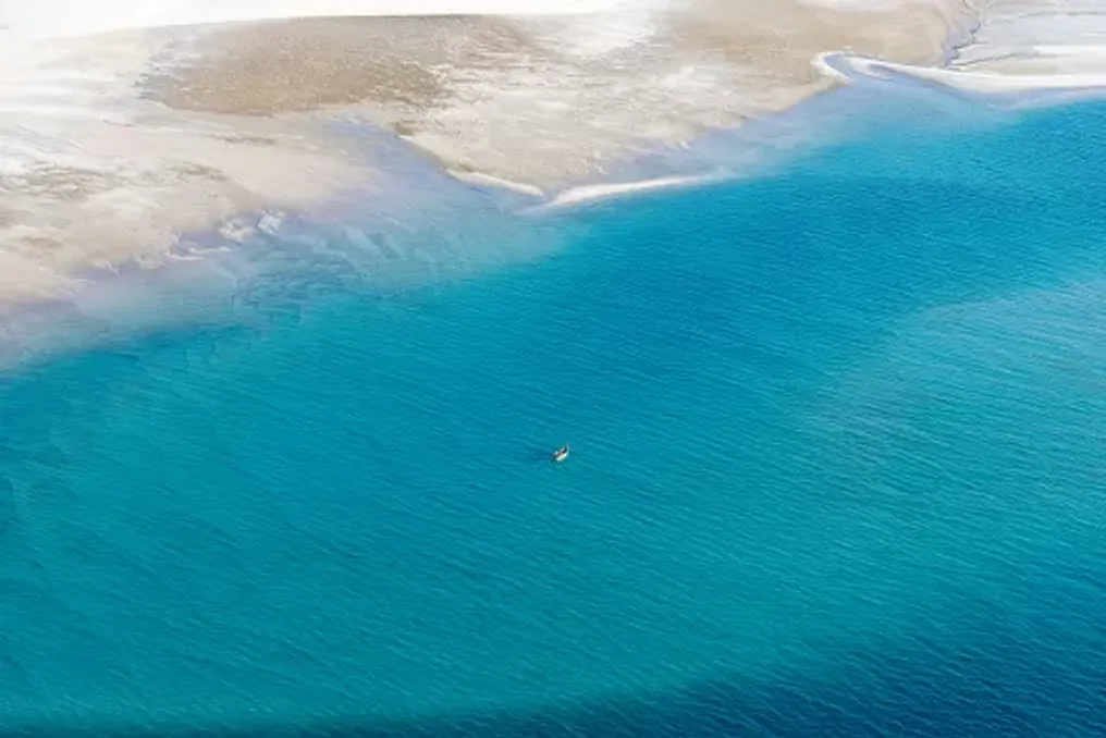
In the deep Zambezi Valley, within the remote Ntumbwe Reserve, an amazing prehistoric secret is hidden beneath the sands of the riverbed. It is here, in Ntumbwe, that huge three-toed tracks preserved in sandstone provide insight into the world that existed about 140 million years ago.

Following its opening to non-hunting tourism in June 2026, travelers have gained a new opportunity to explore this little-known wilderness, discover ancient trails, and experience one of Zimbabwe's most remote nature conservation landscapes.

Located in northern Zimbabwe, the Ntumbwe Reserve is situated in the Chwar South region of the Zambezi Valley, near the famous Mana Pools National Park. This area is part of the UNESCO World Heritage site Mana Pools, Sapi and Chwar and is known for its biodiversity, crisscrossing river systems, and vast wildlife.

However, besides elephants, predators, and birds, Ntumbwe has another reason for fame: an impressive collection of dinosaur fossil tracks. These tracks are preserved along sections of the Ntumbwe River, where exposed sandstone displays imprints left by prehistoric animals millions of years ago. Some of them are clearly discernible, featuring three forward-pointing toes and visible claw marks.

For visitors, this experience differs from viewing dinosaur fossils in a museum. These are tracks left directly in the landscape, allowing tourists to stand next to the imprints and follow the paths of animals that once moved through this ancient environment.

The first scientific attention to this area was drawn in 1984 when geologist Tim Broderick and his wife Trish began documenting these tracks. Further excavations in 1990 uncovered additional tracks under the riverbed, revealing a much longer trail than initially assumed. Today, the Ntumbwe trails are considered one of the outstanding sites with dinosaur footprints in Southern Africa.

The most striking prints belong to large bipedal dinosaurs, some reaching approximately 40–43 cm from heel to toe tip. Their three-toed shape is particularly recognizable and offers clues about the animals that left them. Scientists believe that some of the larger tracks were left by theropods—a group of predominantly carnivorous dinosaurs that walked on two legs. The tracks are linked to dinosaurs of the Allosaurid family, although the imprints themselves cannot determine the exact species responsible.

One of the most significant discoveries was made during the 1990 excavations when researchers found additional prints under the riverbed. The initial trail, which showed 14 prints, was ultimately documented as being about 48 meters long, with 45 registered prints. However, the site holds more than just massive tracks. Researchers also identified clusters of much smaller tracks, some only a few centimeters in diameter. This led to speculation about whether certain areas might have served as nursery grounds for young dinosaurs.

Collectively, these findings indicate that the Ntumbwe River landscape once supported diverse prehistoric animals. Fossil tracks are known as trace fossils. Unlike bones, which provide evidence of an animal's physical structure, trace fossils preserve evidence of how the animal moved and behaved. By studying the distance between individual prints, their depth, shape, and placement, paleontologists can estimate the animal's size, direction of movement, and walking speed. A sequence of prints, for example, can show whether the animal was walking or moving faster. Multiple trails can also give insight into how different animals moved in the same environment.

In Ntumbwe, these prints represent an extraordinary record of prehistoric activity. They also help researchers understand the ancient environments in which dinosaurs lived, including the conditions that allowed their tracks to be preserved. The sandy surfaces along the river serve as a natural window into this distant past, making the site particularly interesting for visitors who value geology, paleontology, and natural history.

Visitors should remember that these are protected scientific sites. Fossils and tracks should be observed without disturbing them, and any finds should be reported to the relevant authorities, not collected. For decades, this area was known as Chwar South safari zone and functioned as a trophy hunting concession. In June 2026, it entered a new chapter, opening up to non-hunting tourism.

This transition is managed by a long-term partnership between the Zimbabwe Parks and Wildlife Management Authority (ZimParks) and the Chwar Conservation Fund, which operates under a 25-year conservation mandate. The goal is to create a tourism model that supports landscape protection while creating opportunities for local communities. Tourism revenue is directed towards conservation efforts, helping to fund the management and long-term protection of this vital ecosystem.

The change also introduces travelers to a direction that remained relatively unknown compared to Zimbabwe's more famous safari areas. Instead of focusing solely on traditional wildlife viewing, Ntumbwe offers a combination of wildlife exploration, walking safaris, birdwatching, and prehistoric discoveries.

While the dinosaur trails are the main attraction, the vast Ntumbwe landscape has much more to offer. The area supports elephants, lions, leopards, African wild dogs, buffalo, and several antelope species, including the sable and the increasingly rare roan antelope. Wildlife viewing is part of the experience, though visitors should understand that this is a remote wilderness, not a traditional high-density safari spot. Animals can be elusive, and exploring the landscape often requires patience.

Walking safaris offer the chance to experience the bush at a slower pace, with experienced guides helping visitors identify animal tracks, plants, birds, and other details easily missed from a vehicle. The wilderness is also home to approximately 400 recorded bird species, making it an attractive destination for bird lovers. Notable species include the African Pitta, Pelsa's Owl, Narina Trogon, and Crested Turkey.

For those wishing to explore independently, self-drive safaris are available, with an extensive network of intersecting forest roads providing access to various parts of the reserve. Visitors can choose between camping and a more comfortable lodge experience at Chenje Camp. The recently renovated camp reopened in June 2026, transforming a former hunting base into an intimate tented retreat along the Chenje River. The camp features six ensuite luxury tents, flexible bed configurations, and offers both all-inclusive safari packages and accommodation-only options for independent visitors. Its unspoiled location allows wildlife to move freely across the surrounding landscape, and walking trails provide opportunities to explore the riverine environment.

Chenje Camp is also conveniently located for visitors interested in the dinosaur trails, which are about a 40-minute drive away. Those preferring a more independent experience can utilize Kanga Camp, which offers another way to experience the remote area.

Getting to Ntumbwe requires some planning, as it is a remote area with rugged terrain and limited infrastructure. The reserve can be accessed through designated entrances, including Mkanga Gate and the Chwar Bridge. Chenje Camp is about a 25-minute drive from the Mkanga Park gate when traveling from Harare, and the journey from Mana Pools takes about three hours from the west. Visitors should book accommodation and activities in advance, especially if planning to join organized walks or multi-day wildlife tours. Independent visitors must be prepared for rough forest roads and ensure their vehicles are suitable for these conditions. It is also advisable to contact the conservation fund before traveling to inquire about current road conditions, access requirements, and event availability.

For bookings and further information, visitors can contact the Chwar Conservation Fund via the official Ntumbwe Wilderness website. Ntumbwe offers something entirely different from traditional safaris in Zimbabwe. Here, the wildlife tells two stories simultaneously: one about the wild animals that continue to inhabit the Zambezi Valley, and another about the prehistoric animals that once roamed its ancient landscapes. The opportunity to stand next to dinosaur tracks preserved for millions of years is reason enough to visit. But thanks to the shift to conservation-managed tourism, walking safaris, and remarkable biodiversity, Ntumbwe also presents an opportunity to discover a lesser-known corner of Zimbabwe, contributing to the protection of one of its important wildlife areas.
Ancient City of Cahokia in the American Midwest: An Exploration of Ruins and Historical Monuments
Read more
getaway.co.za

Ancient City of Cahokia in the American Midwest: An Exploration of Ruins and Historical Monuments

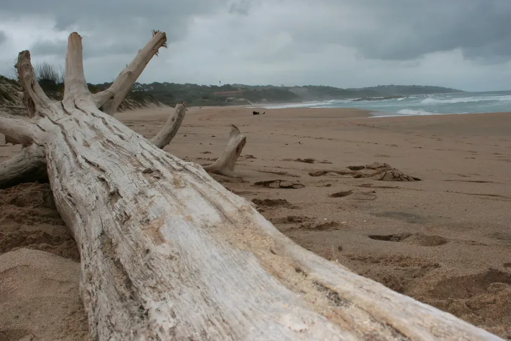
Imagine a view from the top of a massive earthen mound, overlooking a landscape that was once home to one of North America's largest cities. About a thousand years ago, this area, located near the Mississippi River, was inhabited by homes, ceremonial grounds, bustling public plazas, and thousands of people leading their daily lives.

Today, much of this city is hidden beneath the surrounding landscape. However, its massive grassy mounds, ancient gathering places, and archaeological remains are still available for study at the Cahokia Mounds State Historic Site in Illinois.

Located near Collinsville, outside of St. Louis, Missouri, Cahokia was once a thriving indigenous urban center. During its peak, roughly between 1050 and 1150 AD, it is estimated that between 10,000 and 20,000 people lived there. Its outstanding earthworks and carefully organized settlement structure made it one of the most significant pre-Columbian cities in North America.

In 1982, Cahokia was designated a UNESCO World Heritage site, and it is now a fascinating destination for travelers interested in the history, archaeology, and ancient landscapes of the American Midwest. Although much of the former cityscape is no longer visible, there is much to discover on foot.

Key Attractions of Cahokia

No visit to Cahokia is complete without seeing Monks Mound—the largest prehistoric earthwork structure in America. This enormous flat mound covers about six acres and rises approximately 30 meters above the surrounding terrain. It was built by generations of Cahokian residents who transported and stacked countless baskets of earth to create its impressive terraces.

Today, visitors can climb the stairs to the top, where the elevated position offers a different perspective on the archaeological site and the surrounding landscape. From here, it is easier to appreciate the scale of Cahokia and imagine what its central district looked like at the height of the city's life. The contrast between the ancient earthworks and the modern St. Louis urban area creates a particularly striking view.

It is recommended to allocate time to explore the base of the mound and the adjacent paths, rather than treating the ascent as a quick photo stop. Another important spot is the Grand Plaza—a vast open space that once served as the center of Cahokia's public life. This plaza was intentionally leveled and surrounded by significant structures, including several earth mounds. It provided a venue for gatherings, ceremonies, and other community events.

Today, the open landscape allows for the study of the ancient city's layout at a slower pace. Walking through this area, visitors can see how the mounds and public spaces were situated relative to each other. It is also one of the best places to grasp the colossal scale of the settlement; what initially appears as a cluster of grassy hills gradually reveals itself as a meticulously organized urban landscape.

Woodhenges and the City Perimeter

One of the most intriguing features of this site is Woodhenge—a reconstructed circle of large wooden posts associated with solar observation. Archaeologists believe the original structures were used to mark important solar events, including solstices and equinoxes. These observations helped Cahokian residents track seasonal changes and organize aspects of their agricultural and ceremonial calendars. The reconstructed wooden circle gives visitors a tangible sense of what this structure might have looked like a century ago.

If your visit coincides with a seasonal solar event, it is worth checking if any special interpretations or events are scheduled. Otherwise, Woodhenge remains a worthwhile stop for anyone interested in ancient astronomy and the relationship between early societies and nature.

Beyond the main monuments, Cahokia is a place worth exploring on foot. The area includes several walking trails that guide visitors through different parts of the archaeological landscape. Along the way, you may encounter additional mounds, open meadows, and traces of a huge wooden palisade that once encircled the city's central district. The original palisade stretched approximately two miles and was repeatedly rebuilt throughout Cahokia's history. Although much of the structure no longer survives, its archaeological trace helps researchers understand how the city was organized and defended.

For those who enjoy combining history with outdoor recreation, the trails offer a more relaxed way to experience the site. They also provide an opportunity to appreciate the surrounding natural landscape, especially the prairie vegetation. Comfortable walking shoes, sunscreen, a hat, and drinking water are recommended, especially during warmer months.

For a better understanding of what is seen outdoors, take time at the Cahokia Mounds Interpretive Center. The center provides information about the people who built the city, their daily lives, agricultural practices, and the archaeological discoveries that helped reconstruct Cahokia's history. However, visitors should know that the cultural exhibition galleries are currently closed while the site reviews its collections and continues consultations with descendant Native communities.

The vestibule, which includes a model of the site, a canoe exhibit, a temporary display, a gift shop, and visitor amenities, is open from Wednesday to Sunday from 9:00 AM to 3:00 PM according to current visitor information. It is advisable to check the official website before visiting, as access to exhibits and amenities may change.

If you prefer to explore with someone knowledgeable about the site's history, consider joining a guided tour. Cahokia currently offers free guided tours covering Monks Mound and the Grand Plaza. The published schedule lists a Monks Mound tour at 10:00 AM and a Grand Plaza tour at 1:00 PM, from Tuesday to Sunday. Tours last about an hour. Advance registration is required, so contact the site before visiting to confirm availability and arrangements.

A guided tour can add valuable context to the landscape, especially when it comes to understanding the purpose of individual mounds and the significance of various city spaces.

The Cahokia Mounds State Historic Site is located at 30 Ramey Street in Collinsville, Illinois, approximately 13 km from downtown St. Louis, Missouri. Its proximity to St. Louis makes it an accessible day trip for travelers exploring the city and the wider region. For the latest information on operating hours, tour bookings, and visitor updates, please refer to the official Cahokia Mounds website.

Cahokia may no longer be the bustling city it once was, but its preserved monuments offer an exceptional opportunity to explore a little-known chapter of American history. From climbing Monks Mound to walking through the Grand Plaza and standing among the reconstructed Woodhenge posts—a visit allows one to view the scale and ingenuity of this ancient civilization from a new perspective. For travelers passing through the American Midwest, it is a fascinating detour, offering something entirely different from the region's more conventional city attractions.

Marine nature of the Bazaruto archipelago protects the coast of Mozambique
Read more
getaway.co.za

Marine nature of the Bazaruto archipelago protects the coast of Mozambique

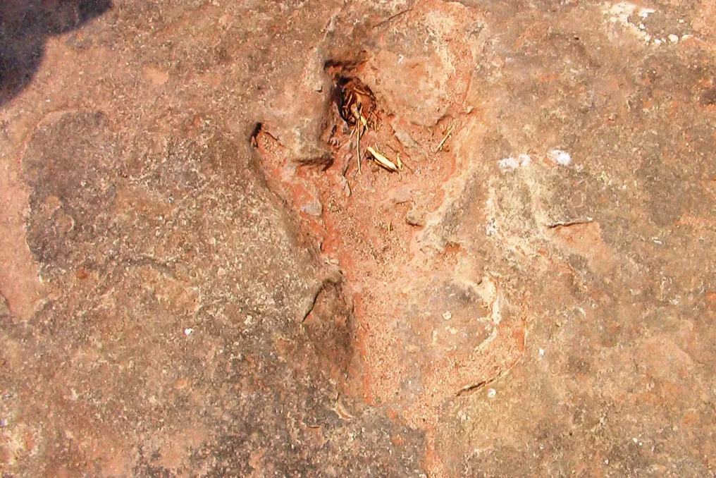
The Bazaruto Archipelago, located off the coast of Mozambique, is known for its white sandy beaches and turquoise waters, but beneath this picturesque surface lies a unique marine ecosystem. It hosts coral reefs, seagrass meadows, and mangrove swamps that support one of the most remarkable wildlife populations in the Indian Ocean.

This protected landscape in southern Mozambique is home to dugongs, dolphins, sea turtles, manta rays, and a vast diversity of marine life. These underwater ecosystems are vital not only for biodiversity conservation but also for sustaining the lives of coastal communities whose existence is closely tied to the sea.

Although tourism has contributed to Bazaruto's fame, the archipelago's greatest value lies beneath the water. Protecting these waters means preserving a complex network of habitats that supports wildlife, fisheries, and the ecological health of the Mozambican coastline.

The archipelago is located near the Inhambane province, close to the mainland settlements of Vilanculo and Inhassoro, and consists of five islands: Bazaruto, Benguerra, Magaruque, Santa Carolina, and Bangue.

These islands are part of the Bazaruto National Park, which was established in 1971 to protect the region's exceptional marine and terrestrial biodiversity. The protected area includes coral reefs, seagrass beds, mangroves, coastal dunes, sandbanks, and surrounding oceanic environments.

These environments are closely interconnected, forming a network of ecosystems that support marine species at different stages of their life. Fish use seagrass meadows and mangroves as nursery grounds, coral reefs provide shelter and feeding areas, and sandy beaches serve as important nesting sites for sea turtles.

The archipelago's location along the Mozambique Channel also makes it part of the broader Western Indian Ocean ecosystem. Its waters support both resident and migratory marine animals traveling along the East African coast.

Despite the fact that the islands and beaches attract visitors from around the world, Bazaruto's protected status reflects something more than just tourist appeal: the necessity of conserving one of the region's most valuable marine environments.

Popular