Swiss company Aegis Rider releases augmented reality helmet that replaces GPS and speedometer
Read more
Olhar Digital
olhardigital.com.br

Swiss company Aegis Rider releases augmented reality helmet that replaces GPS and speedometer

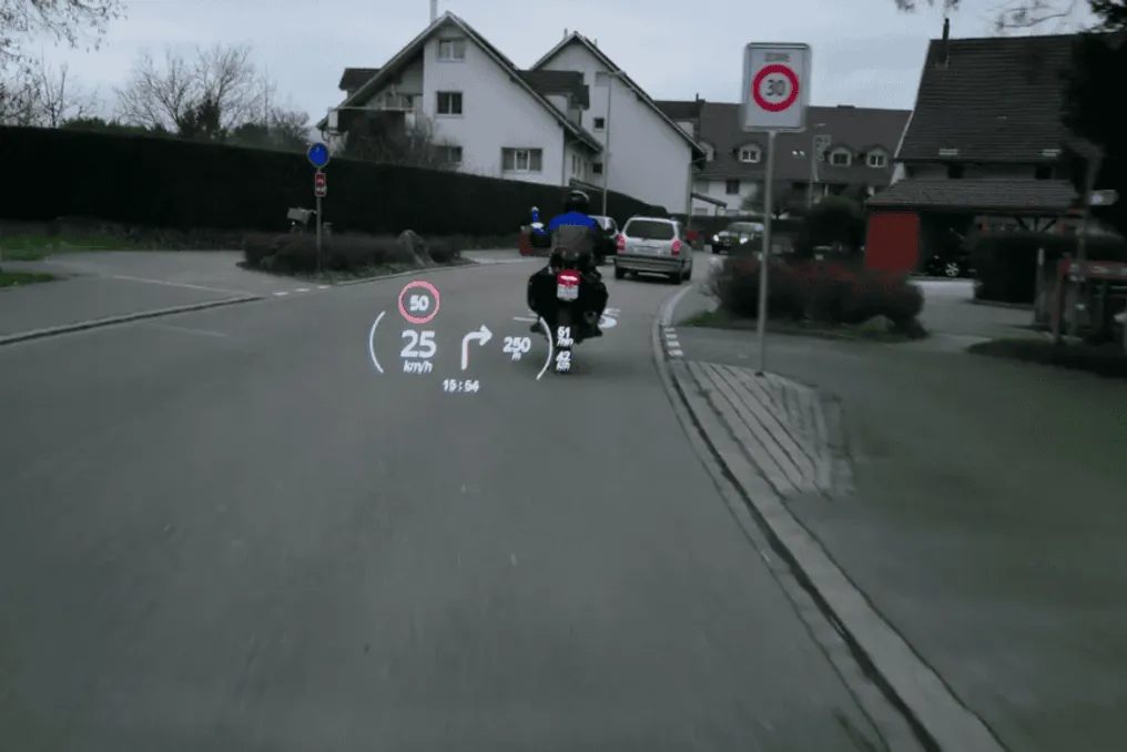
The Swiss firm Aegis Rider has introduced an augmented reality system for motorcycle helmets capable of replacing traditional devices such as GPS, maps, and speedometers. The core concept of the product is to eliminate the need for the driver to look away from the road to view this information.

The system costs start from 849 British pounds (equivalent to 6,271.98 Brazilian reais) and reach 1,399 British pounds (10,335 Brazilian reais) for more advanced configurations. The helmet itself weighs about 2 kg, which is slightly more than standard models, but it is made of carbon fiber to avoid additional weight increase.

The helmet used by Aegis Rider is manufactured by Nexx in Portugal and holds a European safety certificate, while the system itself was developed by the Swiss startup.

From a technological standpoint, the system functions like glasses that display the entire interface, including the speedometer and route. For enhanced safety, the operating mode automatically switches off during turns and when the driver looks in another direction.

The main advantage of this system lies precisely in this change of approach. Other helmet interface gadgets are usually connected to the motorcycle's visor and can obstruct viewing the road while riding.

Location sensors are installed in the chin area of the helmet and track the distance between the rider and the motorcycle. Internal sensors manage head direction and turns, activating or temporarily disabling the interface.

Additionally, there is a camera on the top of the helmet for recording road scenes, capable of shooting up to 20 hours of video in 1080p resolution.

The helmet also supports Bluetooth connectivity and microphones, allowing users to listen to music, receive navigation instructions, or take calls.

Before mounting the motorcycle, integration between the vehicle and the helmet must be performed. The company's application collects motorcycle data, such as its dimensions (weight, length, and width), in about 10 minutes and can save information for five different motorcycles to avoid repeating the process multiple times.

In the future, the company plans to implement sensors to detect objects in the motorcycle's blind spots to prevent collisions and accidents. The helmet is already available for purchase within the specified price range.
Similar stories

Photograph of thousands of satellites in the New Zealand sky mistakenly taken as AI-generated image
Read more
olhardigital.com.br

Photograph of thousands of satellites in the New Zealand sky mistakenly taken as AI-generated image

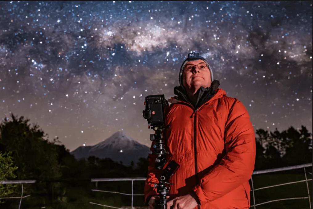
A stunning photograph of the New Zealand night sky caused a huge stir on social media. The image shows hundreds of light trails crossing the horizon, attracting so much attention that some users accused the author of using artificial intelligence (AI) to create the picture.

The author of this shot is Brendan Larsen, a 51-year-old astrophotographer who took the photos over Mount Taranaki in New Zealand. Despite the suspicions, the image is the result of real photography, which required careful planning, hundreds of shots, and significant time for post-processing.

Larsen took 578 photographs in about two hours. Each shot had an eight-second exposure. He then combined all the images into a composition, which took about 40 hours to finish in Photoshop.

The result is a photograph depicting approximately 1.4 thousand satellites and 14 thousand light trails, demonstrating the number of artificial objects passing through the night sky.

Rocket Lab launched Japanese satellite with radar capable of observing Earth through clouds
Read more
olhardigital.com.br

Rocket Lab launched Japanese satellite with radar capable of observing Earth through clouds

The aerospace company Rocket Lab conducted the launch of an Electron rocket on Monday (2), which carried a Japanese Earth observation satellite into space. This equipment, created by the company iQPS, uses radar technology that allows monitoring of the Earth's surface regardless of whether it is night or if there is cloud cover.

The mission, named The Sea God Surveys, began its takeoff at 1:41 PM, Brasília time, departing from the Rocket Lab base located in New Zealand. The satellite will be placed in low Earth orbit at an approximate altitude of 575 kilometers.

This launch constituted the ninety-ninth (99th) mission of Rocket Lab since the beginning of its activities. Additionally, it was the tenth flight executed by the company in collaboration with iQPS, which aims to establish a constellation composed of 36 satellites equipped with synthetic aperture radars (SAR).

The flight also represents a significant milestone for Rocket Lab, being the company's 99th mission and the 90th performed by the Electron rocket in its two-stage configuration. The vehicle is about 18 meters high and was specifically designed to carry small satellites into space on dedicated launches. With this launch, the Electron reached 17 flights conducted in the year 2026.

The other nine missions of Rocket Lab were conducted using HASTE, which is the suborbital version of the Electron and serves to test technologies in hypersonic flight scenarios. This model debuted in June 2023 and generally carries classified payloads.

Popular