Searching for the African Finchfoot in the Forested Rivers of Mpumalanga
Read more
Getaway
getaway.co.za

Searching for the African Finchfoot in the Forested Rivers of Mpumalanga

Some of the most interesting wildlife species in Lowveld can be found away from standard game viewing routes. The African Finchfoot (Podica senegalensis) inhabits the shaded banks of the Sabie River, under dense vegetation and overhanging trees.

This unusual, shy, and rarely seen waterbird spends most of its time near cover, making it a valuable find for ornithology enthusiasts. Good places to start searching are the areas around Skukuza and Lower Sabie in Kruger National Park.

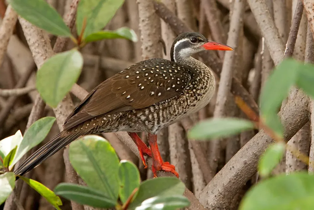
Roughly the size of a cormorant-reed, the African Finchfoot is distinguished by its characteristic coral-red bill, olive-orange legs, and unusually large, webbed feet. Males have a darker plumage, while females possess browner feathers and more noticeable facial markings.

The bird is usually found alone or in pairs along clean, permanent rivers with dense vegetation. Instead of swimming in open water, it stays close to the bank, foraging for aquatic insects, crustaceans, small fish, and amphibians. Its preference for secluded stretches of water often leads to it going unnoticed, even when the habitat is suitable.

The H4-1 route between Skukuza and Lower Sabie is a good starting point. The road follows the Sabie River, offering several spots for stopping and observing across the water. A particularly noteworthy location is the high bridge east of the confluence of the Sabie and Sand rivers. Birding guides in Kruger point to this spot as one of the best places to search for the African Finchfoot.

Another spot worth visiting is the Nkulu picnic area. Located near the Sabie River, it offers views of the water and surrounding riparian vegetation. For a quieter trip, one can take the Salitjie road (S30), which runs along the northern banks of the river. Its secluded water bodies are noted as places where the shy African Finchfoot can occasionally be seen.

The key to success is searching along the shaded edges of the water, especially where branches hang low over the river. Attention should be paid to movement near the bank, rather than expecting the bird to appear in open space.

The African Finchfoot depends on healthy waterways and natural vegetation along the riverbanks. Destruction of this vegetation, excessive water abstraction, siltation, and pollution threaten the environment necessary for the bird's survival.

Its conservation status also adds another layer of meaning to the search. The 2025 BirdLife South Africa Red Data Book classifies the species as vulnerable in South Africa, Lesotho, and Eswatini, with fewer than 1000 adult individuals estimated across the region. However, its global status remains the least alarming.

Regional assessments also record a decline in the frequency of sightings and counts of waterfowl, emphasizing the importance of protecting remaining suitable river habitats. For a bird so closely tied to its environment, conserving the river is as important as conserving the species itself.

Skukuza and Lower Sabie serve as convenient bases for exploring the Sabie River. By including the H4-1 and S30 routes in the trip and allocating time for stops at riverside viewpoints, chances of success can be increased. Using binoculars will facilitate scanning the banks, and a camera with a zoom lens will be useful for photographing the birds without disturbing them. Recent sighting reports and advice from local guides can also help pinpoint locations of recent encounters.

The appearance of the finchfoot is not guaranteed even in its preferred habitat. It is necessary to remain at designated viewpoints and avoid approaching or disturbing the shoreline for a better photograph. One can drive along the Sabie River several times without seeing the African Finchfoot. However, searching for this species offers a different perspective on Kruger National Park, shifting focus from large animals to the quiet life along its waterways.

Similar stories

Mpenjati Nature Reserve: Exploring an Unknown Estuary on the South Coast of KwaZulu-Natal
Read more
getaway.co.za

Mpenjati Nature Reserve: Exploring an Unknown Estuary on the South Coast of KwaZulu-Natal

Located between Trafalgar and Palm Beach on the South Coast of KwaZulu-Natal, the Mpenjati River flows through wetlands and coastal forest before emptying into the Indian Ocean. At its mouth, the Mpenjati Reserve protects a stretch of coastline that offers more for exploration than just a beach.

This 66-hectare reserve encompasses an estuary, dune forest, grasslands, and wetlands, along with walking trails allowing closer inspection of the natural surroundings. It is a light detour for any traveler along the Lower South Coast, especially if one wishes to replace busier beaches with quiet morning time in nature.

Two walking routes are offered to explore Mpenjati. The Ipithi trail, measuring 1.2 km, runs along the southern bank of the river through coastal vegetation. It is named after the blue duiker and provides opportunities to observe wildlife such as the grey duiker and bushbuck.

Opposite the river, the Yengele trail, 1.8 km long, passes through the dune forest, offering viewpoints overlooking the lagoon, wetlands, and coast. During the walk, attention should be paid to forest birds and movement in the undergrowth.

Both routes are relatively short, making them suitable for a leisurely stroll. It should be noted that the Yengele trail has steep sections, so allocating enough time is recommended for a comfortable pace.

The combination of forest, grassland, and wetland habitats in Mpenjati makes it an interesting spot for birdwatchers. BirdLife South Africa lists species to look out for along the river, including the pied kingfisher, giant kingfisher, water rail, and Kittlitz's plover. African black bagbirds and gulls may be seen along the coast, while the red-flanked robin, brown scrub robin, and black-backed puffback can be seen in the forest.

Another species to watch for is the green two-spot. An early morning walk is a good chance to listen to bird songs and observe activity near the water. One does not need to be an expert ornithologist to appreciate the diversity.

In addition to the walking trails, the neighboring Trafalgar Marine Protected Area offers another reason to explore this section of the coast. This protected area, spanning 8.3 km², was declared in 1979 and includes the Mpenjati estuary, the flooded riverbed, as well as areas of sandy beach and rocky shore.

The sand formations here date back to the Cretaceous period and contain fossilized trees, extinct shells, and shark teeth. Some of these can be seen in the intertidal zone during low tide, when the rocky shore also reveals diverse algae and small marine life.

If you wish to explore the rock pools, plan a coastal walk during low tide. However, collecting fossils, shells, and marine life is prohibited. Recreational fishing is permitted provided applicable rules are followed and the necessary permit is obtained.

Mpenjati is ideal for a relaxing day outdoors. There are picnic areas, as well as sanitary facilities and a children's playground on both banks of the river.

Visitors can spend time by the lagoon, walk the trails, or enjoy the nearby beach. Fishing and water activities are also popular in this area, although conditions and applicable restrictions should be checked before going.

Ezemvelo KZN Wildlife manages the reserve, and an entrance fee is charged. It is recommended to check with the reserve for current access conditions and trail status before visiting.

Although Mpenjati Reserve may be small, its appeal lies in the diversity of landscapes gathered in one coastal area. From walks in the dune forest to watching kingfishers along the river and searching for ancient fossils on the shore—there is much to fill a morning here.

For travelers exploring the Lower South Coast, this is a worthwhile stop between more well-known beach destinations. Bring a picnic, binoculars, and allow enough time for exploration. Mpenjati reminds us that some of the most interesting places on the coast are not always the busiest.

Gabon's Forest Elephants: A Study of Tropical Forest Conservation Frontiers
Read more
getaway.co.za

Gabon's Forest Elephants: A Study of Tropical Forest Conservation Frontiers

In the depths of Central African rainforests live African forest elephants, moving through some of the continent's most outstanding wild landscapes. These elusive animals, often hidden under the dense canopy of the forest, are less common than their savanna relatives, but their impact on the environment is immense.

They play a key role in maintaining the ecosystems they inhabit, promoting long-distance seed dispersal and shaping the structure of tropical forests. Gabon is one of the most crucial countries for the survival of these animals, as the country is covered with vast tropical forests and holds a significant portion of the world's remaining forest elephants, making it one of the main conservation hubs in Central Africa.

However, protecting these animals requires more than just species preservation; it involves protecting associated habitats, combating illegal ivory trade, and finding ways for wildlife and rural communities to coexist.

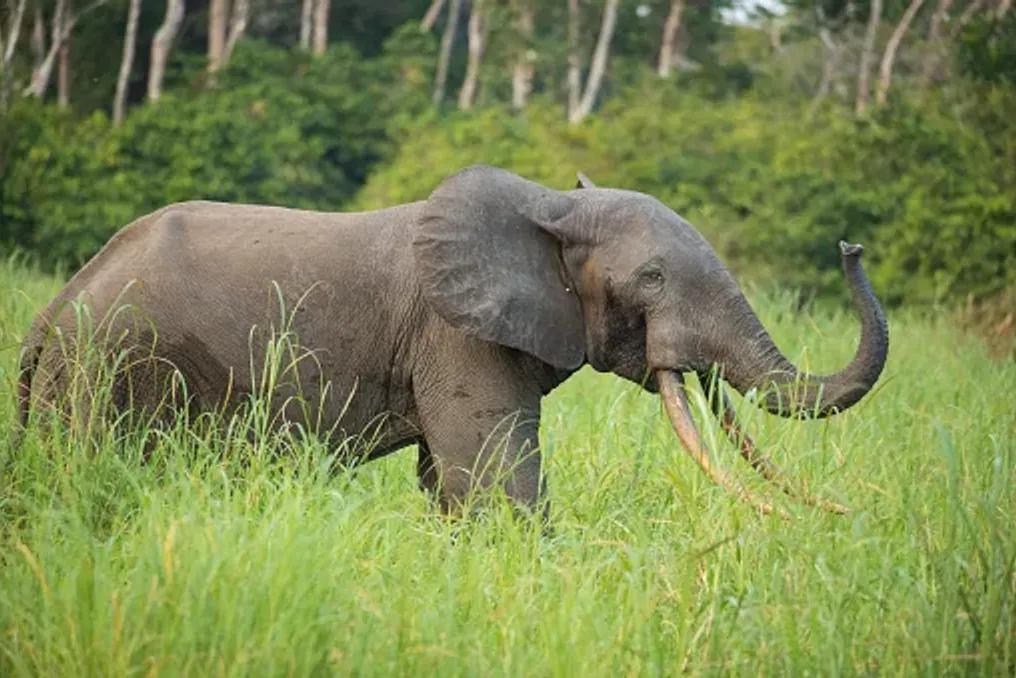
The African forest elephant (Loxodonta cyclotis) is a distinct species, different from the more familiar African savanna elephant. It is found predominantly in the tropical forests of Central and West Africa and possesses several physical characteristics adapted to life under the tropical forest canopy.

Forest elephants are generally smaller than their savanna counterparts, have straighter, downward-pointing tusks, and rounder ears. Their smaller size helps them navigate dense vegetation, and their diet mainly consists of fruits, leaves, bark, and other plant material growing in the forest.

Unlike elephants roaming open grasslands, forest elephants are difficult to spot. Dense vegetation hinders tracking, and their movements often take them far from roads and frequented areas. They are particularly associated with forest clearings known as baobabs, where mineral-rich soil and accessible water attract elephants and other wildlife.

These clearings provide some of the best opportunities for observing forest elephants in their natural habitat, although a sighting cannot be guaranteed. Forest elephants are sometimes called 'gardeners of the rainforest,' and this is not accidental. Their feeding habits and extensive movements influence plant distribution and contribute to the restoration of forest ecosystems.

Fruits form an important part of the forest elephant's diet. As they move through the tropical forest, elephants consume fruits and transport seeds over significant distances before depositing them in their excrement. This process, known as seed dispersal, helps plants colonize new territories and supports the regeneration of tropical forests. Some tree species rely heavily on large animals for seed dispersal, making elephants a vital contribution to the long-term health and diversity of these ecosystems.

Their movements also connect different parts of the forest, helping to maintain ecological links that might otherwise be disrupted by habitat fragmentation. Elephants impact their surroundings through feeding, trampling, and moving vegetation. Their activities can alter the structure of forest habitats, creating opportunities for various plant species and other animals.

Forest clearings, or baobabs, hold special significance. These open spaces in the dense tropical forest often contain mineral-rich water and open ground that attract elephants, gorillas, buffalo, and many other species.

In Indvindo National Park

In places like Baie Langue in Indvindo National Park, these natural gathering spots offer researchers and visitors the chance to observe wildlife that would otherwise remain hidden under the forest canopy. However, the link between elephants and forest regeneration is complex. Their impact varies depending on the plant species, habitat, and local conditions. It is clear that their disappearance would have consequences extending far beyond the loss of a single species.

A crucial part of elephant protection is understanding where they move. Their ranges can span hundreds of square kilometers, encompassing various habitats in search of food, water, and suitable conditions. Studies conducted in the Wonga-Wongwe presidential reserve in Gabon used GPS tracking to study their movements. A study involving 17 collared elephants showed that they traveled an average of about 2840 km annually, with an average range of about 713 square kilometers.

These results demonstrate why conservation cannot be limited to individual national parks or isolated patches of forest. Elephants need space to move, and their survival depends on maintaining connectivity between habitats. Roads, settlements, and agricultural development can disrupt these movements, increasing the likelihood of human contact and hindering access to certain areas for elephants.

Therefore, protecting ecological corridors and managing lands outside officially protected areas are vital elements of Gabon's broader nature conservation efforts.

Gabon is one of the most important remaining habitats for African forest elephants. Its vast tropical forests are part of the Congo Basin—the second-largest tropical forest region in the world, stretching across several Central African countries. A nationwide study published in 2021 estimated that there were about 95,000 forest elephants remaining in Gabon. Although this estimate carried significant uncertainty, it confirmed the country's exceptional importance for this species.

Gabon has also established an extensive network of national parks protecting vital tropical forest habitats, laying the foundation for wildlife research and conservation. Located in northern Gabon, Minkebe National Park protects a vast area of relatively untouched tropical forest. Historically, it supported a significant population of forest elephants but was also subjected to intense poaching pressure. Between 2004 and 2014, researchers counted that the park lost approximately 78–81% of its forest elephant population, mainly due to illegal ivory hunting. The scale of the decline highlighted how quickly even remote wilderness areas can suffer from organized poaching networks.

On the western coast of Gabon, Loango National Park is known for its unusual combination of tropical forest, lagoons, wetlands, beaches, and coastal habitats. The park is particularly interesting because it demonstrates the diversity of environments utilized by forest elephants. It is also part of a wider landscape supporting gorillas, chimpanzees, hippos, buffalo, and diverse birdlife. Its combination of coastal and forest scenery has made Loango one of Gabon's most unique natural destinations.

In eastern Gabon, Indvindo National Park protects vast tropical forests, rivers, and impressive waterfalls. Baie Langue is located here, one of the country's most famous forest clearings. This clearing attracts forest elephants and other wildlife, making it an important site for ecological research and observation. Its remote location also illustrates the challenges of wildlife monitoring in large, densely vegetated landscapes.

Lope National Park offers a different view of Gabon's nature, presenting a landscape where tropical forest meets savanna. This mix of habitats supports rich biodiversity and provides opportunities to study how animals utilize different environments. The park is also recognized as a UNESCO World Heritage site, reflecting its ecological and archaeological significance.

Despite Gabon's importance as a conservation hub, forest elephants are still classified as critically endangered. Their populations face a range of interconnected threats, many of which extend beyond national borders. Illegal ivory trade has had a devastating impact on forest elephants across Central Africa. Their relatively slow reproductive rate means that populations require many years to recover from significant losses. Even protected areas are vulnerable when poaching networks operate in remote forest landscapes. The dramatic decline in Minkebe remains a stark example of the consequences.

Effective protection requires continuous investment in anti-poaching patrols, intelligence gathering, law enforcement, and cooperation between neighboring countries. As forests and agricultural lands increasingly intersect, human-elephant conflict has become a critical conservation issue. Forest elephants sometimes raid crops, damaging fields and threatening the livelihoods of farming communities. For families dependent on harvests, the loss of food or income can create significant hardship. This can lead to retaliatory actions against elephants, undermining conservation efforts and creating tension between local communities and conservation authorities. Solving this problem requires more than just asking for tolerance of elephant presence. Practical measures, community involvement, and support for affected households are necessary to ensure coexistence.

In 2025, Gabon initiated a two-year project involving the government, the Wildlife Conservation Society, and Space for Giants to support efforts toward more peaceful human-elephant coexistence. While national parks provide vital refuges, elephants do not recognize protected boundaries. Many move through forests used for logging and other economic activities. Therefore, responsible forestry, careful infrastructure planning, and the protection of ecological corridors are essential.

The challenge lies in finding ways to balance economic development with the ecological needs of a species that requires large, connected landscapes to survive. Gabon's forest elephants represent more than just one of Africa's most prominent wildlife populations. Their movements, feeding habits, and relationships with other species are woven into the ecological functioning of the tropical forest. By protecting them, we preserve the forests that sustain countless other plants and animals, and we acknowledge the needs of the people who share these landscapes. The country's conservation efforts demonstrate both the opportunities and the difficulties associated with protecting vast wilderness areas. Its national parks, research programs, and community initiatives lay an important foundation, but long-term success will depend on sustainable protection and cooperation.
Chimanimani Mountains in Zimbabwe: Wildlife, Waterfalls, and Rare Plants
Read more
getaway.co.za

Chimanimani Mountains in Zimbabwe: Wildlife, Waterfalls, and Rare Plants

In addition to Zimbabwe's well-known safari landscapes, the Chimanimani Mountains represent a unique mountain reserve with sharp peaks, cascading waterfalls, and rare plants clinging to the rocky slopes.

This rugged natural area is located in the country's Eastern Highlands, along the border with Mozambique, and attracts hikers, ornithologists, and travelers seeking wild places. Chimanimani offers visitors a completely different side of Zimbabwe, full of dramatic landscapes, biodiversity, and the quiet beauty of the highlands.

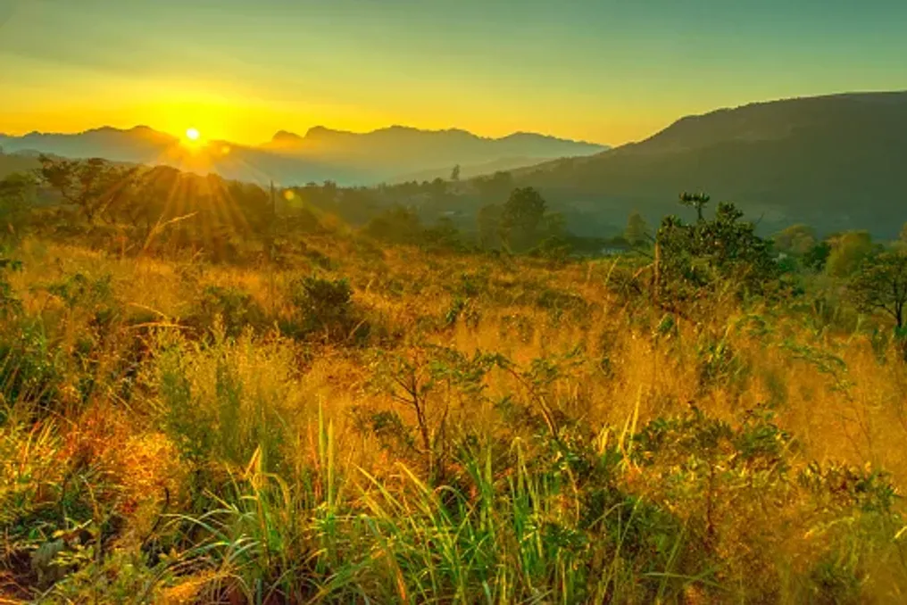
The Chimanimani Mountains are part of the Eastern Highlands, a mountain range running along the border between Zimbabwe and Mozambique. Their characteristic ridges, steep slopes, and deep gorges create a landscape that differs significantly from the open savannas and wildlife reserves more familiar to Zimbabwe.

A large part of the area is formed by ancient quartzite and slate formations. The resilient quartzite has helped shape the dramatic lines of the mountain ridges, while differences in altitude, soil, and precipitation support an astonishing diversity of habitats.

The broader mountain massif rises from low river valleys to high peaks, including Mount Binga, which reaches approximately 2436 meters. This change in altitude causes a shift in conditions for flora and fauna—from warm lowland forests to cooler, open mountain meadows.

For tourists, the landscapes themselves are the main attraction. Rocky peaks rise above rolling hills, mist can settle over the highest points, and narrow trails reveal fresh views at every turn. This landscape is best explored slowly, on foot, to appreciate all the details.

Water plays a central role in Chimanimani's appeal. Springs and mountain streams feed rivers that cut through the rugged terrain, forming waterfalls, shaded pools, and secluded spots for relaxation along the trails.

One of the most famous sites is the 'Bridal Veil Falls,' located near the village of Chimanimani in the Eland Reserve. This waterfall drops approximately 50 meters into a rocky pool, offering an easy excursion for visitors who wish to see the area's beauty without needing a difficult mountain trek.

Further into the mountain reserve, waterfalls such as Muhokhwa and those along the Bundi River enhance the area's appeal. Depending on the route, visitors may encounter clear streams, rocky gorges, and natural ponds framed by vegetation.

These waterways serve not only as scenic features; they are part of an ecological network that supports the region's forests and other habitats, making the protection of rivers and their surrounding vegetation vital for the entire landscape.

Water levels and conditions change depending on the season, so visitors should check local recommendations before swimming or walking near rivers. During the rainy season, sudden floods can make riverbanks and low-lying campsites dangerous.

For plant lovers, Chimanimani is one of Zimbabwe's most outstanding natural areas. The national park includes about 2182 plant species, accounting for over 30% of the country's registered species diversity, with 74 species being endemic to the Chimanimani mountains, according to data from the Zimbabwe Parks and Wildlife Management Authority.

This diversity is closely linked to the geology of the mountains. Soils formed from quartzite are often nutrient-poor, creating specialized conditions where some plants have evolved to survive. Combined with variations in altitude, rainfall, and exposure, these conditions form a mosaic of habitats supporting unusual and locally restricted species.

The mountain flora includes characteristic aloes, proteas, and heaths, as well as other plants adapted to rocky soil and high-altitude conditions. Some of these are found only in small parts of the mountain range, making their survival particularly dependent on the preservation of specific habitats.

Among the notable species recorded in the wider Chimanimani region are Aloe munchii and the endangered Euphorbia rugosiflora. Such plants illustrate the importance of this area for botanists and conservation specialists.

Tourists do not need special botanical knowledge to appreciate this diversity. Careful observation of plants growing between rocks, along forest edges, and on open slopes can reveal another dimension of the landscape. A knowledgeable local guide can help identify species and explain how they have adapted to the environment.

The best approach is to observe without disturbing: collecting flowers, uprooting plants, or trampling fragile vegetation should be avoided, especially in high-altitude areas where recovery can be slow.

Popular