Development of Indian architecture around water: from coastal reclamation to data centers
Read more
ArchDaily Brasil
archdaily.com.br

Development of Indian architecture around water: from coastal reclamation to data centers

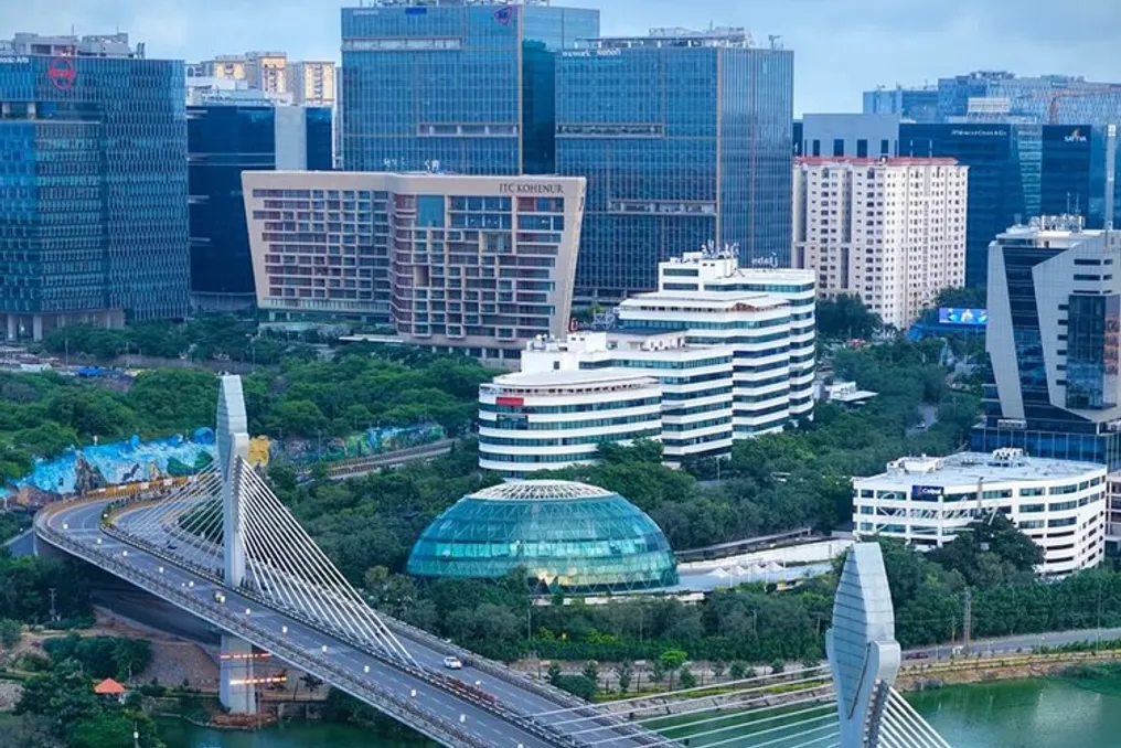
Historically, water was viewed by architecture as a mere backdrop, an obstacle to be drained, or a public service to be provided. However, in contemporary India, the relationship with water has taken on a dimension of great impact. Although water remains a shared ecological resource, the surrounding land and infrastructure are increasingly treated and financed as economic assets. This results in the expansion of coastlines to accommodate traffic and the transformation of lake shores into profitable real estate areas. This decision-making involves various institutions with distinct terminologies, complicating the definition of who controls the use of water and its surroundings, as well as who bears the consequences.

Mumbai was traditionally built through water diversion, and the Coastal Road follows this practice on an infrastructural scale. According to the Municipal Corporation (BMC), the 10.6-kilometer southern segment generated approximately 111 hectares of reclaimed land, designated for roads, bridges, roundabouts, and public spaces. The argument presented by the BMC focuses on improving mobility and public benefit, aiming to reduce travel time in the city and provide about 1.24 square meters per inhabitant in one of the planet's most dense metropolises.

In 2019, the Bombay High Court overturned coastal licenses due to the absence of appropriate scientific studies. Despite this, the court upheld the regulatory change authorizing reclamation for road construction, and the Supreme Court stayed the injunction, allowing the works to proceed. Issues regarding damage to coastal ecosystems caused by reclamation and the behavior of the retaining wall remain under debate without a definitive conclusion.

For local architect Alan Abraham, who later requested design modifications for the reclaimed section from the court, the core of the problem lies in priorities. He argued that 'the city needs roads, not the coast,' suggesting relocating the road inland so that public space could connect directly to the water. The BMC, conversely, responded that the project was based on expert studies and that alterations were no longer possible with most of the work completed.

The lakes of Bengaluru were initially planned as an interconnected system of artificial canals for rainwater drainage, known as rajakaluves. The preservation of these lakes depends less on regulations than on the demarcation of their boundaries. Municipal authorities established a uniform 30-meter buffer zone around the lakes, restricting construction in this area. However, in 2025, the state proposed an amendment that would replace these strips with buffer zones based on the size of the water body, offering no protection for smaller ones, and three meters for areas up to one acre.

Legal analyses indicate that the previous norms were deemed unscientific, and the bill would allow certain public utility structures, such as pumping stations and roads, within these buffer zones. This bill returned at the end of 2025 without consultation with the state expert committee or the public. Lakes that previously absorbed monsoon runoff and recharged the groundwater now direct this water into narrowed canals. Construction in these buffer strips can reduce space for water dispersion and infiltration during heavy rains, increasing surface runoff and pressuring already overloaded drainage networks.

A study on flood-affected neighborhoods confirms the significant presence of informal occupation or improper use of the canals connecting the lake network. In one locality, the water table dropped from about 100 feet to 600 feet in six years after a lake disappeared. In Bengaluru, the buffer zone ceased to be a natural element and became a legal figure, and its alteration redefines what can be considered buildable land.

Data centers represent a problem of another magnitude, given that their water requirement is not visible in form or implementation of the building. WRI India reported that more than half of the country's data centers are located in water-stressed regions, concentrated mainly in five states: Maharashtra, Tamil Nadu, Karnataka, Telangana, and Uttar Pradesh. Furthermore, the proposed guidelines for 2026 in Uttar Pradesh foresee a continuous water supply for data centers, even if India currently lacks established requirements for disclosing water consumption data.

Decreased local water use can increase electricity demand, and since power plants also consume water, scarcity can be transferred to the energy grid instead of being resolved. In India, recycled urban wastewater is a supply resource needed by other users in water-scarce cities. In water-stressed Indian regions, the choice and design of a data center can impact water availability for residences, agriculture, and other local uses. A highly efficient facility in an overcrowded watershed still draws from a shared supply, making site selection essentially a decision about who gets access to water.

In summary, these three examples demonstrate water as a resource: displaced, limited, and destined for infrastructure. In all of them, as in most projects, the decision occurs before architectural planning. Architectural professionals often inherit existing conditions rather than shaping them.

However, architectural professionals can intervene individually in the early stages of the process. They have the capacity to question needs programs that assume guaranteed land, request water balances and hydrological assessments before accepting or proposing a location, and suggest alternatives to fixed layouts, as done by the Abraham collective. The Mumbai architectural community has adopted this approach on more than one occasion. The Mumbai Architects Collective, comprising about 120 firms, presented alternative design proposals for the Coastal Road. In Chennai, in 2019, design teams from the Water as Leverage program developed closed-loop water systems for neighborhoods.

Sustainability cannot be assessed solely by the performance of an isolated building, as this performance depends on the territory it occupies and the shared resources it utilizes. If water demand had been declared from the outset as a condition of the land, some of the buildings today considered inevitable might never have been proposed in their current locations. Whether the profession and the institutions that hire it are willing to start with this premise remains an open question.
Similar stories

2026 Architecture Reflects New Ways of Life at Home, Emphasizing Well-being and Identity
Read more
g1.globo.com

2026 Architecture Reflects New Ways of Life at Home, Emphasizing Well-being and Identity

Throughout 2026, residential projects showed a repetition of certain trends, demonstrating that architectural changes are not solely driven by the emergence of new fashionable directions. How people use their homes, entertain guests, relax, and organize their daily routines is beginning to directly influence decisions made even during the design phase.

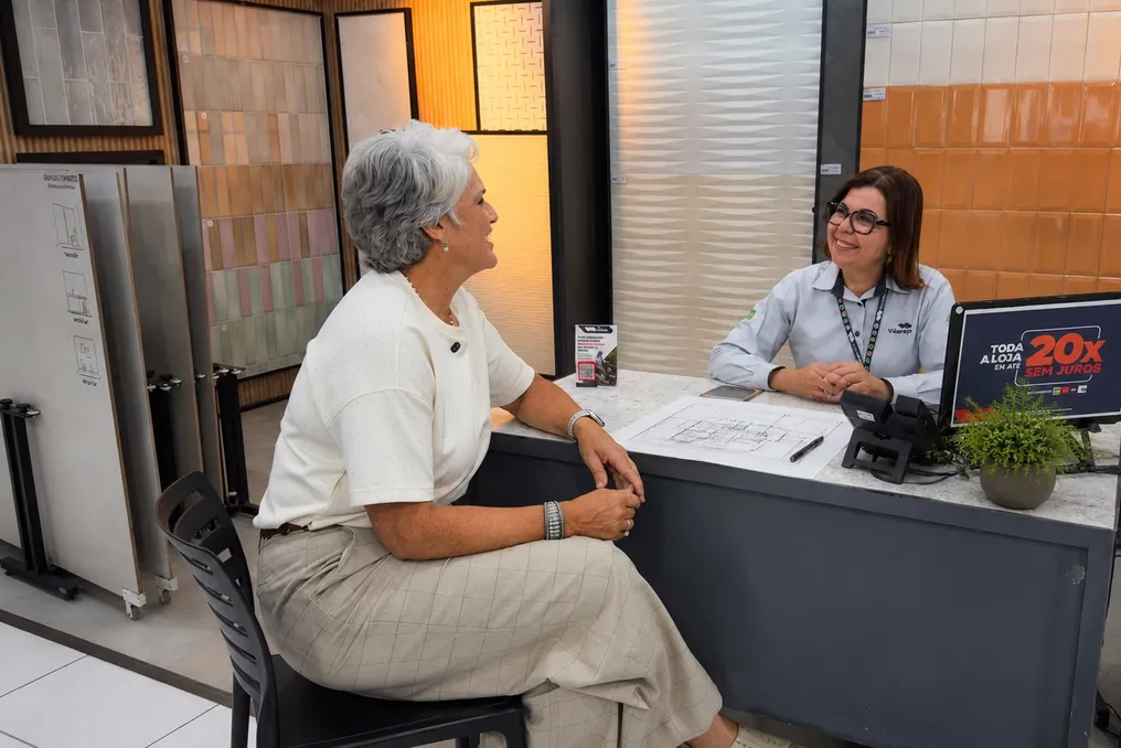
To understand exactly what changes have occurred in living spaces, Vilarejo invited its partner specialists to share observations made while working with clients and projects throughout the year.

Architect, designer, and landscape designer Ana Bordallo, a Vilarejo partner, analyzed the choices that solidified in residential projects in 2026 and what they reveal about new priorities within the home.

According to Ana Bordallo, architect, designer, and landscape designer, well-being and a sense of belonging have become even more important factors in design decisions. She noted that projects began to value comfort, coziness, and a sense of belonging more highly. They incorporated more soft forms, natural textures, thoughtful lighting to create various atmospheres, and biophilic elements. There was also a shift in color palette: the dominance of gray and black shades decreased, while the presence of neutral, green, ochre tones, and nature-related hues increased.

These changes are also evident in the desire to create interiors closely connected to the history and habits of the residents. Architect Ana Bordallo explained that there is a growing demand for spaces that possess their own individuality and tell the story of those who live in them. Furniture, items of emotional value, handmade goods, and family heirlooms began to be re-evaluated. Clients became more open to creating homes that are less standardized and more closely aligned with their own routines and personal values.

These observations point not just to a choice of color or form, but to a transformation in the very approach to understanding the home. Aesthetics remain important, but now they share attention with comfort, identity, and the experiences that matter to those using the space.

Natural references have always been a constant element in recent years' architecture. Wood, stone, vegetation, fibers, and surfaces inspired by natural elements appeared in various interior styles. In 2026, this connection persists, but it is realized in a more balanced way.

Architect Beth Gonzaga believes that stone remains one of the materials occupying a significant place in projects. She emphasized that natural materials continue to be highly sought after, especially stone, which is used in different parts of projects to help create coziness and a feeling of hospitality. However, in her opinion, the most important thing now is knowing how to dose this presence, balancing colors, quantity of use, and combination with other materials so that the result does not look excessive.

The interpretation of closeness to nature is expanding. It no longer depends solely on the presence of plants; textures, mineral surfaces, fibers, natural light, and colors inspired by external elements also contribute to building this connection inside the home.

The living room, kitchen, veranda, and barbecue area continue to become increasingly interconnected in residential projects. Nevertheless, integration is now understood not merely as removing walls, but as a way to promote communication without ignoring the function of each room. Architect Beth Gonzaga reported that integrated zones remain one of the main client requests. There is a greater desire to use the home and spend family time closer, participating in daily activities without separating the main social area.

In practice, materials, lighting, furniture, and layout can provide continuity between spaces without requiring all of them to have an absolutely identical configuration. Thus, integration is beginning to align with the routine of each family.

Social media has significantly expanded access to examples of architecture and decor, accelerating the spread of new ideas. However, in practice, an image saved for inspiration must pass through additional filters before reaching the construction site. Available dimensions, budget, maintenance needs, layout, and resident habits help determine whether a particular decision truly makes sense. A trend may gain great digital fame but fail to meet the needs of a specific dwelling.

This distinction confirms one of the changes noticed in 2026: projects are becoming less dependent on ready-made images and more reliant on the ability to adapt references to the life that will take place in these spaces.

Ultimately, the year's outcomes point toward an architecture more closely connected to the people who will use it. Well-being, nature, emotional memory, communication, and identity act not as isolated elements, but as parts of a single transformation in the mindset regarding the home. The project strives not just to reproduce a trend, but to find answers to real habits. It is in this convergence of architecture and everyday life that 2026 leaves one of its clearest marks on residential interiors.

Ethiopian Renaissance Dam and the Nile: Conflicts between water scarcity and energy
Read more
archdaily.com.br

Ethiopian Renaissance Dam and the Nile: Conflicts between water scarcity and energy

The Grand Ethiopian Renaissance Dam, known by the acronym GERD, is a colossal work of engineering and architecture that, despite connecting, also generates significant divisions. This mega-dam calls into question who holds the right to sovereignty over the river's water and energy resources, challenging the old Nile treaties established during the colonial era.

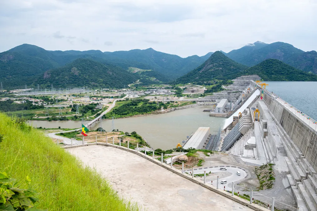
Inaugurated in September 2025, the GERD is a massive concrete structure located on the Blue Nile, in western Ethiopia, specifically in the Benishangul-Gumuz region. It is situated just 30 kilometers upstream and east of the border with Sudan. Its construction aims to make it one of the largest hydroelectric power sources on the planet, symbolizing Ethiopia's technological autonomy and economic advancement.

Dam Architecture Details

To understand the debate, it is essential to know its structure. The GERD was built under the administration of the civil engineering company Webuild (formerly Salini Impregilo) for the Ethiopian Electric Power. It consists of a main roller-compacted concrete (RCC) dam, an earth-fill arch dam with concrete lining, as well as spillway and hydroelectric power plant systems at the base.

With a designed capacity of 6,000 MW (although recent literature registers 5,150 MW), the dam is 1.8 kilometers long and reaches 175 meters in height. The main dam, only 14 kilometers from Sudan, contains a reservoir called Lake Nigat, with a capacity of 74 billion cubic meters of water, an surface area three times larger than Addis Ababa.

Additionally, there is a 5-kilometer-long and 50-meter-high earth-fill arch dam that serves for passive water containment in a lower area of the basin. The total average annual flow of the reservoir is about 50 billion cubic meters. Two hydroelectric power plants, equipped with 13 Francis turbines on both banks of the river, generate an average annual output of 15,700 GWh.

The spillway system ensures the dam's safety by allowing the safe discharge of floodwaters, keeping the reservoir level within planned limits. These include a main service spillway with gates, a freeboard spillway, and a side emergency spillway without gates, prepared for extreme events.

Internal Webuild laboratories were responsible for testing and developing materials to ensure structural stability and long-term mechanical performance. This was achieved through an advanced mix of RCC, developed internally and internationally, characterized by low cement and water content, and prolonged setting times. A network of galleries in the main dam houses high-sensitivity instruments, such as vertical pendulums, to monitor hydrostatic pressure, structural displacements, joint integrity, and turbine operation in real time. This data is sent to a centralized database at the right bank control center, enabling preventive maintenance and ensuring maximum structural reliability.

The reservoir's storage capacity allows GERD to modify seasonal flow patterns, manage floods, and produce energy. However, being part of an international and transboundary river system, the reservoir filling process raises questions about water needs and storage schedules. Filling cycles have been carried out unilaterally, without transparency between the upstream country and its downstream neighbors, intensifying geopolitical tensions.

GERD operation requires hydrological regulation, as lack of coordination and non-transparent data sharing can harm downstream infrastructure, such as the Roseires Dam in Sudan, due to its proximity to GERD.

Egypt alleges that Ethiopia's unilateral actions could reduce water flow, representing a national threat to its economy and population. The country also points to Ethiopia's 'unilateral exploitation' of transboundary waters in the Omo, Jubba, and Shebelle basins, in addition to the damage caused to its neighbors Somalia and Kenya.

Peaceful resolution of this issue could foster crucial regional cooperation on the White Nile. The disorganized release of water from Ugandan dams, for example, has already caused downstream flooding in South Sudan, resulting in forced displacement of people and disease outbreaks.

Historical Hegemony

In the initial planning of GERD, conducted in the 1960s, Ethiopia lacked internal stability to proceed with the project. The initiative was kept secret until a significant amount of work was completed, as it was known that its development would have a strong geopolitical impact, especially on nations located downstream in the basin.

This weight is amplified when considering that the Nile Basin countries total 11, distributed upstream, downstream, or in both positions. Nations strictly upstream include Burundi, Democratic Republic of Congo, Rwanda, Uganda, Tanzania, Kenya, Eritrea, and Ethiopia. Egypt is the only exclusively downstream country. Sudan and South Sudan occupy mixed positions: South Sudan is upstream relative to Sudan and Egypt, but downstream relative to Uganda, given that the White Nile receives rivers that flow into Lake Victoria.

The Blue Nile, which constitutes 85% of the total volume of the Nile River, originates in Lake Tana, in the Ethiopian Plateau, flows towards Sudan, and finally joins the White Nile in Khartoum to form the main course of the Nile, which passes through Egypt until discharging into the Mediterranean Sea.

Historically, water policy in the Nile Basin was dominated by Egypt's water hegemony, a legal pattern consolidated over a century of colonial-era 'treaties'—the Nile Treaties—in contrast to the search for a multilateral agreement that still conflicts with water use rights.

The Anglo-Ethiopian Treaty of 1902 initially secured Egypt's control over the Nile, prohibiting Ethiopia from altering the course of the Blue Nile without British permission. This supremacy was reinforced by the Anglo-Egyptian Treaty of 1929—which functioned more like an exchange of notes than a formal treaty, giving Egypt veto power over upstream projects or unilateral initiatives—and the subsequent Nile Water Agreement of 1959, which granted Egypt exclusive annual quotas of 55.5 billion cubic meters and Sudan 18.5 billion cubic meters.

However, the reality is more complex: although these unequal colonial-era treaties should be revised or revoked, Egypt remains a country with severe water scarcity, depending on the Nile for over 90% of its freshwater needs, with about 95% of the population living along its banks.

Furthermore, unlike other riparian nations in the basin—except Eritrea (which participates as an observer in the Nile Basin Initiative due to its low water impact) and Sudan (which suffers from infrastructure collapse)—Egypt depends on the Nile as a vital line of survival. Since GERD is on the Blue Nile, responsible for the majority of the river's total volume, the project implies a drastic shift in the regional balance of power, ending the 'monopoly' of water and generating apprehension for the agriculture and water security of downstream countries, especially during prolonged droughts.

To challenge this asymmetric control, the Nile Basin Initiative (NBI) was launched in 1999, followed by the Cooperative Framework Agreement (CFA) in 2010, just one year before the start of the Renaissance Dam works in 2011.

Due to the internal tensions of the Arab Spring, Egypt was unable to effectively oppose or block the project. Its isolation increased when Sudan softened its old objections, adopting a posture of moderate neutrality. Since then, the Sudanese position has frequently varied—between rejection, neutrality, or support—influenced mainly by its own internal political fragmentation. The debate over the pros and cons of the dam has also shaped these shifts in position. On one hand, the dam promises more stable irrigation, reduced dredging costs, and better flood management. On the other, it presents serious long-term risks: impoverishment of alluvial plains due to sediment accumulation in the reservoir, disturbances to local ecosystems, and the persistent lack of cooperation among the three nations.

Political pressure culminated in the Principles Declaration on GERD in 2015, which is the main trilateral milestone between Ethiopia, Sudan, and Egypt. In this document, the three countries recognized the existence of the dam and committed to the principles of international water law. However, to date, they have not reached a binding agreement on the rate of reservoir filling or on managing drought periods.

Disagreements persist on a broader scale. When the Nile Basin Cooperative Framework Agreement (CFA) came into force in October 2024, Egypt and Sudan refused to sign it, seeking to protect access to a vital resource and the veto rights they claim based on colonial treaties.

The Architecture of Geopolitics

Concrete structures can control physical flows of water, but they rarely solve political friction. Ethiopia presents GERD as a shared resource, built for its population and for neighboring countries, committing to exporting excess energy to boost its own economy and support the continent. However, hydrological uncertainty remains the biggest obstacle due to the absence of a clear and definitive agreement for the dam's operation.

A sustainable and equitable transboundary water governance model can be observed in the Senegal River Basin Organization (OMVS), which implements a model of collaborative benefit sharing and co-ownership of infrastructure.

In summary, unlocking the true potential of GERD as a driver of East African economic integration depends on overcoming impasses to ensure the security of downstream neighbors and establishing a new paradigm of equitable water governance, environmental security, and lasting trilateral cooperation. Otherwise, how can a shared river basin reconcile the right of one nation to build its economic future with the right of its neighbors to water security?

Popular