
UAE Dietitian Explains How Effective Karak Is for Maintaining Health in Winter
Read more
Khaleej Times
www.khaleejtimes.com

UAE Dietitian Explains How Effective Karak Is for Maintaining Health in Winter

With the drop in temperature and the return of coolness, residents have started consuming the popular drink karak to warm up. People also rely on various food supplements. In any pharmacy in the UAE this week, you can see a winter display featuring Vitamin C, zinc lozenges, ginger capsules, and immunomodulators in different forms and sizes.

However, according to Nada Zuhair Ahmad Al Adib, Secretary General of the UAE Nutrition Society, most of these remedies do not provide the effect people hope for. She emphasizes that true preparation for the season should begin in the kitchen, not at the supplement counter.

According to the UAE National Health Survey, more than 83 percent of men and women in the Emirates consume less than five servings of fruits and vegetables per day, which is the minimum standard recommended by the World Health Organization. Al Adib believes that this single habit makes people vulnerable during seasonal changes.

The immune system functions through the complex interaction of numerous nutrients. Citrus fruits and guava provide Vitamin C, while leafy greens, broccoli, and carrots provide folate and carotenoids. Protein, necessary for the body to produce immune cells, comes from chicken, fish, eggs, and lentils. None of this requires a visit to the pharmacy, but in Al Adib's opinion, many still do not get enough of these elements.

Al Adib is cautious about what Emiratis often choose first. She notes that honey can indeed soothe a cough, and ginger has genuine anti-inflammatory properties. Nevertheless, there is a difference between beneficial ingredients and a mixture that prevents infection. She warns: 'People perceive these mixtures as a shield, but the evidence does not support this.'

A similar caution applies to karak and sweetened tea. Both drinks are deeply integrated into UAE social life during winter, and neither should disappear from the table. Al Adib points to the habit of consuming several heavily sweetened cups throughout the day, believing it is beneficial for the body. Studies consistently show that Vitamin C does not reduce the frequency of colds. Vitamin D and zinc are important for immune function, but only if blood tests confirm a deficiency, not just because October has arrived.

Another non-obvious mistake, Al Adib adds, is buying several products containing the same nutrients, leading to exceeding the daily allowance without realizing it. She concludes: 'A balanced diet provides the full picture; one vitamin cannot provide it alone.'

Regarding habits that truly matter, she advises: regularly drinking water, as thirst becomes less noticeable in cool weather; getting good sleep; spending time outdoors when the weather permits. Before turning to the supplement shelves, Al Adib suggests asking herself a simpler question: when was the last time you ate enough vegetables?

Similar stories

Polar air mass keeps temperatures low in South and Southeast, while rains intensify in other areas
Read more
g1.globo.com

Polar air mass keeps temperatures low in South and Southeast, while rains intensify in other areas

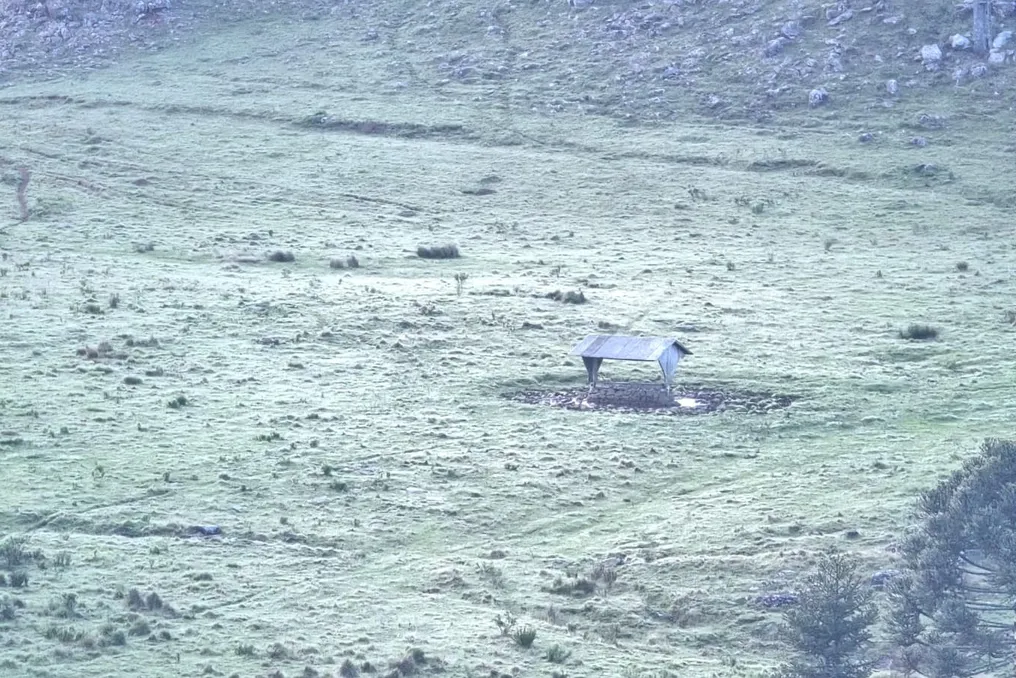
A polar air mass that reached the South and Southeast regions over the weekend is expected to persist, keeping temperatures reduced in parts of these areas this Tuesday, the 27th.

In the Catarinense Mountains, thermometers are expected to reach around 2°C, with a chance of isolated frost. In São Paulo (SP), the forecast points to a minimum of 11°C and a maximum of 20°C. The coldest period should occur during the early morning hours, especially in the mountainous areas of Rio Grande do Sul and Santa Catarina. During the rest of the day, much of the South Region will have sun, but temperatures will remain low for the season.

According to Climatempo, the presence of dry and cold air should ensure stable weather in the three states. However, the circulation of moisture from the ocean may generate light rains in coastal stretches, notably in Paraná. In Curitiba (PR), Tuesday will start with a minimum of 7°C and a maximum of 18°C. Porto Alegre (RS) will have a cold morning, with a minimum of 8°C, potentially rising to 23°C in the afternoon. In Florianópolis (SC), the temperature variation will be between 11°C and 22°C.

In the Southeast, the influence of the polar air will also keep temperatures mild, especially in São Paulo and Rio de Janeiro. The National Institute of Meteorology (Inmet) forecasts a minimum of 11°C and a maximum of 20°C for the São Paulo capital, with sun among few clouds and no forecast of relevant rain. In Rio de Janeiro (RJ), the temperature will range between 17°C and 23°C, with a possibility of rain early in the day. In Belo Horizonte (MG), the expected minimum is 16°C, and the maximum could reach 25°C. Vitória (ES) is also expected to register a maximum close to 24°C.

Starting Wednesday (28), the cold will begin to weaken in part of the South-Central region due to the gradual withdrawal of the polar air mass. Simultaneously, changes in wind circulation will favor the emergence of new rain areas in the interior of the Southeast and Central-West. In São Paulo, rain showers are expected to strengthen in the north and northwest regions, covering Ribeirão Preto and São José do Rio Preto, with moderate to heavy rain forecast in the afternoon, possibly with lightning and isolated thunderstorms.

In Minas Gerais, rain should also affect the Triângulo Mineiro, including Uberlândia and Uberaba, as well as municipalities in the west and northwest regions. On Thursday (29), precipitation is expected to extend to more areas of Minas Gerais and the state of São Paulo. Climatempo indicates that the increase in rain should continue on Friday (30), with potentially more intense thunderstorms in Southern Minas, Zona da Mata, and south-central Rio de Janeiro. In Greater São Paulo, the return of showers is expected starting Thursday.

In the South, rain conditions should improve starting Wednesday, beginning with Paraná and northern Santa Catarina areas. The rest of the region should show a predominance of clouds, but with a lower probability of heavy rain compared to the previous weekend.

Thunderstorms are expected to hit other regions

In the Central-West, Tuesday will be characterized by moderate to heavy showers, concentrated in northern Mato Grosso, northern Goiás, and the Federal District. The combination of heat and humidity should promote the formation of heavy clouds, with a risk of thunder during the afternoon and night. In Cuiabá (MT), the maximum could reach 36°C, with rain expected from the afternoon. Campo Grande (MS) should have temperatures ranging between 18°C and 26°C, also with the possibility of showers accompanied by thunder.

On Wednesday, rain conditions will expand to more regions of Mato Grosso, Goiás, and Mato Grosso do Sul, including chances of isolated thunderstorms. In the Northeast, the cold front that reached the coast of Bahia should sustain rain this Tuesday, mainly in the center, west, and south of the state. There is also a forecast of precipitation in southern Maranhão, southern Piauí, and western Pernambuco. Some locations in Bahia are under alert for large volumes of rain, while intense heat should persist in the interior of other Northeast areas. In Teresina (PI), temperatures may reach 40°C. Salvador (BA) is expected to register a maximum of 29°C, and Fortaleza (CE), 32°C.

In the North, the forecast points to moderate to heavy showers for Amazonas, Acre, Rondônia, Tocantins, and south-central Pará. These rains may be accompanied by lightning and wind gusts, especially in the afternoon. In Manaus (AM), Porto Velho (RO), and Palmas (TO), there is an expectation of rain throughout the day. Meanwhile, in Roraima, Amapá, and northeastern Pará, the weather should be more stable, with long periods of sun. Intense heat will continue in some capitals, such as Macapá (AP), which may reach a maximum of 38°C, and Palmas (TO), which is expected to reach 37°C.

Dry and warm weather up to 20 degrees expected in Uzbekistan this weekend
Read more
podrobno.uz

Dry and warm weather up to 20 degrees expected in Uzbekistan this weekend

According to forecasts, dry and warm weather without precipitation is expected in Uzbekistan from October 23 to 25. In most regions, the daytime air temperature will reach from 15 to 20 degrees Celsius.

In the capital, Tashkent, a higher daytime temperature is expected—from 17 to 21 degrees. At night across the country, the air temperature will be from 3 to 8 degrees Celsius. However, northern regions are expected to see a drop in temperature, with a possible frosty period from -2 degrees to 3 degrees Celsius.

An easterly wind of 7–12 meters per second is forecast. In the northern regions and the desert zone, this wind may intensify, reaching gusts of 13–18 meters per second. Dusty ground winds are possible in some areas.

No precipitation is expected in the capital during today and all weekend days. At night in Tashkent, the air temperature will be 5–7 degrees Celsius. On October 23, a temperature increase to 19–21 degrees is predicted, while on October 24 and 25, daytime figures will be 17–19 degrees Celsius. The easterly wind in the capital will blow at a speed of 3–8 meters per second.

Additional rain and foggy conditions expected in the UAE soon
Read more
www.khaleejtimes.com

Additional rain and foggy conditions expected in the UAE soon

Residents of the United Arab Emirates (UAE) can expect increased precipitation on Tuesday, October 20th. According to the National Center of Meteorology (NCM), convective clouds will begin to form over the eastern regions and spread to some inland and western parts of the country by evening.

Despite the possibility of rain, air temperatures will remain high, reaching up to 41°C in some areas. In Dubai, the maximum temperature is forecast to be 38°C, and in Abu Dhabi—up to 37°C.

The meteorological department has warned that at night and in the morning on Wednesday, it will be humid in several coastal and inland areas, with a possibility of fog or haze formation.

Winds are expected to be light to moderate, changing direction from southeast to northwest. With cloud development, they may strengthen to fresh or strong, reaching speeds from 10 to 25 km/h, and in some cases—up to 50 km/h, which could potentially cause dust lifting.

The sea in the Arabian Gulf and the Oman Sea is expected to maintain small waves.

Popular