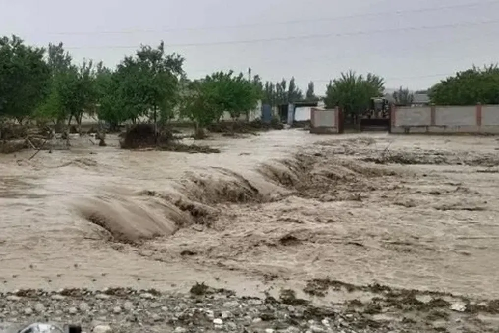
Meteorological Service of Uzbekistan Denies Reports of Heavy Rainfall in November
Read more
UzDaily
uzdaily.uz

Meteorological Service of Uzbekistan Denies Reports of Heavy Rainfall in November

The meteorological agency of Uzbekistan, UzHydromet, has dismissed reports circulating on social media and news channels claiming that heavy rains are expected during the first ten days of November.

According to UzHydromet data, these claims do not align with the forecasts provided by meteorologists. The agency noted that several online publications attributed predictions of abundant precipitation in early November specifically to UzHydromet, but clarified that this information contradicts official forecasts.

UzHydromet acknowledged that precipitation is a natural phenomenon of the autumn season, and seasonal rainfall is widely anticipated. Nevertheless, current forecasts indicate that only a limited number of rainy days are expected in the coming days.

The agency strongly urged the public not to trust unverified weather information circulating on the internet and advised residents to refer to official sources. UzHydromet reported that updated weather forecasts are available through its official information channels.

Similar stories

Strong storms in Southern Brazil put states on alert this week
Read more
olhardigital.com.br

Strong storms in Southern Brazil put states on alert this week

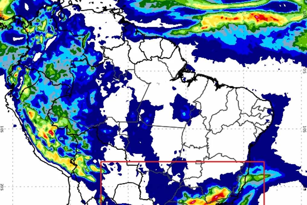
The Southern region of Brazil is expected to receive the highest rainfall volumes in the country until November 10th, with projections of over 100 mm of rain in certain locations in Paraná and Rio Grande do Sul. On Wednesday (4th), the area faces the highest risk of storms, with a red alert issued for three states.

In the coming days, rain is also expected to affect parts of the Southeast, Central-West, and North regions. In contrast, the Northeast coast should see a predominance of sun and high temperatures, concentrating rainfall inland.

A low-pressure system is maintaining unstable weather in the South Region this Wednesday. Inmet issued a red alert of great danger for storms in southern Paraná, Santa Catarina, and northern Rio Grande do Sul. For the other areas of the region, the orange alert indicates danger.

The municipalities covered by the red alert include Francisco Beltrão, Pato Branco, União da Vitória, and Guaratuba, in Paraná; and Passo Fundo, Erechim, Caxias do Sul, Santo Ângelo, and Ijuí, in Rio Grande do Sul. The entire territory of Santa Catarina is also included in the zone of greatest risk.

On Thursday (5th), rain with thunder persists in Paraná, which maintains a yellow alert for potential danger. There is also a possibility of rain in the center and north of Santa Catarina, including Florianópolis. In Rio Grande do Sul, the weather tends to be clearer, with sun predominant in most of the state.

The accumulated forecast until the 10th points to volumes between 40 mm and 80 mm for most of the region. In the center and west of Rio Grande do Sul, these indices may reach 80 mm to 100 mm, while in southern Paraná there are points with a chance of exceeding 100 mm. Precipitation may be accompanied by lightning and hail.

Temperatures are expected to decrease slightly on Thursday. Curitiba and Porto Alegre will record minimums of 17°C and maximums of 25°C. In Florianópolis, the predicted temperature variation is between 18°C and 24°C.

In the Southeast, heat and humidity result in muggy weather this Wednesday, with forecasts of rain and thunderstorms in São Paulo, Minas Gerais, Rio de Janeiro, and southern Espírito Santo. On the border between São Paulo and Paraná, storms may be more intense, under an orange alert. In other areas of São Paulo, Rio de Janeiro, Espírito Santo, and much of Minas Gerais, the alert is yellow.

For Thursday, new showers are possible in São Paulo and Rio de Janeiro. Southern São Paulo, near the border with Paraná, remains under a yellow alert. Meanwhile, northern Minas Gerais and Espírito Santo should have sun and should not register rain.

Until the 10th, the largest accumulations in the region are expected to be between 20 mm and 60 mm in areas of São Paulo, most of Minas Gerais, northern Rio de Janeiro, and southern Espírito Santo. In isolated locations, volumes may exceed 70 mm. The heaviest rain is expected starting this Thursday. In northern Minas Gerais, the rain forecast begins on Sunday (8th).

São Paulo may reach 34°C this Wednesday, while Rio de Janeiro reaches 35°C. On Thursday, the maximum in the city of Rio de Janeiro may rise to 37°C. In Vitória, the forecast is 34°C.

In the Central-West, rain should appear in most of the area. Mato Grosso do Sul will have cloudier weather this Wednesday, with thunderstorms and an orange alert in the south of the state, especially near the border with Paraná. There are also yellow alerts in Mato Grosso, Goiás, and Mato Grosso do Sul.

On Thursday, heat and humidity will continue to favor showers. Thunderstorms should concentrate mainly in western and central Mato Grosso and southern Mato Grosso do Sul. Until the 10th, the projected accumulations vary between 10 mm and 30 mm in most of the region. Starting from the weekend, storms may generate daily volumes of 20 mm to 30 mm in Mato Grosso do Sul and southern Mato Grosso.

Maximum temperatures may reach 36°C in Cuiabá and 35°C in Goiânia on Thursday.

In the North Region, heat will dominate both days, but rain will be concentrated mainly in the west. On Wednesday, there is a forecast of showers in Amazonas, Acre, Rondônia, central and southern Pará, and Tocantins. Some of these areas are under a yellow alert for storms. Amapá and northeastern Pará will have sunny days.

On Thursday, rain with thunderstorms continues in Acre, Rondônia, and various areas of Amazonas. There may also be rain in isolated points of Roraima and in southwestern Tocantins. Amapá will maintain the predominance of sun.

Regarding the Northeast, the scenario is one of intense sun and high temperatures. On Wednesday, isolated rains may occur in the center and south of Maranhão and Piauí, as well as western Bahia. On Thursday, the coast will remain sunny, with no rain forecast on the beaches.

Until the 10th, western and southern Bahia should concentrate the largest volumes in the region, with accumulations of 30 mm to 50 mm and isolated points reaching 60 mm to 70 mm. In the rest of the Northeast, precipitation will be more restricted.

Teresina will be the capital with the highest temperature on both days, reaching 39°C. Fortaleza may record 33°C, while Salvador, Recife, João Pessoa, and Natal should reach 31°C on Thursday.

Weather forecast for Ubatuba (SP): heavy rains and thunderstorms expected on Thursday
Read more
viagemeturismo.abril.com.br

Weather forecast for Ubatuba (SP): heavy rains and thunderstorms expected on Thursday

The city of Ubatuba, located on the northern coast of São Paulo, will experience climatic instability starting on Thursday, the 29th, with forecasts for rain and thunderstorms. Before that, Wednesday, the 28th, will be marked by sun interspersed with many clouds, with no precipitation forecast.

Thursday (10/29) is expected to be the day with the heaviest rain of the period, with thunderstorms predicted for both the afternoon and evening. Minimum temperatures will be 18°C and maximums 20°C, with a 100% chance of rain.

On Friday (10/30), the instability persists, although the rain should be more sporadic. The day will have sun between clouds and a possibility of thunder, with temperatures ranging between 19°C (minimum) and 22°C (maximum), and a 98% probability of rain.

Saturday (10/31) will bring sun in the morning, but from the afternoon, showers are expected that may extend into the night. Temperatures on this day will reach a minimum of 20°C and a maximum of 23°C, with an 85% probability of rain.

In summary, the week in Ubatuba will begin with a partly sunny day on Wednesday (10/28), followed by a period of intense rain and a gradual increase in temperatures, culminating in a high of 23°C on Saturday.

Cyclone and cold front will bring storms and hail to South-Central Brazil
Read more
olhardigital.com.br

Cyclone and cold front will bring storms and hail to South-Central Brazil

An extratropical cyclone, accompanied by a cold front, is expected to cause intense rainfall, hail risk, and temperature drops in the South-Central region of Brazil this Friday (23) and Saturday (24), according to Inmet information.

While the South and parts of the Southeast will face thunderstorms, the North and Northeast are expected to have predominant sunshine in many locations, with temperatures potentially reaching 40 °C.

The conditions for instability are favored by the presence of low-pressure areas located between Bolivia, Paraguay, northern Argentina, and the Center-West and South regions. On Friday night, the formation of an extratropical cyclone is expected between the coast of Rio Grande do Sul and Uruguay, linked to the cold front.

The arrival of colder air masses will begin to reduce temperatures in Rio Grande do Sul and southern Santa Catarina starting Saturday afternoon. Although precipitation will decrease in some parts of Rio Grande do Sul, it will remain heavy in parts of Paraná, Mato Grosso do Sul, and São Paulo.

Alerts issued by Inmet indicate different levels of risk depending on the area and period. While the cold front advances through the South-Central region, much of the North will maintain clearer weather. Rain is forecast in areas of Amazonas, Pará, and Tocantins, but heat will continue to prevail in other locations. Palmas may record 38 °C on Saturday, and Manaus and Boa Vista could reach 37 °C.

In the Northeast, the sun will be visible in most of the region, despite the possibility of isolated rains in southern Bahia and certain areas of Maranhão. Low humidity also requires attention in parts of the northeastern interior. Teresina is pointed out as one of the hottest capitals in the country, with maximums forecast at 40 °C on Friday and 39 °C on Saturday.

In the Center-West, temperatures will vary according to the influence of instabilities. In Campo Grande, Saturday will be milder, with a minimum of 17 °C and a maximum of 25 °C. Goiânia may reach 36 °C, while Cuiabá and Brasília are expected to register maximums of 32 °C.

In the Southeast, rain will persist in São Paulo, southern Minas Gerais, and Rio de Janeiro. The city of São Paulo is under orange alert for thunderstorms on Saturday, with projected temperatures between 15 °C and 21 °C. In Rio de Janeiro, the maximum could reach 31 °C.

Finally, in the South, the advance of cold air will result in cooler capitals. Curitiba and Porto Alegre are expected to have maximums of 19 °C, and Florianópolis should not exceed 21 °C.

Popular