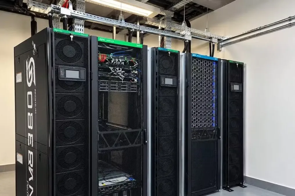
The Federal University of Minas Gerais (UFMG) inaugurated a new supercomputer named 'Soberano' last Tuesday (27th). This equipment was developed to apply artificial intelligence to the analysis of vast amounts of data and images related to Brazilian territory.
The supercomputer was installed at the Institute of Geosciences (IGC), located on the Pampulha campus in Belo Horizonte. In practice, the machine will have the capacity to process large volumes of information from sources such as satellites, radars, and drones, using AI to locate elements of interest in these sources.
Possible applications include identifying changes in vegetation, detecting areas vulnerable to natural disasters, and characterizing soil, in addition to speeding up the creation of detailed maps of Brazil.
Unlike a conventional computer, this supercomputer executes calculations simultaneously, but on a much higher scale, gathering specialized components to perform a much greater number of complex operations at the same time. This type of processing is crucial for artificial intelligence tasks and for analyzing large volumes of data.
During the same event, UFMG also presented the Hyper-Cam Mini xLW, a hyperspectral camera. This tool allows the analysis of light bands invisible to the human eye, which enables the identification of different materials and increases mapping accuracy. For example, it can distinguish materials that appear identical in common photos, such as healthy and dry leaves, or different types of soil, water, concrete, and minerals.
Artificial Intelligence for Mapping Brazil
One of the primary functions of the supercomputer is to assist in creating more detailed maps of Brazil. According to UFMG, only approximately 8% of the 8.5 million square kilometers of national territory have mapping at the 1:25,000 scale, where one centimeter on the map equals 250 meters on the ground.
This level of detail is fundamental for urban and construction planning, for managing rivers and watersheds, and for signaling locations prone to disasters. However, the major challenge lies in the immense amount of data generated by satellites, drones, and radars. The project aims to replace human dependence in analyzing this material by employing artificial intelligence systems to automatically identify relevant data.
Sônia Carvalho Ribeiro, the project coordinator, explained that the main advantage of the supercomputer is its ability to automatically extract information from images, allowing daily satellite images to be quickly analyzed for cartographic purposes, something that previously resulted in outdated maps.
'Soberano' can also be used to monitor illegal mining and deforestation activities, track regions affected by floods and landslides, and supervise the country's borders. Ribeiro added that the central objective is to automate the generation of data for environmental monitoring and defense, making this process faster and more accurate due to the scientific basis of the mapping.
What makes the machine so powerful?
The core of 'Soberano' is composed of eight Nvidia H200 units, equipment specifically designed for scientific computing and intensive artificial intelligence tasks. Each of these units has 141 GB of high-speed internal memory.
The H200 is classified as a Graphics Processing Unit (GPU) intended for servers and data centers, optimized for heavy AI and scientific computing loads, in contrast to domestic use. Simply put, these components act as specialized engines to execute a vast amount of calculations simultaneously and at very high speed. This is vital for AI, as the technology needs to repeat mathematical operations countless times to learn to recognize patterns in large sets of information.
The 'Soberano' system integrates eight of these units into a single server, in addition to having ten other processor sets and approximately 400 terabytes of data storage. UFMG reported that the entire system was designed, installed, and configured by Brazilian teams.
Why 'Soberano'?
According to the Federal University of Minas Gerais, the name 'Soberano' reflects the strategic nature of information related to the national territory and the intention to keep the generated knowledge under the control of Brazilian institutions.
The project involves collaborations between UFMG, the Military Engineering Institute (IME), and the Army Geographic Service Directorate (DSG). The supercomputer and the camera received public investments totaling R$ 15 million and will be made available to support various federal and state agencies, including the National Institute for Space Research (Inpe), the Brazilian Institute of Environment and Renewable Natural Resources (Ibama), and the National Supply Company (Conab).
