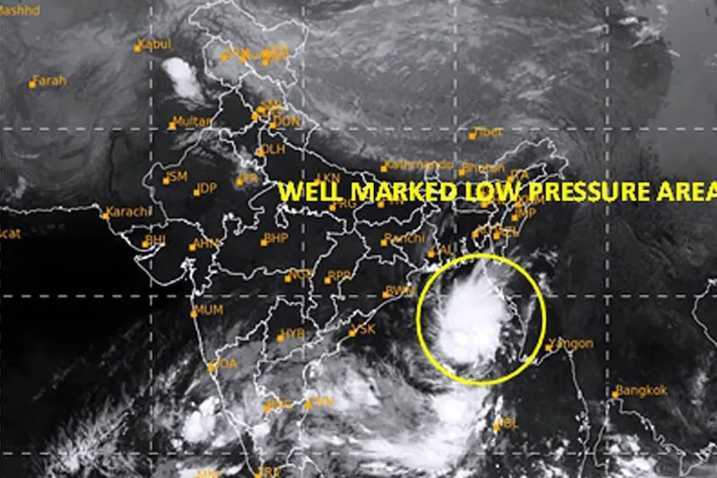
A weather system developing in the Bay of Bengal may turn into a tropical cyclone in the coming days. According to meteorological service data, a low-pressure area formed in the Bay of Bengal on the morning of October 23. It is presumed that by October 26, it could transform into a cyclone. This may affect Odisha, Andhra Pradesh, and neighboring territories. There is a risk of precipitation and strong winds in several areas between October 28 and 30, although it is not yet clear where exactly the cyclone will reach the coastline.
The impact of this weather system may affect parts of Odisha, Andhra Pradesh, Chhattisgarh, Bihar, Jharkhand, West Bengal, and northeastern India, where rain is expected. More detailed information about the direction and intensity of this weather system will be available in the coming days.
According to the meteorological service forecasts, the low-pressure area in the Bay of Bengal may become a depression by October 24, and then deepen into a deep depression by October 25. After that, it is expected to turn into a cyclone by October 26. It is predicted to move towards the coast of Andhra Pradesh in the north and Odisha in the south. However, the exact location where the cyclone will make landfall remains uncertain.
Significant rainfall is expected in the coastal areas of Odisha and Andhra Pradesh. According to the IMD, rain is possible in many places in the coastal part of Andhra Pradesh and Yanam from October 23 to 29, with very heavy rain forecasted in some areas.
In Odisha, an increase in rainfall is possible from October 26. From October 27 to 29, rain accompanied by strong winds is expected in several places. Wind speeds may reach 50–60 kilometers per hour, with gusts up to 70 kilometers per hour. Strong winds can lead to falling trees, power line breakage, and flooding in low-lying areas.
According to a report by the Indian Meteorological Department, the low-pressure area over the East-Central and adjacent South-Eastern Bay of Bengal intensified into a well-marked low-pressure area and was in this region at 05:30 IST on October 24, 2026. It is likely to remain in this region and intensify into a depression today, October 24, 2026. Then, it is likely to move west-northwest and continue to intensify into a deep depression on October 25 and into a cyclonic storm over the West-Central Bay of Bengal by the morning of October 26. Moving west-northwest, it will continue to intensify and reach the coast of Andhra Pradesh near the West-Central Bay of Bengal around the morning of October 28, 2026.
The meteorological service has warned of strong winds in some parts of the Bay of Bengal. From October 26 to 28, wind speeds in the west-central part of the Bay of Bengal may reach 70–80 kilometers per hour, with gusts up to 90 kilometers per hour. Therefore, fishermen were advised not to venture into the affected sea areas. People going out to sea should adhere to the meteorological service warnings.
It is still unclear where exactly the cyclone will reach and how strong it will be. Changes in its direction and strength may occur in the coming days. Residents of coastal areas are advised to monitor new updates from the meteorological service. During heavy rain, avoid driving through flooded streets, and during strong winds, stay away from trees and electricity poles.