
Weather in North India and Delhi to Change: IMD Warns of Storms, Rain, and Hail
Read more
Aaj Tak
www.aajtak.in

Weather in North India and Delhi to Change: IMD Warns of Storms, Rain, and Hail

Weather conditions across the country will begin to change again. While the monsoon season is concluding in some regions, the northeast monsoon is preparing to start. At the same time, a Western Disturbance has begun to affect the weather in North India. Its impact threatens rain, strong winds, and hail in several states of North India, including Delhi-NCR. Furthermore, a period of heavy rains may begin in South India from October 15th.

According to the Meteorological Department (IMD), Thursday will bring predicted rain with thunderstorms in many parts of the country. According to the IMD forecast for October 15th, strong winds with rain are expected in the plains of Northwest India. On the other hand, a warning has been issued for heavy and very heavy rainfall in Tamil Nadu, Puducherry, Karaikal, Kerala, and Mahé. Heavy rains are also possible in some areas of coastal Andhra Pradesh and South Interior Karnataka. Thus, variable weather conditions can be expected in different parts of the country over the next few days.

The withdrawal of the southwest monsoon from the country continues. According to the meteorological department, on October 14th, the monsoon withdrawal line passed through Dhubri, Calcutta, Angul, Hammam, and Honavar. Conditions are becoming favorable for the further withdrawal of the monsoon from other regions. The southwest monsoon usually brings rain to most regions of the country from June to September. With the weakening and withdrawal of this monsoon, the northeast monsoon will become active in South India. During these changes, various weather phenomena may be observed simultaneously in different parts of the country.

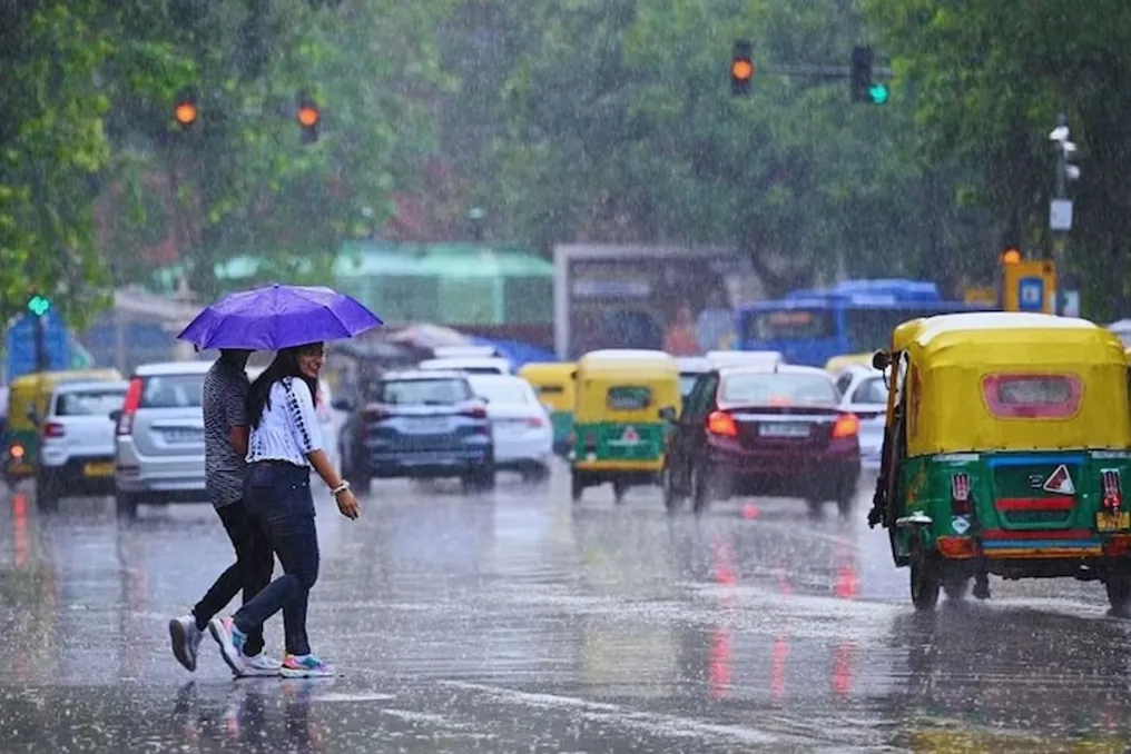
In North India, weather changes continue under the influence of the Western Disturbance. In Delhi-NCR, after brief rains on October 14th, rain is forecasted in many areas on October 15th. The meteorological department reports that heavy or very heavy rain is possible in some places in Delhi, Haryana, Chandigarh, and Punjab. Additionally, there is a possibility of rain in several districts of Jammu and Kashmir, Ladakh, Himachal Pradesh, Uttarakhand, West Uttar Pradesh, and East Rajasthan.

Rain with hail can cause problems for the public. Hailfall is forecasted in some places in Haryana, Chandigarh, Delhi, Punjab, Uttarakhand, West Uttar Pradesh, and East Rajasthan. There is also a threat of lightning during thunderstorms in these areas. The meteorological department has also warned of strong winds. In Haryana, Chandigarh, Delhi, Punjab, and Uttarakhand, wind speeds may reach 40-50 kilometers per hour.

There is a possibility of wind gusts reaching 60 kilometers per hour. Winds of 30-40 kilometers per hour are expected in some areas of West Uttar Pradesh and Rajasthan. Rain and lightning are also forecasted in Jammu and Kashmir, Ladakh, Himachal Pradesh, and East Uttar Pradesh.

While the Western Disturbance influences North India, the northeast monsoon is activating in South India. According to the meteorological department, the onset of northeast monsoon rains is expected on the southern peninsula from October 15th. Along with this, heavy and very heavy rains are possible in some parts of Tamil Nadu, Puducherry, Karaikal, Kerala, and Mahé. Heavy rains are also forecasted in some places in coastal Andhra Pradesh and South Interior Karnataka. There is a risk of lightning during thunderstorms in Andhra Pradesh, Tamil Nadu, Puducherry, Karaikal, Kerala, and Mahé.

Strong winds of 40-50 kilometers per hour may also blow in these regions. Rain with gusty winds is also expected in some interior areas of Telangana and Karnataka. The northeast monsoon is particularly important for South India. Most of the rain falling in Tamil Nadu and surrounding areas after the end of the main southwest monsoon period is attributed to this monsoon. Therefore, its activation can intensify the rainy regime in southern states.

The weather impact will not be limited to North and South India only. Rain with thunderstorms and strong winds are also expected in several states of Central and Eastern India. According to the meteorological department, winds of 30-40 kilometers per hour are expected in some areas of Chhattisgarh, Odisha, Vidarbha, and West Madhya Pradesh. Light or moderate rain and lightning are possible at this time.

Short-term rain with thunderstorms is also possible in parts of Konkan, Goa, and Central Maharashtra. Coastal areas of Karnataka and Konkan-Goa may face heat and humidity causing discomfort. Weather in coastal zones may remain varied amidst rains and strong winds. Currently, the meteorological department has not issued warnings against fishermen going out to sea.

Similar stories

Meteorologists warn of rains and storms in 15 Indian states on October 9
Read more
www.aajtak.in

Meteorologists warn of rains and storms in 15 Indian states on October 9

According to the India Meteorological Department (IMD), weather in many parts of the country may change on October 9. Some areas are expected to see rain and thunderstorms, which could provide relief from the heat, while others face strong winds and heavy precipitation that might cause problems.

Forecasts indicate the possibility of rain and storms in states such as Uttarakhand, Uttar Pradesh, Bihar, Delhi, Rajasthan, Madhya Pradesh, and many others. In some regions, wind speeds could reach 60 kilometers per hour.

Furthermore, a warning for heavy rainfall has been issued in some parts of South India. Meanwhile, the southwest monsoon continues to withdraw from the country. Meteorologists note that conditions are becoming favorable for the conclusion of the monsoon season in Eastern India, North Peninsular India, and some parts of Northeast India over the next three to four days. However, this does not mean that the rains will completely stop.

The southwest monsoon is receding from many parts of the country. By October 8, it had already left most of Maharashtra, some areas of Goa, Karnataka, Telangana, and parts of Odisha, as well as many districts of Jharkhand and Chhattisgarh. Despite this, rains continue in various parts of the country due to the activity of local weather systems, cyclonic vortices, and western disturbances.

The meteorological department's forecast indicates that rain and strong winds are possible in several areas of North, Central, East, and South India on October 9. States expecting adverse weather include Uttar Pradesh, Bihar, Delhi, Rajasthan, Madhya Pradesh, Uttarakhand, Himachal Pradesh, Jammu and Kashmir, Punjab, Haryana, Jharkhand, West Bengal, Kerala, Karnataka, and Odisha. Heavy rain with thunderstorms is possible in some zones. In mountainous regions, the risk of landslides persists due to intense rainfall.

In Delhi and surrounding areas, cloudy skies and rain accompanied by wind and thunderstorms are expected on October 9. According to available forecasts, wind speed in Delhi will be around 20 kilometers per hour. The maximum temperature in Delhi is predicted to reach approximately 31 degrees Celsius, and the minimum will be 22 degrees Celsius. Localized rains are also possible in Haryana, Chandigarh, and Punjab between October 9 and 14.

Rain and strong winds are forecasted for several areas of Uttar Pradesh on October 9. Weather may change in places such as Ghaziabad, Meerut, Mirzapur, Gorakhpur, Kanpur, Agra, Prayagraj, Saharanpur, Basti, and Raebareli. It is warned that wind speed could reach 60 kilometers per hour at some points. Rains are possible in Western Uttar Pradesh until October 11, and in Eastern Uttar Pradesh until October 10.

In Lucknow, the maximum temperature is expected to fluctuate between 29–31 degrees Celsius, and the minimum around 22 degrees Celsius.

Bihar is expected to continue its rainy period. The rain warning applies to districts such as Madhubani, Darbhanga, Gaya, Jahanabad, Rohtas, Saharsa, and Buxar. Thunderstorms are possible during these downpours, and wind speeds may reach 40 kilometers per hour. Patna is forecast to have a maximum temperature of about 29–30 degrees Celsius, with a minimum of 22 to 23 degrees Celsius. Rainfall activity in the state may continue until October 11.

Some areas of Rajasthan, including Bikaner, Ajmer, Dholpur, Bharatpur, and Bundi, are expected to experience rain and strong winds. Jaipur is forecast to have a maximum temperature of about 35 degrees Celsius, with a minimum of 22 to 23 degrees Celsius. Madhya Pradesh may see thunderstorms in places like Vidisha, Sidhi, Damoh, Sagar, Indore, Ujjain, Shahdol, and Chhindwara. Wind speeds could reach 45 kilometers per hour at some points. Bhopal is expected to have a maximum temperature of about 33 degrees Celsius and a minimum of 21 degrees Celsius.

Localized heavy rains are possible in Uttarakhand on October 9. In areas such as Haridwar, Rishikesh, and Chamoli, rain and strong winds are expected, with wind speeds potentially reaching 60 kilometers per hour. Dehradun is forecast to have a maximum temperature of 24 degrees Celsius and a minimum of 18 degrees Celsius.

Rains are also possible in Himachal Pradesh in Darshan, Kangra, Mandi, and Solan, with wind speeds predicted up to 45 kilometers per hour. Prolonged precipitation in mountainous regions increases the threat of landslides and may disrupt traffic. Rains are also expected in some parts of Jammu and Kashmir.

South India is expected to see an increase in rainfall activity on October 9. The meteorological department has warned of possible heavy rain in South Interior Karnataka. Kerala, Mahē, and other regions are also mentioned.

Meteorologists predict storms and heavy rains in Delhi-NCR, Uttar Pradesh, and other states
Read more
www.aajtak.in

Meteorologists predict storms and heavy rains in Delhi-NCR, Uttar Pradesh, and other states

With the start of October, the weather in many regions of the country has begun to change. On Tuesday, thunderstorms, strong winds, and rain are possible in various parts of the country. These changes occur against the backdrop of the continued withdrawal of the southwest monsoon from the country.

According to IMD data, the monsoon withdrawal line moved towards the western coast, passing through Bihar, Jharkhand, Chhattisgarh, and some areas of Maharashtra on October 5.

Despite dry weather in recent days, changes are possible in Delhi-NCR on Tuesday. Rain with thunderstorms, lightning, and strong winds is forecasted in Haryana, Chandigarh, Delhi, and Punjab. Wind speeds during this period may reach 40–50 kilometers per hour.

Weather conditions may also change in the Western Himalayas. Thunderstorms and strong winds are predicted in Himachal Pradesh, Jammu and Kashmir, Ladakh, and Uttarakhand. Additionally, rain with thunderstorms and lightning flashes is expected in some parts of Uttar Pradesh. There is also a probability of thunderstorms and lightning strikes in some parts of Madhya Pradesh, Chhattisgarh, Vidarbha, Konkan, Goa, and Maharashtra.

Various atmospheric systems contribute to rainfall and thunderstorms in many parts of the country. Cyclonic movement of upper air layers persists over Bihar and adjacent territories. Furthermore, a trough has formed from West Bengal to central Maharashtra. Due to these weather systems, the activity of storms, rains, and thunderstorms may continue in Eastern and Central India. Strong winds with thunderstorms are also expected in some areas of Andhra Pradesh, Bihar, Jharkhand, Odisha, West Bengal, and Sikkim on Tuesday.

The Meteorological Department (IMD) has predicted heavy rains in some parts of South India, while stormy weather with lightning and strong winds is expected in several northern Indian states. The highest probability of precipitation in South India is observed in Kerala, South Interior Karnataka, Tamil Nadu, Puducherry, and Karaikal. Heavy rains are possible in these areas. Rain is forecasted in many places in Kerala and Maharashtra.

According to IMD data, the impact of rains will be most noticeable in South India on Tuesday. Heavy precipitation is possible in Kerala, South Interior Karnataka, Tamil Nadu, Puducherry, and Karaikal. Rain is expected in many towns and villages in Kerala and Maharashtra.

Rainfall drops by 13% in the country after monsoon withdrawal; rains expected in some regions
Read more
www.aajtak.in

Rainfall drops by 13% in the country after monsoon withdrawal; rains expected in some regions

The monsoon season has concluded, and the country recorded 13% less rainfall than normal. The Meteorological Department (IMD) officially announced the end of the monsoon season on Wednesday. Although the monsoon is receding, it continues to bring rain to several places across the country.

According to the Meteorological Department's forecast from September 30, there is a high probability of heavy rains in certain areas of South India, Northeast India, Kerala, South Interior Karnataka, Tamil Nadu, Puducherry, and Karaikal. Rains are also expected in the coastal areas of Kerala, South Karnataka, and South Karnataka itself. In Tamil Nadu, Puducherry, and Lakshadweep, precipitation is forecasted in isolated spots; here, the term 'isolated' rains means that rain may be recorded at about 25% of weather stations.

Meanwhile, dry weather is expected in most regions of North and West India, including Delhi, Punjab, Haryana, Chandigarh, Himachal Pradesh, Jammu and Kashmir, Rajasthan, Uttar Pradesh, Bihar, Marathwada, Vidarbha, and Western Madhya Pradesh. IMD notes that the monsoon usually begins to withdraw from northwestern India in mid-September and completely leaves the country by mid-October. Currently, the monsoon withdrawal line passes through Gurdaspur, Chandigarh, Muzaffarnagar, Aligarh, Dauhampur, Udaipur, and Disa, reaching Nali in Gujarat.

The Meteorological Department reported that in the next two to three days, conditions may become favorable for the monsoon to retreat from the rest of Punjab, Haryana, Rajasthan, and Uttar Pradesh. There is also a possibility of improved weather conditions for the monsoon to withdraw in most of Gujarat and Madhya Pradesh, as well as in all areas of Jammu and Kashmir, Himachal Pradesh, and Uttarakhand. Furthermore, the monsoon withdrawal may continue in some parts of Bihar, Jharkhand, Chhattisgarh, and Maharashtra in the coming days.

Rains in Karnataka

In Karnataka, heavy rains occurred in several places on Wednesday morning before 8:30 AM. Kibbanhalli in the Tumkur district received 10 centimeters of precipitation, which is the highest figure for this period according to IMD data. Thunderstorms and strong gusts of wind at speeds of 40-50 kilometers per hour are possible in Kerala and Mahé, Raillesimé, and Tamil Nadu, Puducherry, and Karaikal. Winds of 30-40 kilometers per hour are forecast in Andhra Pradesh, Interior Karnataka, and Odisha. Strong surface winds are possible in Andhra Pradesh.

Reasons for Rains in the Northeast

The weather in Northeast India may also remain active on October 1. Thunderstorms are possible in Assam, Meghalaya, Nagaland, Manipur, Mizoram, and Tripura. Scattered rains are expected in Arunachal Pradesh, Assam, Meghalaya, Nagaland, Manipur, Mizoram, and Tripura. The weather in East Madhya Pradesh may also change with thunderstorms. According to IMD, the cause of the rains in the Northeast is a low-pressure area formed over Northern Myanmar, Southeast Bangladesh, Mizoram, and the Bay of Bengal. This system may move in a north-northwest direction towards Mizoram and Tripura and weaken into a low-pressure area within the next 12 hours.

Flooding Risk in Bangalore

Concerns remain regarding rain in Bangalore. Very heavy rains occurred in Hoskote. The change in wind direction is directing the rain system towards KIA airport. Since the speed of the system remains low, this period of rain may develop slowly. They stated that if such rain cells form over Bangalore, which is likely in the coming hours, it could lead to flooding in the city.

Popular