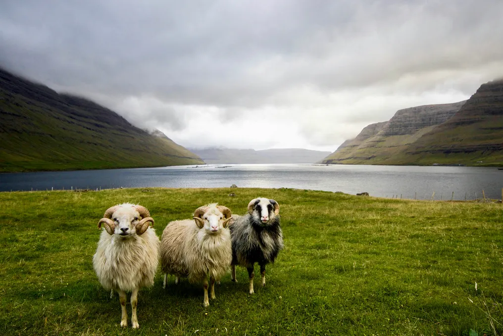
The Faroe Islands are an archipelago consisting of 18 islands located in the North Atlantic between Scotland and Iceland. These green islands, connected by tunnels, bridges, and sea routes, were formed millions of years ago by volcanic activity and glaciers during the Ice Age. They are currently an autonomous territory within the Kingdom of Denmark.
Of the 18 islands, 16 are inhabited, although nearly half the population is concentrated in Tórshavn, the capital of the archipelago. The name of the islands—Føroyar in Faroese—means 'Sheep Islands' and was given by the Norse who colonized the region in the 9th century. This name is not accidental: the archipelago has about 80 thousand sheep, which exceeds the total population estimated at approximately 49 thousand residents.
The region's economy is mainly based on fishing and its derivatives, which account for 90% to 95% of export revenue. Nevertheless, tourism is constantly growing, turning the region into an attractive destination for adventure lovers seeking picturesque landscapes and the charm of virtually untouched places.
Below are some of the most attractive sights in the Faroe Islands.
Tórshavn, located on the island of Streymoy, is known worldwide as one of the smallest capitals in the world. It features Tinganes, the oldest district of the capital, filled with narrow streets and traditional houses in a preserved atmosphere, as if time has stood still.
This district is adorned with charming multi-colored houses with grass roofs, as well as picturesque buildings and stone streets. Many of these structures serve as government headquarters. A walk through this area allows for a quiet exploration of local restaurants and observation of the tranquility of ships in the harbor, though it should be noted that the visit is quite short: only 5 minutes are needed to walk from one end to the other of this small district.
The small village of Gásadalur, hidden among the mountains of Vágar island, is one of the most popular spots for visitors to the Faroe Islands. Interestingly, until 2004, this place was practically isolated until a tunnel was built connecting the island to the neighboring village of Bøur, which eased access to the region's beauty.
Today, thanks to well-marked trails and the impressive number of sheep scattered along the way, this location showcases one of its greatest natural features—the Múlafossur waterfall, a magnificent waterfall over 30 meters high, plunging from dark cliffs directly into the North Atlantic.
The Gjógv gorge, about 200 meters long, is a stunning natural canyon located in the village of Gjógv at the northeastern tip of Eysturoy island. Seawater flows inside it, and it is often a destination for visitors seeking direct contact with nature.
In addition to being an ideal backdrop for photographs highlighting the beauty of these natural formations, this spot is suitable for birdwatching. Both in spring and summer, the region attracts various species of seabirds, such as the famous guillemots, also known as 'puffins'. Trails of moderate difficulty run around the cliffs, offering magnificent views of the neighboring island of Kalsoy. However, caution is advised: the ground can be muddy and slippery, especially on damp and rainy days, so appropriate footwear for such trails is recommended.
The historic lighthouse Mykines Holmur is located on the remote island of Mykinesholmur, at the westernmost edge of the Faroe Islands. This small structure is worth visiting. The tower was erected in 1909 and is situated on the edge of a remote rocky islet, connected to the village of Mykines by a 40-meter pedestrian bridge (the only way to reach it).
Surrounded by large sea cliffs, this location is home to extensive colonies of seabirds, as well as an excellent spot for observing guillemots and Northern Gannets. The green path to the lighthouse is a pleasure in itself, offering breathtaking scenery.