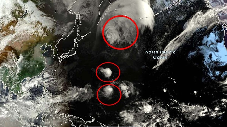
Currently, three storms are active in the Western Pacific Ocean: Typhoon Choi-wan, Typhoon Nolo, and Tropical Storm Koguma. The simultaneous activation of three storms in October has been observed after an interval of nearly five years. These storms are expected to cause high waves and increased sea activity in some maritime areas of Japan.
These three storms are located quite far apart from each other and have varying strengths. Choi-wan is moving northward away from the Ogasawara Islands of Japan. Nolo is advancing westward, while Koguma is relatively weak for now and is moving in a northwest direction. Although no large-scale damage threat has been reported for the main islands of Japan at present, caution regarding high waves in the sea remains necessary.
On Tuesday, Choi-wan was moving north away from the Ogasawara Islands at a speed of approximately 30 kilometers per hour. According to the Japan Meteorological Agency, its central atmospheric pressure was recorded at 960 hectopascals. Its sustained wind speed was 144 kilometers per hour, with gusts reaching up to 198 kilometers per hour.
It is estimated that Choi-wan will move rapidly northeastward by Wednesday, after which it may gradually transform from a typhoon into another type of storm. Despite this, the impact of the generated waves in the sea may persist for some time. High waves could occur around the Ogasawara and Izu Islands, and the effect might also be visible on the eastern Pacific coast of Japan.
Nolo remained a strong typhoon until Tuesday afternoon. It was moving westward near the Wake Islands at a rate of about 30 kilometers per hour. Its central atmospheric pressure was 965 hectopascals, and its sustained wind speed was 162 kilometers per hour, with gusts up to 216 kilometers per hour.
A distinctive feature of Nolo is that it developed east of the International Date Line. It later crossed this line and reached the Western Pacific region. Subsequently, it entered the area monitored by the Japan Meteorological Agency. Such a storm is called a transboundary typhoon. A similar case was observed before in August 2023.
Koguma is the newest of these three storms. It formed near the Marshall Islands on Monday. On Tuesday, it was moving in a northwest direction, with a sustained wind speed of about 65 kilometers per hour and gust speeds of 90 kilometers per hour. Its central atmospheric pressure was 1000 hectopascals.
The meteorological department assesses that Koguma may increase in strength in the coming days. It could reach typhoon status by the end of this week. By Saturday, its central atmospheric pressure is estimated to reach about 950 hectopascals, and maximum wind speed up to 144 kilometers per hour, with gusts potentially reaching 216 kilometers per hour.
The simultaneous activation of three tropical systems in the Western Pacific during October is an unusual event. According to the Japan Weather Association, this occurred in the last five years in October. This time, all three storms are in different locations and moving in different directions.
The number of typhoons in the Western Pacific this year has also been higher than normal. As of October 6, 2026, 29 typhoons had been recorded, whereas according to long-term data, this number usually hovers around 20 during this period. Currently, there is no apprehension of large-scale damage to the main islands of Japan. High waves may occur around the Ogasawara and Izu Islands, and sea waves could also become rough on the Pacific coast of Honshu. The meteorological department is closely monitoring the direction and strength of all three storms, especially Koguma, as it may strengthen further in the coming days.