How to spend 48 hours in Baviaanskloof exploring beyond the road
Read more
Getaway
getaway.co.za

How to spend 48 hours in Baviaanskloof exploring beyond the road

Baviaanskloof is often associated exclusively with its road—a rugged track winding between the mountains of Baviaans and Kuag, offering steep passes, river crossings, and impressive views. However, this World Heritage landscape deserves more than just a quick drive-through.

As part of the 'Protected Flora Areas of the Cape Region' World Heritage site, Baviaanskloof is known for its exceptional plant diversity, endemic species, and varied landscapes. Furthermore, it possesses rich archaeological heritage, including Stone Age monuments found throughout the area.

Spending 48 hours allows you to slow down and discover what lies beyond the famous road: mountain trails, natural pools, waterfalls, rock formations, wildlife, farm stays, and surprisingly quiet wilderness.

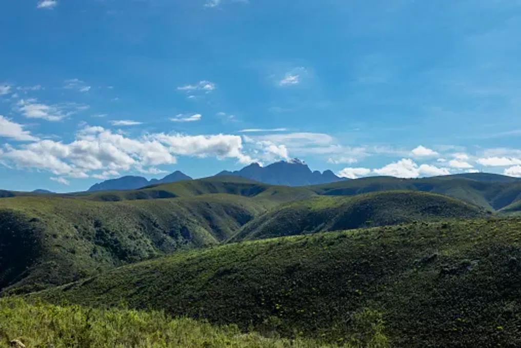
Entering Baviaanskloof itself is an adventure, but one should avoid the temptation to treat the route as something to be rushed through. The landscape changes drastically when the road enters the mountainous terrain, where the Baviaans and Kuag ranges create a harsh backdrop of cliffs, valleys, and plateaus.

The Cambrian Route offers an easier introduction to this landscape and is accessible by a sedan, whereas some deeper trails are better suited for high-clearance vehicles or 4x4s.

It is necessary to stop safely to observe the geology, vegetation, and the immense sense of space. This area is part of one of the world's most important centers of plant diversity, making even an apparently ordinary roadside landscape worthy of closer study.

Instead of using Baviaanskloof merely as a passage between settlements, it is worth spending at least one night in the wilder areas or nearby. Accommodation options range from rustic campsites to farm stays and eco-lodges. Deep within the reserve, places like Ruikhoek and Dudsklip offer particularly secluded experiences with basic amenities and minimal separation between visitors and the environment.

If you prefer more comfortable conditions, the farms and lodges around Baviaanskloof allow you to experience the rural side of the region. For example, Baviaans Lodge offers cottages and camping alongside activities such as hiking, bird watching, mountain biking, and viewing San rock art.

The key is to make your stay part of the journey. Wake up to a view of the mountains, listen to the river or birds instead of traffic noise, and let the landscape set the pace.

One of the simplest ways to see Baviaanskloof beyond the roads is by walking. The reserve offers several hiking options, including the Portjies waterfall trail, the Komdomo River trail, and routes from Bergplaas.

Portjies is particularly appealing because the landscape transitions from open mountain vistas associated with the road to a greener, more sheltered environment. The forest, river, and waterfall setting serves as a good reminder that Baviaanskloof is far more diverse than its rugged, arid reputation suggests.

A hike to the Cider waterfall in the western part of Baviaanskloof is another option. Go Baviaans currently lists the Cider waterfall as a day hike, and the Leopard Trail as a four-day trek.

Choose a hike that matches your physical fitness, vehicle access, and available time, rather than trying to visit as many trails as possible.

Baviaanskloof is not a traditional safari destination, and that is part of its appeal. The wider protected area supports species such as mountain zebra, black rhino, Cape buffalo, and Cape leopard, according to the Kuag Municipality.

You may also encounter smaller and more common inhabitants, from baboons and birds to reptiles and insects. Bring binoculars and take time to observe rather than just drive past.

Birdwatching is especially beneficial near riverine and forested areas. The Portjies area, with its trees, water, and more sheltered conditions, offers a different habitat compared to the open mountain slopes.

Similar stories

Thessaloniki Exploration: Three Days Discovering the City Beyond the Waterfront
Read more
getaway.co.za

Thessaloniki Exploration: Three Days Discovering the City Beyond the Waterfront

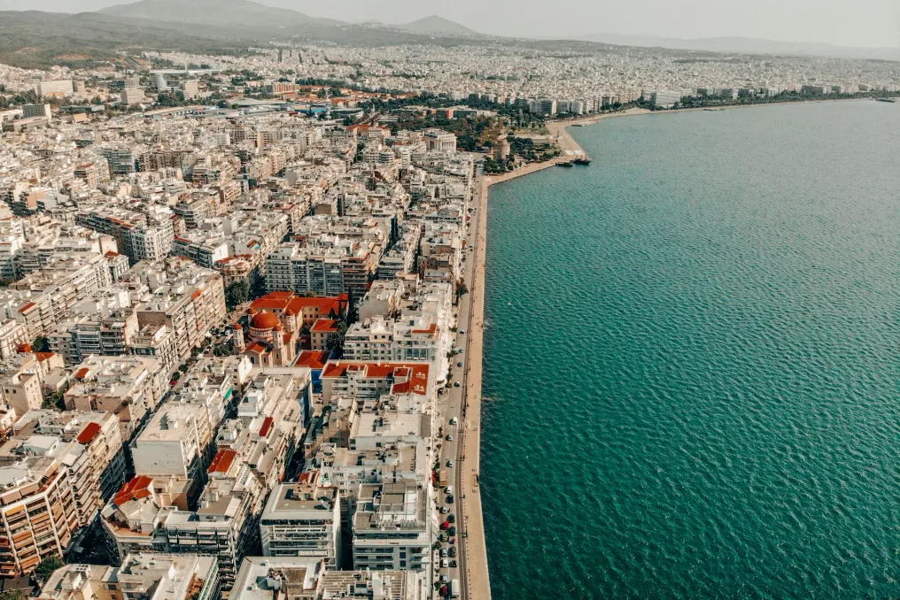
Thessaloniki, Greece's second-largest city, offers numerous attractions that extend beyond the famous waterfront and White Tower. In three days, one can explore bustling food markets, Roman and Byzantine monuments, atmospheric quarters, street art, and flavors that have made Thessaloniki one of Greece's great gastronomic centers.

This city is best explored on foot, as layers of history emerge between cafes, shops, and residential buildings. Roman ruins neighbor Byzantine churches, Ottoman-era buildings, and modern street art, while traditional markets remain an integral part of daily life. The urban landscape features 15 UNESCO World Heritage sites, many of which are Byzantine churches.

A good starting point is the center, visiting the Kapani market, also known as Agora Vlali. This ancient market is one of the oldest surviving in Thessaloniki and continues to function in the city's daily life. It hosts rows of fresh produce, spices, olives, fish, meat, and sweets, alongside bakeries, coffee shops, tavernas, and meze restaurants.

Many of these stalls have been owned by families for two or three generations. A walk through the narrow streets allows one to experience the full range of sensations—sounds, smells, and sights. Nearby is Athos Square, where one can view small food stalls and relax with a cup of coffee or a meal. The surrounding streets are abundant with traditional shops and small businesses.

Next is the Modiano Market, a covered market whose construction began in 1922 and was completed in 1930 by architect Eli Modiano. This historic market is designed with a glass roof in the style of European market halls. Today, it combines grocery stores, traditional goods, restaurants, and bars.

Modiano is particularly interesting due to its connection with Thessaloniki's Sephardic Jewish culture. Its architect, Eli Modiano, came from one of the city's well-known Jewish families. The market also reflects the city's evolving gastronomic culture, offering a chance to taste local flavors while observing the intersection of traditional and modern Thessaloniki.

From the markets, one should move towards the Roman Forum and the Galeria complex, where the city's ancient history is undeniable. The Rotunda is one of Thessaloniki's most outstanding monuments. This monumental structure, built during the Roman period, served various purposes over centuries and is considered one of the city's most important historical landmarks today.

Near the Galeria Arch and the remains of the Galeria complex, another glimpse into the Roman city is provided. Instead of rushing between monuments, it is recommended to stroll through the surrounding streets. This is where the contrast begins to emerge, making Thessaloniki so appealing: ancient ruins stand next to modern cafes, university buildings, shops, and lively streets.

No gastronomic journey in Thessaloniki is complete without bougatsa, the city's famous layered pastry. This pastry is made from thin, crispy filo and can be sweet or savory. The classic sweet version is filled with cream and dusted with powdered sugar and cinnamon, while other versions contain cheese, spinach, or minced meat.

Bougatsa became especially associated with Thessaloniki after the arrival of Greek refugees from Constantinople and other parts of Asia Minor in the early 20th century. It is traditionally served with Greek coffee, forming one of the city's classic breakfasts.

In the evening, one should head to Ladika, a former commercial district located near the center. Its cobbled streets and preserved facades now house restaurants, bars, and tavernas. This historic area survived the great fire of 1917 and was subsequently transformed into one of Thessaloniki's most famous gastronomic and nightlife zones.

Instead of ordering one large dish, it is better to order several small portions. The meze dining style is ideal for Thessaloniki, allowing one to try more local flavors. Furthermore, the UNESCO monuments include churches, monasteries, fortifications, and the Rotunda. These monuments span centuries and contain important examples of Byzantine art and architecture.

Visit the Church of St. Demetrius, dedicated to the city's patron saint, and the Church of the Holy Wisdom before heading to Ano Poli. On a short trip, it is not necessary to visit all Byzantine monuments; one should choose a few of interest and leave enough time to explore the quarters between them.

The upper city, or Ano Poli, feels distinctly different from the bustling center. This area has retained its narrow streets, traditional houses, and older architectural details, offering a look at the quieter side of Thessaloniki. The elevated position of the area also provides panoramic views of the entire city.

Time should be set aside to wander without a strict itinerary. Stop at a traditional cafe, look for old houses, and follow the alleys toward the city walls. From there, one can proceed to the Vlatadon Monastery, a Byzantine monastery in Ano Poli. Its elevated location makes it a tranquil place for relaxation with a view of Thessaloniki and part of the city's broader Byzantine heritage.

From Ano Poli, one can follow the preserved city walls to Eptapirgio and the Trigonion tower. These fortifications are among the most picturesque places for walks, especially closer to evening, when Thessaloniki spreads out below. The walls form an important part of the city's Byzantine heritage and offer a different perspective on Thessaloniki's long history. Tourist authorities describe Ano Poli and the walls as places where the city's historical layers are most evident.

It is recommended to have dinner in the Upper City rather than returning immediately to the center. Traditional tavernas hidden in the neighborhood's alleys offer a chance to experience the quieter side of Thessaloniki. One should look for local dishes, grilled meats, meze, and seasonal vegetables.

The cuisine of Thessaloniki has been shaped by local traditions, as well as recipes brought by Greek refugees from Asia Minor, Pontus, and Eastern Phrygia. Thessaloniki's history is also inextricably linked to its historic Jewish community. After the expulsion of Jews from Spain in 1492, a large number of Sephardic Jews settled in Ottoman Thessaloniki, becoming an important part of the city's commercial and cultural life.

The Thessaloniki Jewish Museum provides an introduction to this history. Its building is one of the few structures in the city center to have survived the devastating fire of 1917. It currently houses collections dedicated to the Jewish community and the heritage of Thessaloniki. It is worth visiting, even if historical museums are usually not on a traveler's list, as it adds another vital layer of understanding of the city.

The history of Thessaloniki is not limited to archaeological sites. Modern street art has become another layer of the urban landscape, with frescoes and small works appearing throughout the city. Time should be spent exploring the side streets around the center and university district, instead of sticking to main tourist routes. The contrast between historic buildings, archaeological remains, and contemporary art is part of Thessaloniki's appeal.

Head to Navarin Square, where the remains of the Galeria Palace neighbor a vibrant modern district. The square is known for its youthful and alternative atmosphere, with cafes, bars, restaurants, and shops. It is particularly popular among students and remains lively throughout the day and evening. Nearby is Dimitrios Gounaris pedestrian street, which is also worth exploring, featuring shops, cafes, and quick bite spots. Scattered Roman ruins in this area serve as a reminder of the close relationship between Thessaloniki's ancient and modern identities.

Reserve part of the last day for gastronomy. Thessaloniki is part of the UNESCO Creative Cities Network for Gastronomy, and its food culture reflects the numerous communities and migratory movements that have shaped the city. Beyond obvious gyros and souvlaki, one should try koulouri, a sesame-coated bread ring sold throughout the city, or look for local sweets such as trigaona—crispy dough cones filled with cream. Bougatsa is also a must-try, regardless of whether one chooses the sweet version with custard cream or the savory filling.

The gastronomic culture of Thessaloniki also includes meze restaurants, ouzeries, tavernas, and confectioneries. Seafood, mussels, meatballs, stuffed vegetables, and other dishes shaped by the city's multicultural past are found everywhere in the local culinary landscape. The essence is not just about ticking off dishes on a list, but about understanding how food tells the story of the city.

The Thessaloniki waterfront may be its most recognizable feature, but that is only the beginning. By spending 72 hours exploring beyond it, another city is revealed: a city of markets and Byzantine churches, Roman ruins and Ottoman influence, traditional bakeries and modern cafes, street art, and old quarters. It is a city where history is not locked behind museum doors. It is woven into the streets, the food, and daily life, making Thessaloniki a particularly valuable destination for travelers who prefer to explore by walking, eating, and observing, rather than simply moving from one famous landmark to another.
Kuga Region Exploration: Rivers, Mountains, and Life in Small Settlements
Read more
getaway.co.za

Kuga Region Exploration: Rivers, Mountains, and Life in Small Settlements

Away from the resorts of the Eastern Cape in South Africa lies another side of Kuga—a landscape composed of citrus farms, winding rivers, rugged mountains, and small communities where the pace of life is significantly slower.

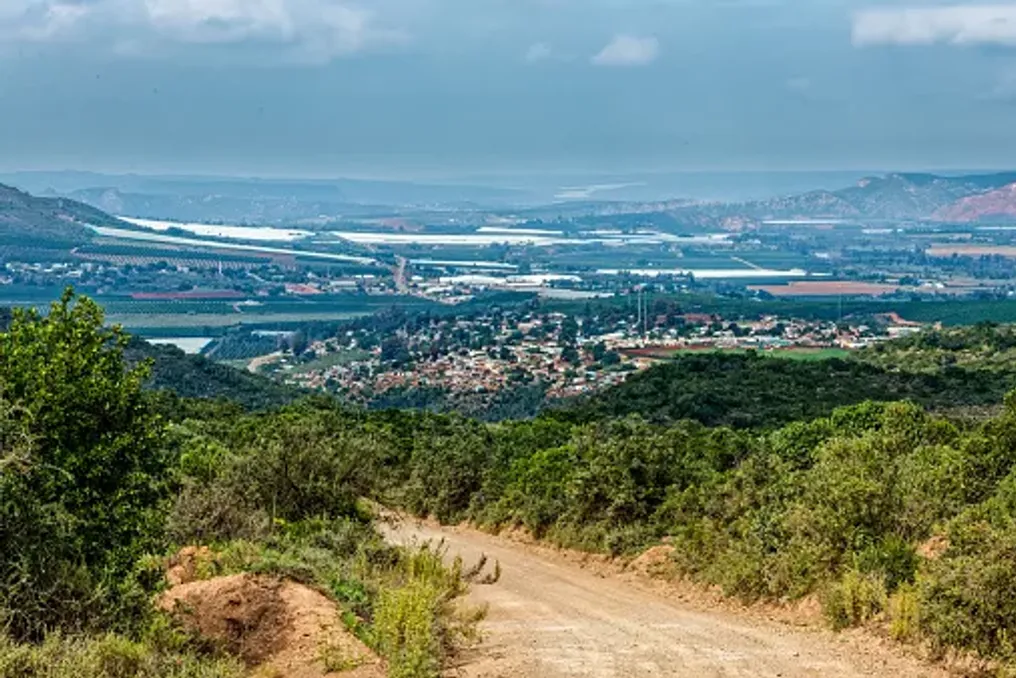
The Gamtoos River Valley forms the inner core of the Kuga region, where Hankey and Patensie are surrounded by fertile agricultural lands and impressive mountain scenery. This area is rich in history, ranging from early missionary settlements to the story of Saartjie Bartman and the farming communities that continue to shape the valley.

A joint 48-hour trip allows one to experience the atmosphere of this quieter corner of the Eastern Cape, providing time to familiarize oneself with the heritage, local produce, mountain views, and a deeper immersion into the valley.

The journey should begin in Humansdorp, one of the inland entrances to the Kuga region. From there, one needs to head towards Hankey and the Gamtoos River Valley, where the landscape transforms from urban and open rural space to fertile fields framed by mountains.

The Gamtoos Valley is one of the key agricultural zones of the region. Its wide floodplains are surrounded by steeper slopes, and Hankey, Patensie, Loery, and Thornhill are the main settlements in this part of Kuga.

It is recommended to dedicate time to the journey itself, viewing it not just as a route between destinations. The citrus groves, farmlands, and mountain views become part of the experience.

History and Attractions

Hankey is one of the oldest towns in the Gamtoos Valley, founded in the 19th century as a missionary and agricultural settlement. Today, its history is closely linked to the surrounding landscape.

One of the most significant historical sites in this area is the Saartjie Bartman Memorial, which marks the burial site of Saartjie Bartman. She was taken from South Africa to Europe in the early 19th century and exhibited there. Her remains were returned to South Africa in 2002 and she was buried near Hankey.

After visiting the town, one should head to the surrounding hills for a different perspective. Bergvenster is a natural rock arch formed by weathering, offering views over the Gamtoos Valley. It can be reached from the Philipp Tunnel area, allowing one to experience the mountains without needing a multi-day expedition.

Another unusual landmark is the rock formation known as Queen Victoria's Profile, visible on the road between Patensie and Babaviaanskloof. From certain angles, the weathered rock resembles the profile of Queen Victoria.

The mountains are one reason to slow down on this route. They transform what could be a simple rural trip into a picturesque adventure.

For accommodation in the Gamtoos Valley, one should choose lodging in or near Hankey or Patensie. Smaller settlements allow one to enjoy the area at a more relaxed pace, offering local guesthouses, self-catering options, and farm stays in the wider valley.

The day can conclude with a meal using local produce whenever possible. Agriculture plays a central role in the identity of the valley, as citrus and vegetables are grown in the region.

Second Day in Patensie

The second day begins in Patensie, a small farming town surrounded by the mountains of the Gamtoos Valley. Patensie is closely linked to the region's citrus industry and is the last major settlement before the road continues into the Babaviaanskloof reserve. The Kokskomberg mountain serves as a dramatic backdrop to the town.

Instead of rushing, one should take time to explore local shops and stop for breakfast or coffee. The local visitor point, Tolbos Country Shop and Tea Garden, provides information on Eastern Cape tourism, offering a chance to pause before moving further into the valley.

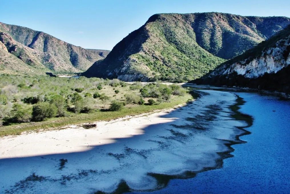
From Patensie, one can travel towards the Kuga Dam, an impressive engineering structure situated among the mountains. The road also offers some of the best opportunities to appreciate the contrast between the cultivated valley and the rugged mountains beyond it.

Attention should be paid to the unusual rock formations along the route, including Queen Victoria's Profile.

The wider Kuga area offers many ways to spend time outdoors, including hiking, kayaking, fishing, camping, and off-road routes.

However, it is not necessary to turn the weekend into an endurance test. A short walk, a scenic tour, or a leisurely swim can be enough to get acquainted with the landscape.

For visitors seeking something more unique, local tour operators offer activities related to farming and nature. For example, honey tasting and beekeeping tours provide an opportunity to learn more about another aspect of the valley's agricultural landscape.

Provided the roads are in good condition and there is time, one can proceed to the entrance of Babaviaanskloof. The Babaviaanskloof reserve is located beyond Patensie and is surrounded by mountain ranges, making it a natural continuation of the trip through the Gamtoos Valley. The broader Kuga tourist route connects Humansdorp, Hankey, and Patensie with Babaviaanskloof.

This should be viewed as an optional addition rather than trying to fit an entire adventure in Babaviaanskloof within a 48-hour plan. The valley itself offers enough scenery, history, and opportunities for outdoor recreation for a weekend.

The appeal of Kuga's inland towns is that they do not require a rigid schedule. Here, a weekend can mean following the river, stopping at a farm shop, contemplating the mountains, learning about Hankey's history, buying local products in Patensie, or taking a scenic drive simply because the landscape looks inviting.

The Gamtoos River Valley also serves as a reminder that the tourism stories of the Eastern Cape extend far beyond its coast. Its fertile lands, rivers, and mountain ranges have shaped communities here for generations, creating a place where nature and life in small towns remain closely intertwined.

For travelers who prefer more relaxed road trips, Kuga offers a chance to slow down and explore a landscape that is easily driven past but brings satisfaction if given a little more time.

Open Baviaans Canyon Trail offers five-day wilderness trekking experience
Read more
getaway.co.za

Open Baviaans Canyon Trail offers five-day wilderness trekking experience

Baviaanskloof has always rewarded those willing to go further. Now, a new five-day hiking route has opened in this area, allowing travelers to delve deeper into the mountains, canyons, and gorges, including sections previously inaccessible to the public.

The Baviaans Canyon Trail was opened in February 2026. It covers approximately 76 kilometers over five days and four nights. The route starts and ends at the Baviaanskloof Information Centre and passes through the Kouga and Baviaans mountains.

This trek is classified as slackpacking, but it is not easy. Its difficulty is rated as moderate to difficult; most days involve trekking between 15 and 18 kilometers, with tourists carrying only a daypack, while luggage and food are transported between camps.

Baviaanskloof is part of the protected areas of the Cape Floral Region, which is a UNESCO World Heritage site known for its exceptional biodiversity and endemism. The larger protected zone encompasses seven out of South Africa's eight biomes.

This diversity manifests with every kilometer along the route. The first two days traverse the foothills of the Kouga Mountains, crossing ridges, valleys, and steep terrain before the landscape begins to narrow.

The third day leads into Paradise Kloof. Although it is the shortest day, covering only 8 km, it is considered the most thrilling. The trail enters narrow canyons and forested gorges, following the river in sections where the water can reach depths of about 50 cm. Tourists are advised to wear footwear that can get wet.

Here, the character of the experience changes: rocky walls rise around the trail, the river becomes part of the journey, and the vastness of the mountains gives way to the intimacy of the canyon. The last two days involve ascending back into the Baviaans Mountains, crossing high plateaus and ridges before returning to the starting point.

At the end of each day, tourists return to private accommodation equipped with bathrooms, hot showers, and solar lighting. The camps also feature communal cooking areas, fireplaces, barbecue spots, and swimming pools.

This is a comfortable and somewhat modern way to experience truly remote landscapes without carrying gear for four nights of camping. However, one must not let the aspect of comfort be misleading: the wilderness remains the dominant force.

There is no mobile phone coverage along the entire route, and groups are provided with a satellite phone for emergencies. Tourists must also be prepared for variable weather, sudden floods, and other hazards inherent to remote mountainous terrain.

Due to the limit of 12 tourists per group, the experience maintains an intentionally small scale. The route operates under a concession with the Eastern Cape Parks and Tourism Agency, which manages the Baviaanskloof World Heritage site, while the trail itself is operated by Go Baviaans.

The appeal of the Baviaans Canyon Trail lies not just in the opening of a new canyon, but in the opportunity to slowly absorb Baviaanskloof. The mountain pass transforms into an ascent, the river becomes part of the path, and the distance between camps becomes a daily adventure.

Over five days, there is little to do except walk, look, and listen. Perhaps this is the true luxury here—not the hot shower at the camp, but the feeling of complete detachment from the noise of everyday life, surrounded by one of the most unique wilderness areas in the Eastern Cape.

Popular