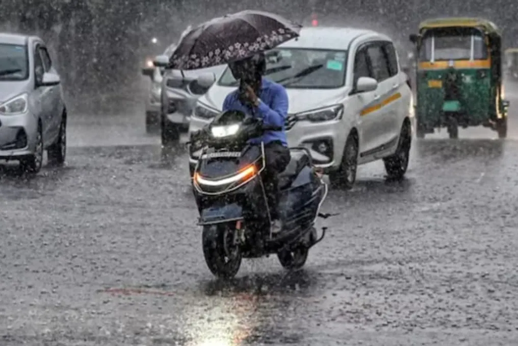
Despite the rains, air quality in Delhi remains poor: only one 'good' weather day recorded in 92 days
Read more
Aaj Tak
www.aajtak.in

Despite the rains, air quality in Delhi remains poor: only one 'good' weather day recorded in 92 days

Despite heavy monsoon rains in Delhi, the air has not remained clean for long periods. According to a new study by the Centre for Science and Environment (CSE), during the period from June 1 to August 31, 2026, the air quality in Delhi was 'good' on only one out of 92 days.

During this period, the total rainfall registered in Safdarjung and Palme was 576.9 mm. Nevertheless, for 53 days, which accounts for 57.6 percent, the air quality was in the 'moderate' category.

The study showed that although PM2.5 levels decreased during the rain, they began to rise again as soon as the rain stopped. The average PM2.5 level during precipitation was 32.7 micrograms per cubic meter. However, 24 hours after the rain stopped, it reached 36.2, and after 48 hours, it reached 45.1 micrograms per cubic meter, indicating a 37.9 percent increase in PM2.5 levels over 48 hours.

CSE compared the air quality in Delhi in April-May and in June-August 2026. In April-May, the average PM2.5 level in Delhi was 60.2 micrograms per cubic meter, whereas during the monsoon season, it dropped to 40.2 micrograms, representing a decrease of approximately 33.2 percent. Analyzing six individual rain events during the monsoon season, CSE noted that the average PM2.5 level before the rain started was 40.6 micrograms. During the precipitation, it decreased to 32.7 micrograms, which is a reduction of approximately 19.5 percent. But after the rain stopped, PM2.5 started rising again: after 24 hours, it reached 36.2 micrograms, and after 48 hours, it reached 45.1 micrograms, which was 11.1 percent higher than the 40.6 micrograms recorded before the rain started.

For the entire monsoon period of 92 days, the air in Delhi was 'good' only on July 9. On this day, the average rainfall in Safdarjung and Palme was 67.75 mm. Furthermore, August 8 saw the highest daily rainfall of the monsoon season—101.05 mm—but on that day, the air quality was only 'satisfactory'.

Overall, during the monsoon season, 53 days had 'moderate' quality, 35 days had 'satisfactory' quality, and three days had 'poor' quality. Compared to April-May, where 38 out of 61 days were 'moderate', 17 were 'poor', and six were 'satisfactory', the monsoon season showed a higher proportion of 'moderate' conditions.

According to CSE, the 'moderate' category does not mean completely clean air; in this category, the 24-hour average PM2.5 can reach between 61 and 90 micrograms per cubic meter, exceeding the national standard of 60 micrograms.

Rain helps settle fine particles such as PM2.5 and PM10 present in the air. However, some gaseous pollutants do not disappear under the influence of precipitation. Therefore, during many rainy days, major air quality degrading pollutants included ozone, nitrogen dioxide, and carbon monoxide.

Ground-level ozone was the main pollutant on 20 days during the monsoon season, and also on 49 percent of days during the summer period. Nitrogen dioxide was the dominant pollutant on 10 monsoon days, compared to only 3 percent in the summer period. Carbon monoxide was the main pollutant on 7 percent of monsoon days.

CSE explains that some gases emitted by vehicles, diesel generators, and industry remain in the air even during rain. When sunlight breaks through the clouds, these gases can undergo chemical reactions, leading to the formation of ground-level ozone.

The natural help provided by weather conditions will weaken. After this, due to reduced wind speed in winter and the sinking of upper air layers, pollution may increase. CSE emphasizes that Delhi-NCR cannot rely solely on emergency measures during the winter; year-round pollution reduction efforts are necessary. To achieve this, it is critically important to reduce emissions from transport, industry, construction, waste burning, and diesel generators. Furthermore, coordinated action is required across the entire NCR.
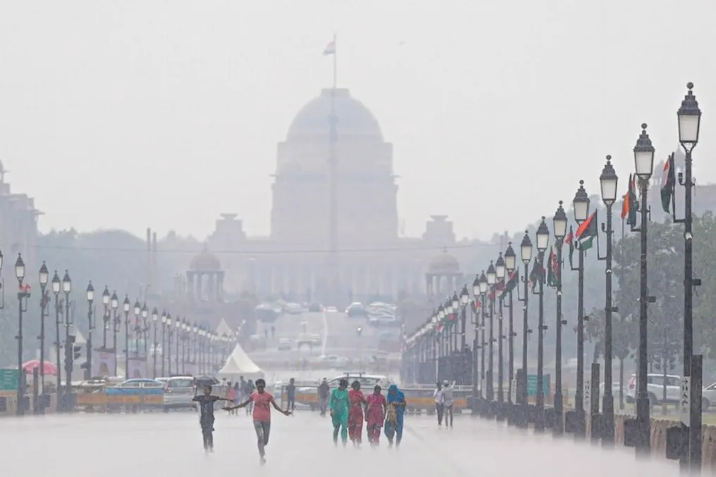

Similar stories

Weather in Delhi: Climate Change Expected After Cold Spell
Read more
www.aajtak.in

Weather in Delhi: Climate Change Expected After Cold Spell

The climate in the Delhi-NCR region has been undergoing sudden changes over the last two to three days. Due to rain and cool winds, temperatures have dropped, making the weather pleasant. However, this altered climate is not long-term.

According to the current situation, the period of rain and cold in Delhi-NCR is likely to last only until tomorrow. After that, temperatures may rise again, meaning that the current coolness cannot be considered the start of a stable winter. The weather may change again in the coming days.

The cause of this sharp weather change is attributed to the influence of a deep depression over the Bay of Bengal. This system shifted towards Uttar Pradesh. Its impact caused weather changes in Delhi-NCR and other plains areas over the last two to three days. Additionally, rainfall and snowfall in the mountainous regions, where a Western Disturbance was active, influenced the weather in the plains areas.

Although there is no new Western Disturbance in the near future, the weather in the mountainous regions may gradually change, which will subsequently affect the climate of the plains areas. Regarding the monsoon situation, monsoon processes are still active in some parts of the country, so it continues to rain in different places. Nevertheless, the monsoon has moved out of Rajasthan and Delhi-NCR.

At the same time, the process of monsoon withdrawal is continuing in several other states of the country, indicating that the monsoon has not left the entire country simultaneously. The situation varies across different areas, and rain continues in some places. For residents of Delhi-NCR, it is most important to understand that the coolness of the past few days should not be considered a permanent change in weather. Although the temperature has indeed dropped due to the rains, it may rise again in the coming days.

Meteorologists warn of continued rain, storms, and thunderstorms in India from September 28
Read more
www.aajtak.in

Meteorologists warn of continued rain, storms, and thunderstorms in India from September 28

As September concludes, the weather in many regions of the country is changing: strong precipitation, thunderstorms, and high winds are being observed, causing concern. In mountainous areas, the risk of flash floods and landslides persists amid the rains. The Meteorological Department (IMD) has issued a warning for rain, storms, lightning strikes, and strong winds, which is also effective on September 28 in several states.

Although the southwest monsoon in India is in a withdrawal phase, the weather remains active in many places. According to IMD data, the tropical disturbance line of the retreating monsoon passed through Gurdaspur, Chandigarh, Muzaffarnagar, Aligarh, Dauhampur, Udaipur, Disa, and Naliya, reaching the Arabian Sea on September 27. Furthermore, a low-pressure area has formed over the northern part of central Uttar Pradesh, which is expected to shift in a north-northwesterly direction and begin to weaken over the next 12 hours.

This may lead to the persistence of rainfall in some parts of North India. Another low-pressure area has also formed near the southern coast of Myanmar. It may move towards the North Andaman Sea and then towards the coast of the Bay of Bengal and neighboring Bangladesh. This weather phenomenon could potentially cause rain in some areas of Eastern and Northeast India.

In Delhi and NCR, partly cloudy skies are expected on September 28, with a possibility of light drizzle in some zones. The maximum temperature may reach around 31 degrees Celsius, and the minimum will be 20 degrees Celsius. By September 29, clearer weather is anticipated in Delhi, with a slight increase in temperature. On that day, the wind from the northwest may blow at a speed of about 18 kilometers per hour.

Following recent heavy rains in Uttar Pradesh, signs of improvement are gradually appearing. No warnings for heavy rainfall have been issued for the state on September 28. Nevertheless, the weather system in the northern part of central Uttar Pradesh has not yet dissipated, and rains may continue in some places as it moves. Very heavy rainfall, exceeding 30 centimeters in some areas, was recorded in Eastern Uttar Pradesh on September 27.

Very heavy rains were also noted in Western Uttar Pradesh. Persistent precipitation has negatively affected people's lives, causing flooding in many places. On September 28, rain and thunderstorms are possible in some parts of Western and Eastern Uttar Pradesh, but a decrease in precipitation intensity is forecast.

In Bihar, a period of rain and thunderstorms accompanied by strong winds is expected in several districts from September 28 to October 1. Although no heavy rainfall warning has been issued at the moment, very heavy rains were registered in some parts of Bihar on September 27. Precipitation may continue in the coming days, but a gradual decrease in intensity is expected.

In Uttarakhand, heavy rains are possible in isolated places on September 28, along with the threat of thunderstorms and lightning. Within the next 24 hours, there is a danger of flash floods in some areas of Uttarkashi, Dehradun, Tehri Garhwal, Chamoli, and Rudprayag. Rain and thunderstorms are also forecasted in Himachal Pradesh; residents of Kinnaur, Shimla, and Sirmaur are advised to remain vigilant. During heavy rainfall in mountainous areas, the risk of landslides and road closures increases.

Rain and thunderstorms are also possible in Panchabagh, Haryana, and other parts of Northwest India. Very heavy rainfall, ranging from 12 to 20 centimeters, was recorded in Uttarakhand and Western Uttar Pradesh on September 27.

Rainfall is expected to continue in Madhya Pradesh from September 28. In Western Madhya Pradesh, rain is forecast from September 28 to 30, and in Eastern Madhya Pradesh, from September 28 to October 1. Thunderstorms and lightning are possible in some areas. Rains may also occur in Vidarbha, and rain and thunderstorm activity is expected in Chhattisgarh.

Active weather is expected in several Northeastern Indian states on September 28. Rain is possible in Arunachal Pradesh, while Assam, Meghalaya, Nagaland, Manipur, Mizoram, and Tripura are also forecast to receive precipitation. In Assam and Meghalaya, strong winds of 40–50 kilometers per hour are expected from September 28 to 30, with maximum speeds potentially reaching 60 kilometers per hour. Such weather is likely in Nagaland, Manipur, Mizoram, and Tripura from September 28 to October 1.

In West India, rain is possible in Gujarat, Konkan, Goa, and Central Maharashtra. Rainfall is also expected in Marathwada on September 28. Central Maharashtra is expected to experience strong winds of 30–40 kilometers per hour on September 28, with gusts up to 50 kilometers per hour. Strong winds are also forecast in Marathwada.

Deep depression center formed in the Bay of Bengal: Warning of heavy rainfall in 10 states, including Uttar Pradesh and Bihar
Read more
www.aajtak.in

Deep depression center formed in the Bay of Bengal: Warning of heavy rainfall in 10 states, including Uttar Pradesh and Bihar

The influence of the deep depression center that has formed in the Bay of Bengal may lead to increased rainfall in many states of Eastern and Central India. The Meteorological Department (IMD) issued a warning for heavy and very heavy rainfall for regions such as Uttar Pradesh, Bihar, Jharkhand, Orissa, Chhattisgarh, Madhya Pradesh, and Vidarbha on September 25.

In addition to rain, there is a warning for thunderstorms and strong winds in several places. Wind speeds in some areas may reach 70 kilometers per hour. Localized rains are expected on September 25 in several parts of the country's capital Delhi, as well as in Haryana and Chandigarh. According to the meteorological department, this rainfall impact may persist until September 29, accompanied by cloudiness, light and moderate rains, and thunderstorms.

The influence of the weather system that originated in the Bay of Bengal is being felt in Uttar Pradesh, especially in the eastern districts of the state. Heavy rains occurred in Purvanchal districts on September 24. IMD forecasts very heavy rains in eastern Uttar Pradesh on September 25 and 26. Strong surface winds may also blow in many parts of Uttar Pradesh, which could cause sudden weather changes and lightning strikes.

The situation of heavy rain, storm, and thunderstorms may develop in cities such as Varanasi, Gorakhpur, Prayagraj, Ayodhya, Jaunpur, Azamgarh, Mirzapur, Ghazipur, Mau, Ballia, Sultanpur, Amethi, Pratapgarh, Chandauri, Bhadohi, Sonbhandh, Dewaria, Kushinagar, Maharajganj, Basti, Sant Kabir Nagar, Siddharthnagar, Gonda, Bahraich, Shravasti, Balrampur, and Ambedkar Nagar.

Extensive rains are forecasted in Bihar on September 25. Heavy precipitation is expected in some places, while intense rains may be observed in other regions. There is also a possibility of strong winds, thunderstorms, and lightning in the state. The next 24 hours will be significant from a weather perspective in Jharkhand. Orange warnings have been issued for Ranchi, Hunti, Gumla, Simdega, and West Singhbhum due to heavy or very heavy rainfall in some areas, and yellow warnings for 11 districts.

A warning for heavy rains, thunderstorms, and storms has been issued for Jammu and Kashmir, Ladakh, Himachal Pradesh, and Uttarakhand on September 25. The impact of rain and strong winds may also affect some other parts of North-West India.

Monsoon activity will also continue in Rajasthan. In eastern Rajasthan, including Jaipur, Alwar, Bharatpur, Dholpur, Dausa, Karauli, Sawai Madhopur, Tonk, Bundi, Kota, Baran, Jhalawar, Sikar, Junghunhu, and Chittorgarh, rain is expected in several places on September 25. This period of rain is forecast to last until September 27. In western Rajasthan, including Jodhpur, Jaisalmer, Barmer, Bikaner, Nagaur, Sri Ganganagar, Hanumangarh, Churu, Pali, Balotra, Phalodi, and Sirohi, there is also a possibility of rain in some places.

Increased rainfall is expected in Madhya Pradesh, Chhattisgarh, and Vidarbha on September 25. There is a warning of very heavy precipitation in parts of Western Madhya Pradesh, Eastern Madhya Pradesh, Chhattisgarh, and Vidarbha. Strong winds up to 70 kilometers per hour are expected in Chhattisgarh. Thunderstorms, lightning, and storms may also occur in these areas.

Relatively less rain is expected in the Konkan region of Maharashtra on the day of Ananta Chaturdashi. Nevertheless, heavy rains are possible in some areas of Marathwada and Vidarbha. Heavy rain is possible in some places in Chhatrapati Sambhajinagar, Nanded, Latur, Parbhani, Beed, Jalna, Dharashiv, Hingoli, and Ambajogai. Orange warnings have been issued for Bhandara, Chandrapur, Gadchiroli, and Gondia.

The deep pressure over the Bay of Bengal is affecting the weather in West Bengal and Orissa. Consequently, heavy and very heavy rains are expected in some parts of West Bengal from September 25 to Saturday. Rain is also predicted in Purbi Medinipur, Paschim Medinipur, Jhargram, Darjeeling, Kalimpong, Jalpaiguri, and Alipurduar.

Considering the strong winds at sea, IMD advised fishermen near the coasts of West Bengal and Orissa not to go out to sea until Friday. During this period, wind speed may range from 55 to 65 kilometers per hour. Extensive rains are also expected in Orissa on September 25, with the possibility of very heavy precipitation, thunderstorms, lightning, and strong winds in some places.

There is a rain warning in all Northeastern Indian states. Rains with a probability of storms and thunderstorms are expected in Arunachal Pradesh, Assam, Meghalaya, Nagaland, Manipur, Mizoram, and Tripura. The weather will also be active in many Southern Indian states. Rain may fall in Raisalaim, Tamil Nadu, Puducherry, Karaikal, Kerala, Mahé, and Lakshadweep. Rain is also predicted in coastal Karnataka, North and South Interior Karnataka, Telangana, coastal Andhra Pradesh, and Yanam, where thunderstorms are expected.

Popular