Due to the strong El Niño phenomenon, the monsoon in India this year proved weak. Between June and September, the country received 12.6% less than the normal amount of rainfall. During this period, 759.4 millimeters of rain were recorded against a normal of 868.6 millimeters. Consequently, the 2026 monsoon became the fourth weakest since 2001. The lack of precipitation significantly impacted agriculture and water resources.
The situation is particularly severe in the Marathwada region of Maharashtra. According to a report prepared by local correspondents of Amar Ujala, about 80% of crops perished here, and only about 12% of the water remained in several reservoirs.
The history of this monsoon is related not only to the overall decrease in rainfall but also to when and where it fell. In June, rains were very sparse, and the number of low-pressure atmospheric systems was also low. This prevented the monsoon from gaining sufficient strength in many areas. Later, some low-pressure systems formed in the Bay of Bengal, causing rains in some places. Odisha was a prime example of such a phenomenon, where record rainfall was observed thanks to these systems.
The start of the monsoon season was weak. In June, the entire country received approximately 35% less than the normal amount of rainfall. In many states, rainfall was significantly below expectations. Partially, this was due to insufficient formation of low-pressure systems in the Bay of Bengal. These systems are critically important for the monsoon as they carry moisture from the sea to the interior regions of the country. When there are fewer such systems, rainfall weakens in several regions.
In July, the rainfall situation slightly improved: the country received approximately 1% more than the normal amount. This partially compensated for the initial monsoon deficit. However, in August and September, rains became rare again, which reflected in the overall figures for the entire monsoon season.
Overall, between June and September, the country received 759.4 millimeters of rain against a normal of 868.6 millimeters, indicating a deficit of about 109 millimeters. This is why the 2026 monsoon is recognized as the fourth weakest after 2001.
Although a weakening of the monsoon was anticipated due to El Niño, the low-pressure systems that formed during the season helped mitigate the rainfall deficit in certain regions. Low-pressure systems forming in the Bay of Bengal move into the eastern and central parts of India, ensuring good rainfall in many states. This year, after the formation of such systems, rainfall increased in some areas.
Odisha became the most obvious exception. Thanks to numerous low-pressure systems in the Bay of Bengal, Odisha experienced heavy rains, including record precipitation in some places. This showed that the impact of El Niño was not uniform across the country; while some areas experienced a deficit, other states saw heavy rains due to weather systems.
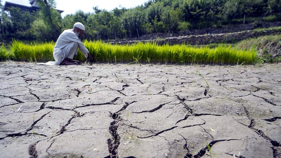
During the four months of the monsoon, several states experienced a rainfall deficit compared to the norm. Drought continued in some areas. This directly affected the Kharif early harvest crops. Where rains did not arrive on time, soil moisture decreased, negatively affecting the growth of crops such as soy, cotton, and arhar. The prolonged absence of rainfall led to the wilting of crops in several places.
The most serious consequences are felt in Marathwada, Maharashtra. Due to the prolonged rainfall deficit, standing crops suffered significant damage.
In districts such as Latur, Bid, Parbhani, and Dharashiv, the situation is extremely difficult. Between June and September, the normal rainfall expected in these areas was 679.5 millimeters, but only 424.5 millimeters were actually recorded. The lack of rain directly damaged the fields: soy turned yellowish, cotton growth stopped, and arhar began to dry up. Sugarcane harvest was also affected.
In these areas, about 80% of the crops were destroyed. Farmers invested money in seeds, fertilizers, labor, and other necessities for growing the harvest. Now that the crop has died, most of their income is lost. Furthermore, there is a problem with clearing the dead crop from the fields, which will require additional expenses.
Farmer Ram Bellade from Savargaon Gokde in Latur planted eight acres of soy, arhar, and jowar. About one and a half lakh rupees were spent on this planting. Since the crop died, it is now necessary to remove the dry plants from the field to prepare the land for the next season. Reports indicate that this may cost up to five thousand rupees per acre. Sugarcane is also drying up in many places. The cane, which usually reaches a height of 20–25 feet, reached only 10–12 feet this year before starting to wilt.
The lack of rainfall affected not only the crops but also reservoirs and other water sources. The water level in Latur...
2