Southpansberg Region Exploration: Mountains, Forests, and Venda Culture in 48 Hours
Read more
Getaway
getaway.co.za

Southpansberg Region Exploration: Mountains, Forests, and Venda Culture in 48 Hours

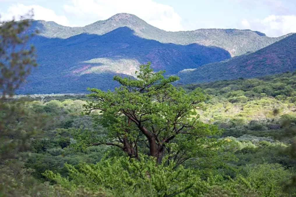
In the northern part of Limpopo, Southpansberg rises above the surrounding plains, presenting a dramatic landscape composed of forested mountains, waterfalls, rivers, and valleys. On the eastern slopes, this scenery merges with the cultural center of the VhaVenda people, where natural features intertwine with traditions, beliefs, and histories.

Spending a weekend here allows for combining mountain hikes, wildlife observation, visits to local forests and waterfalls with familiarization with Venda history and culture. Instead of rushing between attractions, it is recommended to let the landscape set the pace.

To begin exploring Southpansberg, one should use the town of Louis Trichardt, also known as Makhado, which is located at the foot of the mountain range and serves as a convenient base for exploring the surroundings.

The mountains are the main attraction from arrival. Their slopes support diverse vegetation—from grasslands and shrubs to patches of local forest, and the valleys are crossed by streams and waterfalls. For a complete immersion, it is better to spend the morning hiking in the mountains rather than just driving through them.

One option is Leshiba Wilderness, a private ecotourism area and reserve in Southpansberg. Its activities include guided tours, mountain biking, wildlife tracking, learning about medicinal plants, and the opportunity to see ancient rock art. This reserve is also notable for allowing encounters with some animals during hikes.

The focus here is not on finding the 'Big Five,' but on experiencing the mountain environment at a relaxed pace. It is worth making lunch part of the landscape by choosing a lodge, farm restaurant, or local establishment where one can linger instead of rushing on.

The broader Southpansberg and Wembe region is an agricultural zone where bananas, corn, and other subtropical crops are grown. Thus, local cuisine becomes another way to connect the trip with the landscape, rather than viewing the mountains merely as decoration.

In the eastern part of Southpansberg, the landscape becomes greener and more impressive as the mountains give way to forests, rivers, and waterfalls. The Piphidi Waterfall is considered one of the most famous attractions in the area, but it is important to remember that it is more than just a picnic spot; local communities consider the waterfalls sacred places, so visitors must behave respectfully and follow local instructions. The Makhado Municipal Tourist Guide also designates these waterfalls as sacred territory.

Another interesting location is Tshatshingo Potholes, where the Mutale River cuts deep formations into the rocks. These potholes are part of a wider landscape that includes streams, forest, and waterfalls, presenting a striking contrast to the open mountain scenery of western Southpansberg.

It is recommended to stay somewhere that allows you to experience Southpansberg after dark. There are many lodges and guesthouses in the mountains and Wembe region, ranging from wildlife viewing shelters to small, local accommodations. Staying near the mountains also provides the opportunity to start the second day without needing to spend the morning traveling back to the area.

For example, Thathe Dam Lodge positions itself as a base for exploring Venda's natural and cultural attractions and offers accommodation decorated with local art and crafts.

Similar stories

Kuruman in the Northern Cape: An Oasis Formed by a Natural Spring
Read more
getaway.co.za

Kuruman in the Northern Cape: An Oasis Formed by a Natural Spring

In the arid landscape of the Northern Cape, Kuruman presents an unexpected green island. This town, known as the Kalahari Oasis, originated around the Kuruman Eye—a natural spring that supplies about 20 million liters of water daily. The spring, named Gasegonyane in Setswana, has provided water for people, agriculture, and wildlife in this dry area for generations.

However, Kuruman is not only its famous spring. Its history spans from indigenous communities and missionary settlements to archaeological finds dating back over a million years. Outside the town, the landscape transforms into thornbush, rocky hills, and the Kalahari plains.

A weekend visit here allows one to see how water influenced the development of this place—from the earliest inhabitants to the modern town. The central point giving Kuruman its unique character is the Kuruman Eye. It is located in the center of the town, from where clean spring water rises from the ground and collects in a pool surrounded by gardens, palms, and other vegetation.

The spring produces approximately 20 million liters of water daily, even during the dry season. Its name in Setswana is Gasegonyane, which means a small basin of bubbling water. It is recommended to spend time walking around the area rather than viewing the Eye as a quick roadside stop. One should observe the clear water for fish and other aquatic life, watch birds among the vegetation, and notice the sharp contrast between the greenery and the dry land outside the town.

This spring also feeds the Kuruman River and historically supported irrigation and agriculture in the region. The history of the Eye is inextricably linked to the history of Kuruman. The spring enabled permanent settlement and later became the center for the establishment of Moffat Mission. Robert and Mary Moffat founded their mission here in the 1820s, working with local communities speaking Setswana.

The mission became an important center for education, language, and printing. Robert Moffat translated the Bible into Tswana and used a printing press for local reproduction. This history is still visible on the mission grounds. Moffat Mission is one of Kuruman's most important historical sites. The site includes Moffat's former homestead, foundations of an early classroom, Moffat Church, and other historic buildings. The church was completed in 1838 and designed to accommodate about 800 people.

The mission grounds demonstrate a striking contrast with the surrounding Northern Cape landscape. Mature trees and gardens grow next to historic buildings, facilitated by the reliable water source in the area, creating a surprisingly green corner. Inside the mission, visitors can find the historic cast-iron printing press used by Moffat, as well as other items related to the mission's history.

After visiting the Eye and Moffat Mission, time should be allocated to exploring the town and its surroundings. The contrast between shaded streets, gardens, and the dry landscape outside the oasis is part of the appeal of this place. Kuruman also has local craft shops where tourists can view regional art and handmade goods.

If you are traveling through the Northern Cape and not making Kuruman your sole destination, the town serves as a convenient base for exploring attractions in the surrounding region. The next morning, one can travel south from Kuruman towards Wonderwerk Cave. This archaeological site is about 43–45 km from Kuruman and represents one of the most outstanding testimonies to the distant past of humans in the region. Excavations have uncovered traces spanning over a million years, including stone tools, animal remains, engraved stones, and evidence of controlled fire. The cave is about 140 meters long, and its archaeological record covers several periods of human habitation. Later rock paintings include pictures made with red and yellow ochre.

This is a particularly useful stop as it changes the perspective on the landscape outside Kuruman. Kuruman's dry hills and thornbush are not just scenery; they are part of the environment in which people lived, traveled, and adapted for hundreds of thousands of years. Before traveling, it is necessary to check access conditions, as visits and tours may depend on arrangements with the site.

Returning to Kuruman, time should be spent contemplating the landscape itself. The area around the town is characterized by dry thornbush, rocky terrain, and the broader Kalahari environment. Nevertheless, pockets of water create unexpectedly rich habitats for plants and animals. Birdwatchers can explore areas such as the Hotazel Road bird sanctuary north of the town, and wildlife enthusiasts have larger conservation areas within reach, including Tsawal Kalahari Reserve to the west.

It is important to note the difference between the water-supported green zones and the much drier surrounding terrain. The most fascinating story of Kuruman is not so much about one spring as it is about what happens when a reliable water source appears in an arid environment. The water from the Eye sustained the town, fed the Kuruman River, and allowed for irrigation in the adjacent area. The underground resource under the Gaap plateau effectively creates a green thread through an otherwise dry landscape.

This distinguishes Kuruman from many destinations in the Northern Cape. The attraction lies not just in the desert, but in the dramatic interplay between water and dryness. If you have extra hours, it is worth exploring some of the smaller attractions around Kuruman instead of leaving the town immediately. The Ga-Segonyana region includes the Boesmansgat gorge, the Koranna-Langberg area, local nature reserves, and other historical sites. Kuruman can also be used as a starting point for a longer road trip through the Northern Cape, accessing places like Kaapvaal, Hotazel, and the wider Kalahari region.

Kuruman can be very hot, especially in the summer. Tourist authorities advise avoiding the hottest time of year if possible, while winter brings warm days but potentially very cold nights. Sunscreen and comfortable walking shoes, as well as warm clothing if traveling in colder months, must be packed. The dry season can emphasize the surrounding landscape, and the greenery around the Eye is particularly impressive. Kuruman is ideally suited for a two-day stopover in the Northern Cape, rather than a location requiring tight itinerary planning.

The first day should be dedicated to understanding the town through its water and history: starting with the Eye, visiting Moffat Mission, and leisurely touring the town. The second day can be devoted to exploring the past at Wonderwerk Cave before returning to the Kalahari landscape. By the time of departure, the Kuruman Eye will be understood more clearly: it is not just an attractive spring in the town center, but the reason for the existence of this green patch and a reminder of how deeply water can shape life in one of South Africa's driest regions.

iSimangaliso Park Study: Ecosystem Diversity Beyond the Beaches
Read more
getaway.co.za

iSimangaliso Park Study: Ecosystem Diversity Beyond the Beaches

iSimangaliso Park is known for its vast golden coastlines, but its most captivating stories unfold away from the sand. Within the northern KwaZulu-Natal region, wetlands, estuaries, lakes, grasslands, coastal forests, and marine habitats coexist, making it one of South Africa's most diverse protected areas.

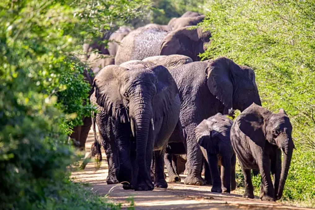
The park was recognized as South Africa's first UNESCO World Heritage Site in 1999 and stretches along approximately 220 kilometers of coastline. Over 520 bird species are registered here, and its habitats support animals such as hippos, crocodiles, elephants, rhinos, whales, and nesting turtles.

A 48-hour trip allows visitors to experience this diversity without spending all their time on the beach. It is recommended to stay in St Lucia and use this town as a base for exploring the estuary, wetlands, coastal forests, and the wildlife-rich Eastern Shores.

Exploring Lake St Lucia

Begin by familiarizing yourself with the ecosystem that defines this region: Lake St Lucia. This estuary is one of South Africa's most vital wetland complexes, serving as a feeding, resting, or nesting ground for over half of KwaZulu-Natal's waterfowl. The lake also serves as an important fish breeding ground, as 71 out of 155 registered fish species depend on it for spawning.

The simplest way to get acquainted with the lake is by taking a boat cruise from St Lucia. Instead of searching for animals on land, you should observe the water for hippos, crocodiles, and birds along the shoreline. It is advisable to bring binoculars for spotting waterfowl and raptors, and hippos can often be seen in or near the water. The area around the lake also hosts numerous antelopes, including the waterbuck, reedbuck, kudu, nyala, impalas, and duikers.

Lake St Lucia is more than just a backdrop for wildlife viewing; its changing conditions sustain a complex wetland ecosystem, supporting an exceptional diversity of plants. Over 2180 species of flowering plants have been documented around the lake, demonstrating the immense life supported by this aquatic landscape. This underscores that animals are only part of the much larger iSimangaliso system.

Exploring the Forest Area

In the afternoon, visit the western part of Lake St Lucia in False Bay Park, where the landscape transforms from open water to sparse sandy forests. This area contains ancient deposits of fossils and shells, testifying to a completely different past landscape. Today, the forest supports birds, butterflies, and small wildlife, while hippos and crocodiles remain in the surrounding wetlands.

Three self-guided trails, including Mphofomeni, Ingwe, and Dukandlovo, pass through the sandy forest and thickets toward the shores of Lake St Lucia. This is an excellent place to slow down instead of just ticking off large animals. It is worth exploring the forest canopy for forest birds, scanning the vegetation for butterflies, and paying attention to tracks and other signs of wildlife. Swimming in the lake is not recommended due to the presence of hippos and crocodiles, so the shoreline is better suited for walks, boating, birdwatching, and simply enjoying the scenery.

Returning to town, the evening offers a chance to soak up the atmosphere of St Lucia without major organized events. The town is located near the park and serves as a convenient base for exploring the various iSimangaliso habitats. After a day spent by the water, in the forest, and in the wetlands, dinner in town brings one back to civilization before another early start.

Eastern Shores and Cape Vidal

Start early in the morning and head to the Eastern Shores section towards Cape Vidal. This is where the unusual geography of iSimangaliso is particularly evident. The route passes through coastal forest, grasslands, and freshwater ponds before reaching the Indian Ocean. The park describes the Eastern Shores as an area where scrubland, lake, and ocean meet, creating opportunities for both wildlife and bird watching.

Do not rush along the ring roads, viewing the trip merely as a journey to Cape Vidal. Elephants, rhinos, buffalo, and other wildlife are found in this zone, while the freshwater ponds and forested areas attract various bird species. The Eastern Shores are especially valuable if one moves away from the idea of safari as a hunt for large mammals. The park's diverse habitats support species such as the Livingstone's Turaco, pygmy bitter, red-breasted cormorant, and southern striped eagle.

Over 500 bird species have been recorded throughout iSimangaliso. The changing landscape also offers a chance to see how different habitats support different species. A freshwater pond, a patch of grassland, and a section of coastal forest can offer a completely different wildlife viewing experience within a single morning.

Before proceeding further to Cape Vidal, take time at Mishn Rocks. The rocky shore features tidal pools, coastal views, and fossil deposits, but due to strong currents and powerful tides, it is not a swimming spot. Instead, it is well-suited for stopping, exploring the coast, and observing marine life. Depending on the season, humpback whales can also be seen in the open sea. Whales migrate along the iSimangaliso coast roughly from June to November.

The contrast makes this stop worthwhile: behind you lies a wildlife-rich protected landscape, and ahead is the Indian Ocean. Cape Vidal is where the different sides of iSimangaliso converge most clearly. The coastline borders the forest and wild landscape, and the open waters attract dolphins and migrating whales. During turtle nesting season, loggerhead and leatherback turtles come ashore, usually between November and March.

Instead of making the beach the final destination, consider how the coastal environment connects to everything else you have seen. Forest dunes form a transition between terrestrial and marine environments, and the wider park protects wetlands, grasslands, lakes, estuaries, forests, and marine habitats. UNESCO recognizes this mosaic of ecosystems as one of the defining features of the World Heritage Site.

A weekend in iSimangaliso can easily turn into a beach holiday, but this only shows one part of the park. Within the broader protected area are three main systems of lakes, wetlands, coastal forests, grasslands, estuaries, freshwater bodies, and marine environments. The park is also home to over 500 registered bird species and an exceptional range of terrestrial and marine wildlife.

A 48-Hour Route in Tbilisi: Exploring Neighborhoods Beyond the Old Town
Read more
getaway.co.za

A 48-Hour Route in Tbilisi: Exploring Neighborhoods Beyond the Old Town

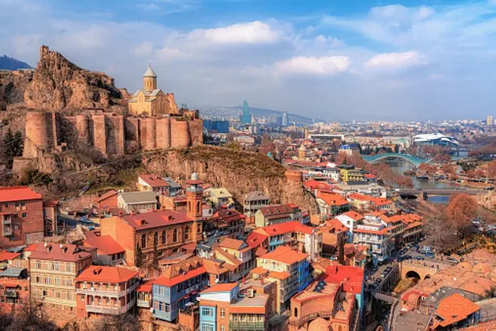
Tbilisi is a city where layers of history coexist with a rapidly developing creative environment. Beyond the cobbled streets and balconies of the Old Town, the Georgian capital offers vibrant food markets, relics of the Soviet era, modern art spaces, repurposed industrial buildings, and neighborhoods where cafes and restaurants animate old streets.

This 48-hour travel plan goes beyond standard tourist routes while making room for one of Tbilisi's most unique traditions—its sulfur baths.

The morning should start at the Dezert Market, one of Tbilisi's largest agricultural markets, located near the city's Central Railway Station. The market covers an area of about 2000 square meters and is lined with stalls featuring fruits, vegetables, nuts, herbs, cheeses, dairy products, spices, and traditional Georgian delicacies. Depending on the season, you can find churchkhela, tklapi, pickled goods, and tkemali—a sour plum sauce often found in Georgian cuisine.

It is recommended to arrive early, as the market usually opens around 07:00, allowing time to wander through the aisles before starting sightseeing. It is important not to rush at this stop; part of the experience is observing locals buying ingredients and assessing the diversity of produce that feeds the city's cuisine.

After the market, head to Chugureti, a neighborhood north of the Mtkvari River, where old architecture blends with Tbilisi's new cafe culture and creative atmosphere. This area provides an interesting contrast to the more manicured historic center. Its streets combine old residential houses with cafes, restaurants, studios, and independent businesses, while the neighboring Factory has become one of the most well-known examples of the city's creative redevelopment.

Instead of following a strict point-to-point itinerary, spend time here exploring inner courtyards, stopping for coffee, and noticing murals, balconies, and architectural details. The Factory, formerly a Soviet sewing factory, has been transformed into a multifunctional creative space. The complex is now associated with Tbilisi's contemporary urban culture, where the former industrial site hosts cafes, restaurants, shops, studios, and public areas.

It is also a useful place to understand the changing character of the city. Tbilisi's identity is not limited to its historic churches and traditional architecture; new businesses and creative spaces are increasingly occupying buildings and districts with much older histories. It is worth sitting in an inner courtyard to have a drink or coffee before moving on.

Later, proceed to Dry Bridge Market, one of Tbilisi's most characteristic open-air markets. The market has operated in its current form since the 1950s and is known for its assortment of antiques, Soviet-era items, old photographs, household goods, jewelry, and other curiosities. Nearby, artists display their paintings and handmade items in an open gallery.

This is a place where you simply need to wander rather than look for something specific to buy. You might stumble upon an old camera, a piece of porcelain, a Soviet souvenir, or a Georgian work of art. The market is usually open daily, and Georgia Travel indicates operating hours of approximately 09:00 to 17:00.

The day should conclude with a full Georgian dinner. Tbilisi is an ideal place to taste dishes from different regions of the country, as regional culinary traditions have merged in the capital. You should try khinkali, Georgian dumplings; khachapuri, the famous cheese bread; pkhali, made from vegetables and walnuts; and fried mtsvadi.

Khachapuri deserves special attention, as the dish has many regional variations. The familiar Adjarian version is shaped like a boat and decorated with cheese, butter, and egg, while Imeretian khachapuri is round and filled with cheese. Do not worry about fitting everything into one meal; Georgian food is meant to be shared.

The second morning can begin on Rustaveli Avenue, Tbilisi's main central artery. This avenue, spanning about 1.5 kilometers, unites several cultural institutions in the city, including the Georgian National Gallery, the Opera and Ballet Theatre, the Rustaveli Theatre, and the Museum of Modern Art. The avenue also presents an architectural journey through various periods of Tbilisi's history. Time should be spent looking not only at the museums but also at the facades, monuments, churches, and public buildings along the route.

The Georgian National Gallery is a valuable stop for understanding the country's artistic heritage. Its collection includes works by prominent Georgian artists such as Niko Pirosmani, David Kakabadze, and Lado Gudiaashvili, as well as contemporary Georgian painting and sculpture. For travelers interested in the city's modern creative scene, Tbilisi also boasts an extensive network of galleries and art events. For example, the annual Tbilisi Art Fair brings together galleries and artists from Georgia and other regions, reflecting the city's growing connections with the international contemporary art world.

Another opportunity to experience Georgian cuisine without repeating the previous night's dinner. Try lobio, a stewed bean dish, adjapsandali, a vegetable dish associated with Tbilisi, or a selection of pkhali, which is typically made from vegetables mixed with walnuts, herbs, and spices. If you missed khinkali the first evening, this is another chance. In Tbilisi, dumplings have acquired their own urban style, known as kalakuri khinkali, whose filling includes herbs.

No trip to Tbilisi would be complete without visiting the sulfur baths, even within a route designed to show the city outside the Old Town. The baths are concentrated in Abanotubani, a name roughly translating to 'bath quarter.' Naturally heated hydrogen sulfide water rises beneath the city, and the characteristic domed baths have been part of Tbilisi's culture for centuries.

Most baths offer both private rooms and communal bathing areas. A traditional visit may include soaking in warm mineral water, followed by a kisa—an energetic scrub performed with coarse cloth. It is recommended to book in advance if you choose a specific bath, especially during busy periods.

Technically, the sulfur baths are located in the historical core, but they function here because the experience lies in participating in one of Tbilisi's enduring traditions, rather than simply visiting another viewpoint or monument. Conclude your 48 hours with a leisurely Georgian dinner and a glass of local wine. Instead of trying to cram another attraction into the schedule, spend the evening in one of Tbilisi's cafes, wine bars, or restaurants and watch the city transform after dark. Perhaps this is the best way to understand Tbilisi beyond its postcards. The city is historic, but it does not seem frozen in the past; its markets, food, art, and repurposed spaces reveal a capital that continues to evolve.

Tbilisi is relatively easy to explore without a car. The metro operates daily from 06:00 to midnight, and public transport generally runs from 07:00 to 23:00. For this route, it is recommended to combine public transport with walking tours. Markets and neighborhoods are spread across the city, but several stops can be connected on foot after arriving in each area. Extra time must be allocated for wandering. Some of the most interesting places in Tbilisi are not individual attractions, but the streets, inner courtyards, cafes, and markets between them.
Popular