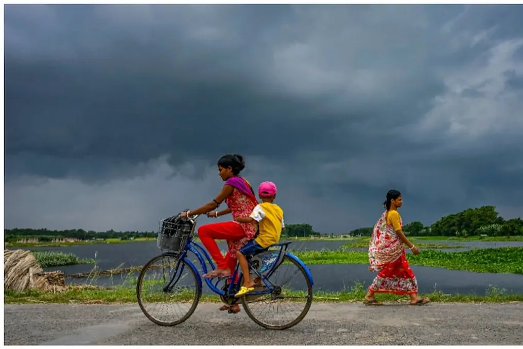
In September, the weakening of the southwest monsoon and a gradual decrease in rainfall are traditionally expected in India. However, in 2026, during the last weeks of September, many regions of the country have experienced heavy rains, floods, and landslides in mountainous areas.
Simultaneously, rains are occurring from Bihar to Uttar Pradesh, floods in Odisha, snowfall and landslides in Uttarakhand, avalanches in Nepal, which has disrupted the Char Dham pilgrimage. The question arises whether this is related to El Niño or to the formation of a low-pressure area after a deep depression formed in the Bay of Bengal, which attracted a western atmospheric wave.
The immediate cause of these rains is a meteorological system that formed in the Bay of Bengal. In the third week of September, a low-pressure area formed in the bay, which gradually transformed into a depression and then into a deep depression. This system reached the land near the coasts of Andhra Pradesh and Odisha around September 23-24.
Afterward, it moved in a northwest direction, weakening in the areas of Madhya Pradesh and Uttar Pradesh. According to meteorological service data, despite the weakening, this system continued to bring moist air. Due to its remaining strength, a low-pressure area formed over the northern and central parts of Uttar Pradesh.
When a deep depression reaches land, it attracts surrounding air masses. As a result, moisture from the Bay of Bengal moved northward, causing heavy rains in Eastern and Central India. In Odisha, rivers rose to critical levels, creating a situation similar to flooding. Anomalously heavy precipitation was also recorded in Bihar and Uttar Pradesh.
El Niño plays a significant role in this entire situation. In 2026, the equatorial Pacific Ocean remains in a state ranging from strong to very strong El Niño. Typically, El Niño weakens the Indian monsoon by altering atmospheric circulation and reducing monsoon humidity.
This year, the total rainfall across the country was approximately 15 percent less than normal, leading to arid conditions in several places. However, El Niño does not always have a uniform impact. Systems such as deep depressions in the Bay of Bengal can locally increase humidity.
Several depressions formed in the bay this year, bringing some relief to Eastern and Central India. Thus, while El Niño reduced the overall volume of precipitation, local weather systems suddenly caused heavy rains at the end of September. This is why intense precipitation is still observed in some areas during the monsoon withdrawal period.
Another important reason for the rains in North India is the western atmospheric wave. Western air systems coming from the Mediterranean through Pakistan are active in winter but sometimes activate in September-October.
During this period, there was an interaction between the low-pressure area that came from the Bay of Bengal and the western atmospheric wave. The low-pressure area drew moist air northward, while the western atmospheric wave provided cold air at upper levels. Their combined effect made the atmosphere unstable, leading to heavy rains and snowfall in mountainous regions.
Landslides and snowfall in Uttarakhand occurred precisely because of this. The Char Dham pilgrimage routes were disrupted due to road damage from heavy rains and landslides. Heavy rains also affected Nepal under the influence of this system, leading to an avalanche near the base camp of Himalung Himwal. Flooding in Odisha occurred due to rising river levels, and thousands of people were evacuated to safe places. Fields were flooded in Bihar and Uttar Pradesh, damaging crops in several areas. Landslides and snowfall in Uttarakhand impacted tourism and religious travel.
It is predicted that rains may also occur in the Delhi-NCR, Punjab, Haryana, Rajasthan, and Chandigarh regions from September 28 to 30 under the influence of the western atmospheric wave. These rains may be more intense than usual due to existing moisture.
According to the meteorological service, rain is possible in northwestern India from September 28 to 30 under the influence of the western atmospheric wave. The risk of landslides and flash floods remains high in mountainous areas. It is likely that the strong El Niño condition will persist in the coming months, which may affect the winter season.
From a scientific perspective, the main reason for the anomalous rains in September lies in the deep depression of the Bay of Bengal and the subsequent low-pressure area, which, combined with the western atmospheric wave, increased humidity. El Niño weakened the monsoon, but local systems remained active.
Due to climate change, such phenomena are becoming increasingly unpredictable and intense. The public should pay attention to meteorological service warnings and exercise extra caution in mountainous areas.