
South African meteorological service forecasts fire danger in Limpopo amid isolated country-wide showers
Read more
IOL
iol.co.za

South African meteorological service forecasts fire danger in Limpopo amid isolated country-wide showers

The South African Weather Service forecasts that on Thursday, September 24, 2026, isolated showers and thunderstorms are expected in various parts of the country. Residents of South Africa may expect mixed weather on Heritage Day, with extremely high fire danger predicted in some areas of Limpopo, while scattered showers and thunderstorms are anticipated in several provinces.

Although the South African Weather Service has not issued severe weather warnings based on impact, it has warned of extremely high fire danger in the municipalities of Musina and Tzaneen in Limpopo. Precipitation is expected to remain localized, with a rain probability of about 30% in the affected areas.

Thunderstorm forecast for Eastern South Africa

Limpopo is expected to have variable cloudiness and warm or hot weather, with a 30% chance of showers and thunderstorms over the southern and central regions in the afternoon. However, the fire warning will be in effect in Musina and Tzaneen, where conditions are considered particularly favorable for fires.

In Mpumalanga province, the day will begin with patches of morning fog in the southern areas, after which the weather will become partly cloudy and cool, although Lowveld is forecast to be warmer. A 30% chance of afternoon showers and thunderstorms is expected.

KwaZulu-Natal will also see morning fog over inland areas before partly cloudy and warm weather gives way to increased cloud cover in the afternoon. Isolated showers and thunderstorms are expected with a 30% chance of rain.

The eastern half of the Eastern Cape will be cloudy with morning fog in places, then become partly cloudy and cool or warm. Isolated showers and thunderstorms are forecast, giving affected areas a 30% chance of precipitation.

Gauteng remains dry and warm

Gauteng is expected to remain dry, with a forecast of partly cloudy and warm weather for Thursday. The UVB sunstroke index will be high.

North West will also remain dry, with clear and warm weather expected throughout the day. Free State is expected to have partly cloudy and warm weather, with a 30% chance of showers and thunderstorms in the south and along the Lesotho border.

Isolated storms reach Northern and Western Cape

In the Northern Cape, the western and southern areas will be cloudy, with isolated showers and thunderstorms bringing a 30% chance of rain. In other areas, the weather will be clear and cool or warm, becoming hot in the northern regions.

The Western Cape will experience cloudy conditions and morning fog in the western and southern areas before becoming partly cloudy and cool or warm. Hot weather is expected along the West Coast, while the northeasternmost parts of the province have a 30% chance of isolated showers and thunderstorms.

The UVB sunstroke index in the Western Cape is expected to be very high. In the western part of the Eastern Cape along the coast and the adjacent inland eastern part east of Cape St Francis, cloudy conditions, fog, and light morning rain are expected. Otherwise, the weather will be clear and warm, although temperatures along the coast will remain cooler.

Overall, the precipitation forecast indicates that isolated thunderstorms will spread across the eastern and southern parts of the country, while large areas of the central and northwestern interior are expected to remain dry on Thursday.
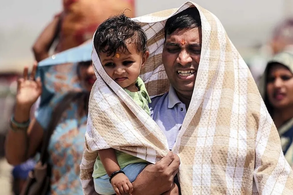
Similar stories

Study shows heatwave duration increased by 39 days over 45 years
Read more
www.aajtak.in

Study shows heatwave duration increased by 39 days over 45 years

According to a new study of global climate data from 1979 to 2023, heatwaves in many parts of the world are now starting earlier and ending later. Researchers found that over 45 years, the dry season for heatwaves has lengthened by an average of about 39 days.

This study was conducted by scientists from the South China Botanical Garden (SCBG) and the Chinese Academy of Sciences (CAS). The team analyzed data from 1979 to 2023, examining when the first heatwaves began, when the last ones ended, the overall season duration, and the speed at which the first wave reached peak temperature.

The study found that every ten years, the first heatwave started, on average, 3.29 days earlier. At the same time, the last heatwave ended approximately 5.41 days later. Thus, per decade, the heatwave season lengthened by an average of 8.71 days. Between 1979 and 2023, the first heatwave appeared about two weeks earlier, and the last one ended about 24 days later.

Researchers analyzed heatwave patterns in various terrestrial regions worldwide. They identified a trend toward an earlier start of the first heatwave in 72% of land areas and a later end of the last heatwave in 79.6% of areas. The most significant changes were observed in the duration of the heatwave season: a trend toward an increase in the season's length was recorded in 92.1% of the world's land areas. These changes were particularly pronounced in arid regions.

This means that the threat associated with heat can persist for a longer period in many places. If heatwaves used to arrive around a certain time, their season now starts earlier and lasts longer in many regions.

The team also studied how quickly the maximum temperature is reached in the first wave of the season. For this, the first wave was classified as fast, moderate, or slow onset. Between 2001 and 2023, the proportion of first heatwaves with a fast onset increased in areas affected by heatwaves. This indicates that in some places, the first heatwave is now growing faster and reaching its maximum temperature in less time.

Such heatwaves may give people and other systems less time to prepare. According to the researchers, simply looking at temperature increase or heat duration is not enough to understand the danger of heatwaves; it is also important to consider when the wave started and how quickly it intensified.

The lengthening of heatwave seasons also affects agriculture. The study examined the impact of heatwaves on agricultural crops between 2001 and 2023. Special attention was paid to critical phases such as flowering and grain filling, during which the impact of heatwaves on many major crops increased. Crop exposure during these important stages increased from 1.6% to 13.3% in the 2001–2023 period compared to 1979–2000. The impact of heatwaves also increased before and after these crop development phases.

The researchers emphasize that when assessing heatwave risk, it is insufficient to consider only temperature and its duration. It is also necessary to consider when the wave started and ended, as well as the speed at which it reached its maximum temperature. According to the study, incorporating these changes into heat monitoring and early warning systems can help better understand and prepare for threats related to people, agriculture, ecosystem management, and energy supply.

Popular