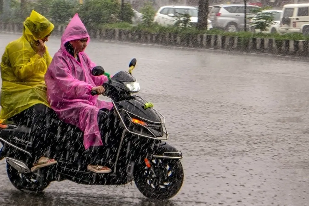
According to the Meteorological Department (IMD), rainfall intensity may persist across various parts of the country on Wednesday. The influence of the Deep Depression formed over the Bay of Bengal is now rapidly affecting the weather in Eastern, Central, and Southern India, resulting in heavy rains starting in several states. Heavy to very heavy rainfall is being recorded in the coastal and southern regions of Odisha. Considering this severe weather situation, the state government has alerted the administration in several districts; a decision has been made to keep educational institutions closed in seven districts until September 24, while government employees have been instructed to return to duty and their holidays have been canceled.
The Meteorological Department has issued warnings for heavy to very heavy rainfall in some areas and anticipates an increase in rainfall activity in the coming days, which will cause the weather pattern to change in many states. According to the statement by IMD Director General Mrutyunjay Mahapatra, this system may make landfall around 70 kilometers per hour on the night of September 23. A Deep Depression is a weather system more powerful than a low-pressure area but not as intense as a cyclonic storm.
In addition to Odisha, several other states, including Karnataka, Andhra Pradesh, and Telangana, are forecasted to receive heavy to very heavy rainfall, with the possibility of strong winds accompanied by thunder in some places. No major weather alert has been issued for the Delhi-NCR region currently, and the weather is expected to remain generally dry there on Wednesday. IMD has not issued any warning related to weather changes for Delhi, Haryana, and Chandigarh until September 28. The withdrawal process of the Southwest Monsoon has begun from North-Western India, which is also affecting the weather in Delhi. Due to clear skies, there is no expectation of significant relief in daytime temperatures, and the maximum temperature may remain around 34 to 36 degrees Celsius. However, in some parts of North India, rainfall activities may increase as the week progresses, especially with an anticipated increase in the scope of rain in Uttar Pradesh and Uttarakhand in the coming days.
Light or scattered rainfall may occur in some places in eastern parts of Uttar Pradesh on Wednesday. Thunder and lightning are expected in East UP from Thursday, while heavy rain may occur in some areas from September 25. Rainfall is also expected to increase in western Uttar Pradesh by the end of the week, with heavy rain likely from September 26.
Rainfall may spread to several areas in Uttarakhand from Friday, followed by the possibility of very heavy rainfall in some places on Saturday. The weather can change rapidly in the hilly areas during this period, so residents in rain-affected areas are advised to pay attention to local weather updates.
Some places in Bihar may experience rain on Wednesday. Following this, rainfall activity is expected to increase from Thursday. According to IMD, some parts of Bihar may witness very heavy rainfall on Thursday and Friday, meaning the state will remain quite active meteorologically for the next two days.
Rainfall is predicted in several areas of Odisha on Wednesday, with the possibility of very heavy rain in some places. During this time, stormy conditions with thunder, lightning, and strong winds may develop, and the weather is expected to be highly active on Wednesday and Thursday. Jharkhand is also expected to see rain in most parts on Wednesday, with the possibility of thunderstorms and lightning along with heavy rain in some places.
To deal with potential disasters, the Odisha government has deployed 33 Odisha Disaster Rapid Action Force (ODRAF) teams. 24 of these teams have been sent to sensitive districts, while 9 teams have been kept reserved in Chhatrapur of Ganjam. Rescue teams have been deployed in Ganjam, Gajapati, Koraput, Malkangiri, Raigarh, Kalahandi, and Balangir. Essential supplies, medical aid, and emergency services have also been kept ready. Water levels in rivers, reservoirs, and dams are being continuously monitored.
IMD has issued a Red Alert for Koraput, Gajapati, and Ganjam on September 23 and 24, as these districts are expected to receive more than 20 centimeters of rain. Red alerts have also been issued for Kalahandi, Nabarangpur, Koraput, and Malkangiri for September 24 and 25. Very heavy to extremely heavy rainfall is forecast for South Odisha on September 23 and 24, and heavy rain may continue in some areas on September 25 and 26.
In view of the adverse weather forecast, fishermen have been advised not to go into the sea until September 24. Sea conditions near the coasts of South Odisha and North Andhra Pradesh may remain bad to very bad. According to IMD, strong winds up to 75 kilometers per hour may blow in these coastal areas from the morning of September 23 to the evening of September 24. Puri administration has put up red flags on the beaches and imposed a complete ban on swimming in the sea until September 24. Additionally, earthmoving machines have been deployed to clear roads in hilly and landslide-prone areas.